Mount Batur
Twice the mountain swallowed itself. The first collapse came roughly 29,300 years ago, when the magma chamber beneath what is now central Bali emptied catastrophically and the ground above dropped into the void, forming a caldera 10 by 13 kilometers across. Then, about 20,000 years later, the inner portion collapsed again, carving a smaller 7.5-kilometer depression inside the first. What remained was Mount Batur -- not a single peak but a volcanic cone rebuilding itself at the center of nested ruins, surrounded by the lake that filled the low ground and the villages that would, improbably, choose to make their homes here.
Fire on a Schedule
Mount Batur's first documented eruption was in 1804. Since then, the volcano has erupted repeatedly, most significantly in 1917, 1926, and 1963, with the most recent activity occurring in 2000. The 1917 eruption killed more than a thousand people and sent lava flowing through the village of Karang Anyar at the volcano's southwestern base. When lava from that eruption stopped just short of the gates of Pura Ulun Danu Batur, the local temple, the Balinese took it as a divine sign and stayed. Nine years later, in 1926, Mount Batur erupted again. This time the lava buried the village entirely, though the population escaped. The substantial lava field from the 1963 eruption remains visible today from Kintamani, a town perched on the caldera's southwestern rim, its dark surface still largely bare more than sixty years on.
Fifteen Villages in a Volcano
Living inside an active caldera sounds reckless until you understand the economics. Volcanic soil is extraordinarily fertile, and the Batur caldera supports intensive agriculture -- fruit, vegetables, and other produce thrive in the mineral-rich ground. The four main villages of Kedisan, Songan, Trunyan, and Toya Bungkah anchor a network of fifteen settlements whose residents farm, fish Lake Batur, and increasingly serve the tourism industry. The trek to Mount Batur's summit has become one of Bali's most popular hikes, largely because it is manageable for non-mountaineers -- the path is steep but not technical, and the sunrise views from the top, looking across the caldera lake to the towering profile of Mount Agung, are considered among the island's finest.
Geopark and Battleground
On September 20, 2012, UNESCO designated the Mount Batur Caldera as part of the Global Geoparks Network, recognizing its geological significance and the way human communities have adapted to its volatile landscape. But the recognition came with an implicit warning. The caldera's lake is in trouble: heavy sedimentation from volcanic ash and agricultural runoff is reducing its depth, while water hyacinths -- fed by nutrient-rich inflows from farming and fish cages -- have spread across the surface in choking mats. The combination of sediment building from below and vegetation smothering from above has raised serious questions about the lake's long-term survival. Plans to restrict lakeside development, reduce aquaculture, and dredge accumulated sediment have been proposed but face resistance from communities whose livelihoods depend on exactly the activities causing the damage.
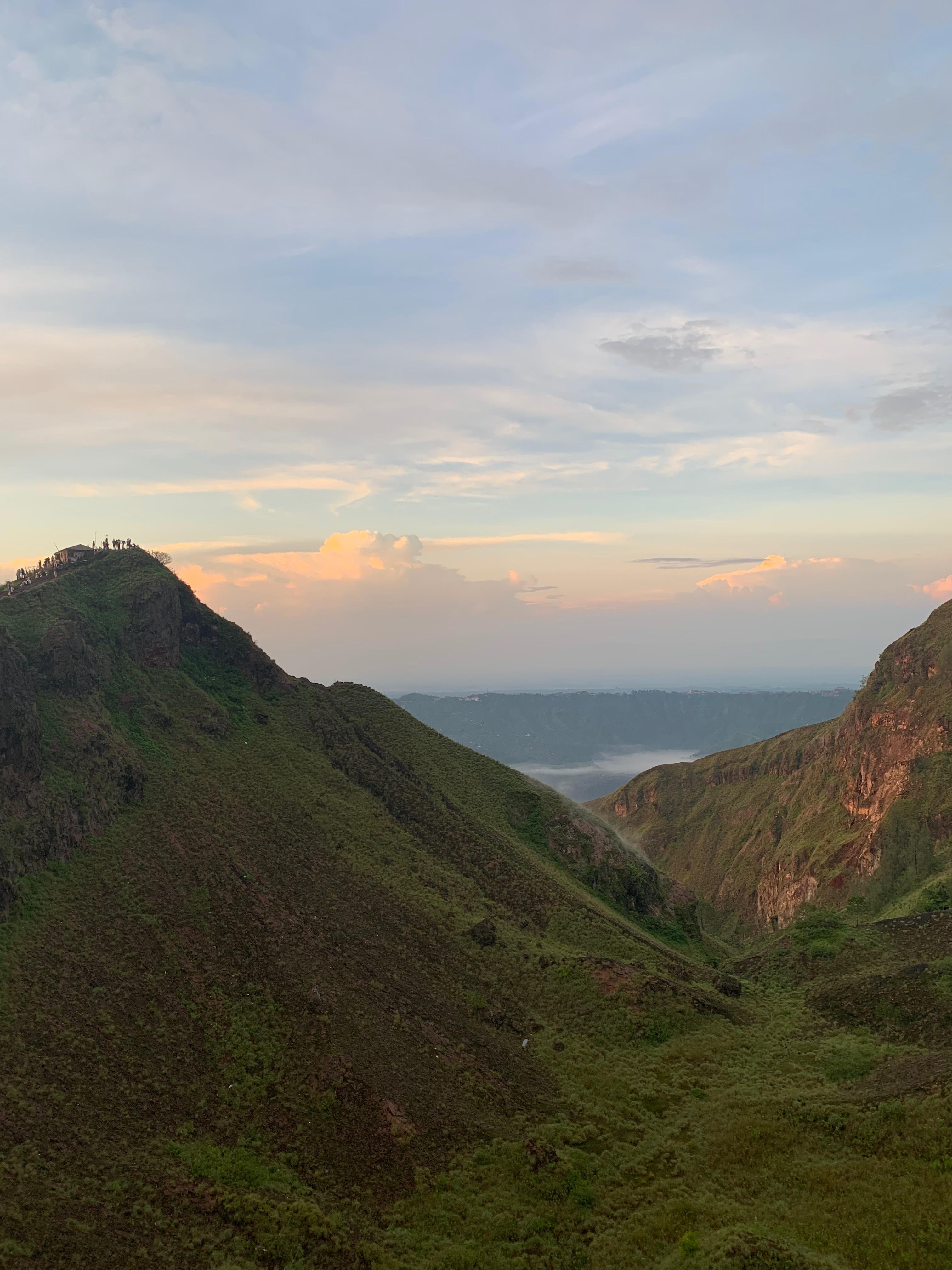
The View from the Rim
From the caldera rim at Kintamani, the entire system reveals itself. The volcanic cone rises from the caldera floor, dark lava fields fanning from its base like spilled ink. Lake Batur curves around the southeastern flank, its water reflecting the sky or turning opaque under cloud cover. Villages cluster along the shore and on the lower slopes, their terraced fields stepping down toward the water. On clear mornings, Mount Agung dominates the eastern horizon, Bali's highest peak and holiest mountain, while Mount Bratan rises to the southwest. The scale is deceptive -- the caldera looks compact from above, but its floor encompasses an entire agricultural economy, a threatened lake ecosystem, and a volcano that last erupted within living memory. It is a landscape that rewards patience: the light changes constantly, and the volcano's moods shift with the weather.
From the Air
Located at 8.24S, 115.38E in central Bali. Mount Batur (1,717 m / 5,633 ft) rises from the center of its caldera, with Lake Batur curving around its southeastern flank. The double caldera rim is a striking feature from altitude. Mount Agung (3,031 m) is visible to the east-southeast. Nearest major airport is Ngurah Rai International (WADD) approximately 45 nm to the south. Caution: active volcano with potential for sudden eruptions and associated ash clouds. Thermal convection over the caldera can produce turbulence, especially in afternoon hours.