Mount Daibosatsu
The name means "Great Bodhisattva" -- an enlightened being on the threshold of Buddhahood. How a 2,057-meter peak in the mountains west of Tokyo came to carry such a spiritually charged title remains a matter of local legend, but standing on the open grasslands of its southwestern ridge, watching Mount Fuji float above the Kofu Basin in the early morning light, you start to understand the impulse to reach for sacred language. Mount Daibosatsu is one of the 100 Famous Mountains of Japan, and among those elite peaks, it occupies an unusual position: accessible enough for a day hike from Tokyo, yet wild enough to feel like genuine backcountry once the trail drops below the ridgeline into dense forest.
The Merchant's Highway
Long before hikers laced up boots for the summit, Mount Daibosatsu served a grimmer purpose. During the Edo period, the mountain's passes formed a critical section of the Ome Kaido, a trade road used to haul lime from Kai Province to the capital at Edo. The Tokugawa shogunate established Taba-shuku, a post station, near the mountain to service the merchants and packhorses laboring over the terrain. Two passes defined the route: Daibosatsu-toge, the original crossing, and Yanagisawa-toge, which replaced it when modern road engineering arrived in the Meiji era. The old pass trail still exists, threading through forests of beech and birch that have reclaimed what was once a busy commercial artery.
A Ridge Between Worlds
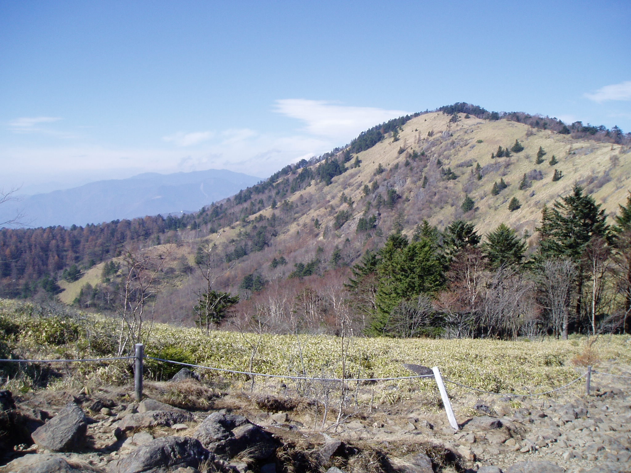
The summit of Mount Daibosatsu, at 2,057 meters, sits within the dense forest of Chichibu Tama Kai National Park and offers limited views. The real spectacle lies along the ridge to the south, where the trees fall away and open grasslands called kayato-no-hara spread across the mountain's southwestern slope. From here, the panorama is staggering: Mount Fuji rises to the south beyond the deep fold of the Hikawa Valley, the Southern Alps stretch along the western horizon, and the entire Kofu Basin spreads below like a rumpled green blanket. Many of the poster photographs that define Yamanashi Prefecture's tourism campaigns are shot from this very ridgeline. Visibility is sharpest in the cold months, when the air clears and the snow-capped peaks stand in crystalline relief against blue sky.
The Sword of Doom
Daibosatsu Pass entered Japanese literary history in 1913 when novelist Kaizan Nakazato began serializing Daibosatsu Toge, a sprawling historical epic set during the final years of the Tokugawa shogunate. The novel follows the enigmatic and nihilistic swordsman Ryunosuke Tsukue through a landscape of violence and moral ambiguity. Nakazato published forty-one volumes before his death in 1944, leaving the work unfinished -- Japan's longest serialized novel. The story was adapted into multiple films, most famously Kihachi Okamoto's 1966 film "The Sword of Doom," which brought the brooding atmosphere of the mountain pass to international audiences. The pass itself, where the novel's opening murder takes place, still carries the weight of that fictional darkness for Japanese readers.
Trails to the Sky
Modern hikers approach Mount Daibosatsu from multiple directions. The most popular trailhead begins near Hashidate-shita bus stop, accessible via Nishi Tokyo Bus from Okutama Station. A shorter approach starts from Kamihikawa bus stop, served by Eiwa Transportation from Kai-Yamato Station, which brings hikers close to Lodge Chobe near the upper reaches of the mountain. From the Kofu side, Koshu Municipal Bus runs to Daibosatsu-Toge Tozanguchi from Enzan Station. The loop hike over the summit and along the southern ridge takes roughly five to six hours, making it one of the most rewarding day hikes accessible from the Tokyo metropolitan area. The trail passes through shifting zones: cedar plantations give way to deciduous forest, then subalpine meadows open onto that unforgettable ridgeline view.
From the Air
Mount Daibosatsu sits at 35.7487N, 138.8455E in the mountains of Yamanashi Prefecture, within Chichibu Tama Kai National Park. The peak reaches 2,057 meters (6,749 feet). Approach from the east over the Kanto Plain or from the south along the Kofu Basin. Mount Fuji is clearly visible to the south-southwest. The nearest airports are Matsumoto (RJAF) to the northwest, Shizuoka (RJNS) to the south, and Tokyo Haneda (RJTT) to the east. Recommend viewing altitude of 8,000-10,000 feet AGL. Mountain weather can change rapidly; watch for orographic clouds building along the ridgeline.