Mount Ena: Where the Sun Goddess Was Born
The mountain's name is its oldest story. "Ena" can be written with the characters for placenta or afterbirth, and the legend says that when Amaterasu Omikami -- the sun goddess at the center of Shinto belief -- was born, her ena was carried to the summit of this peak and buried there for safekeeping. The mountain kept the name, and the land around it became Ena. A shrine still stands at the summit. At 2,191 meters, Mount Ena anchors the southern end of the Kiso Mountains, which form the Central Alps of the Japanese Alps on central Honshu. It straddles the border between Nakatsugawa in Gifu Prefecture and Achi in Nagano Prefecture, and its forested slopes rise from the same valleys that once carried travelers along the Nakasendo highway between Edo and Kyoto. The novelist Toson Shimazaki, who grew up in the post town of Magome at the mountain's feet, opened his masterwork "Before the Dawn" with the line: "The entire Kiso Road is in the mountains." Mount Ena is the mountain he meant.
The Central Alps at the Edge
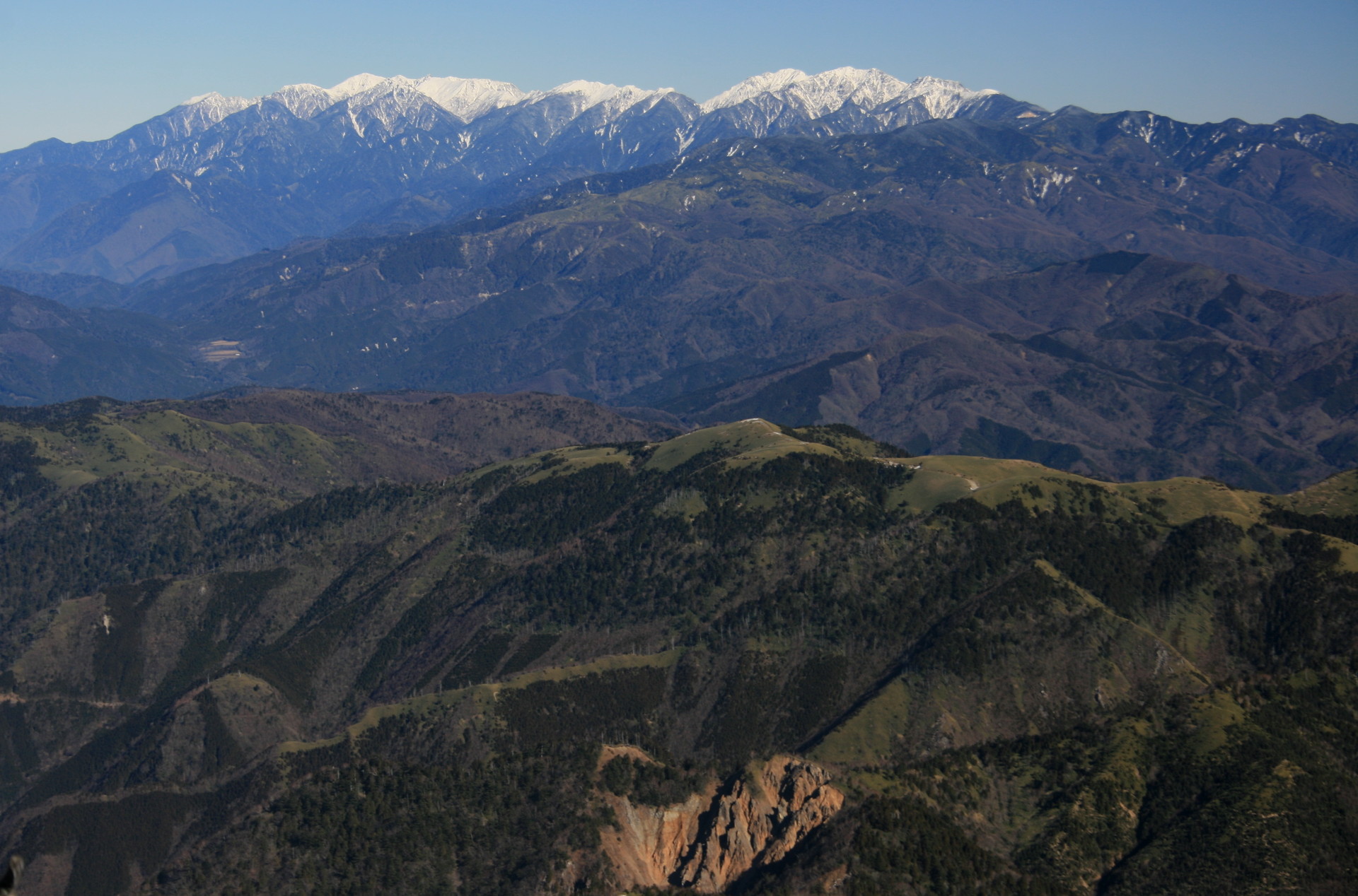
The Kiso Mountains run roughly north-south through central Honshu, forming the middle chain of the three ranges collectively called the Japanese Alps. Mount Ena marks the southern terminus of this range, standing somewhat apart from the higher peaks to the north. Its 2,191-meter elevation earns it a place among the 100 Famous Japanese Mountains, the list compiled by mountaineer and author Kyuya Fukada that has guided Japanese hikers since its publication in 1964. The mountain's prominence -- 995 meters above its surrounding terrain -- makes it a defining landmark of the region, visible from the towns and river valleys of eastern Gifu and western Nagano. From the summit, the panorama unfolds in every direction: the Japanese Alps ranges stretch to the north and west, the volcanic cone of Mount Ontake rises to the northwest, Mount Haku stands to the west, Mount Norikura appears nearby, and on clear days, part of Mount Fuji emerges on the eastern horizon.
Four Paths to the Sky
Four hiking routes lead to the summit of Mount Ena, each with its own character. The Hirogawara Route begins at 1,256 meters and climbs through forest on a winding path of switchbacks, gaining roughly a thousand meters of elevation over several hours. The Kuroisawa Route starts at a similar elevation and follows a different drainage. The Misaka Pass Route approaches from the historic mountain pass that once connected Mino Province to Shinano Province along the ancient highway system. The Maemiya Route begins at just 600 meters and is the longest and most demanding approach, requiring seven to eight hours of steady climbing. All four paths share a common quality: dense forest that provides shade on the ascent but limits views until the higher elevations, where the canopy thins and the surrounding peaks reveal themselves. A red-roofed emergency shelter stands near the summit, offering refuge in the weather that can change rapidly at this altitude.
A Novelist's Mountain
Shimazaki Toson was born in 1872 in Magome, the forty-third of the sixty-nine post stations on the Nakasendo, the great inland highway that connected Edo with Kyoto through the Kiso Valley. Mount Ena loomed over his childhood, a constant presence at the edge of the valley where his family had served as headmen of the post town for generations. His novel "Before the Dawn," published between 1929 and 1935, is a semi-historical account of his father's life during the upheaval of the Meiji Restoration, set against the landscape of the Kiso Road. The mountain appears throughout the narrative as backdrop and symbol -- Toson wrote of the broad sky spreading toward the foot of Mount Ena and the Mino plains beyond. Today, the preserved post town of Magome draws walkers who hike the old Nakasendo route between Magome and neighboring Tsumago, following stone-paved paths through cedar forests with Mount Ena watching over the valley as it has for centuries.
Sacred Ground Above the Clouds
The mythology of Mount Ena predates recorded history. In the Shinto creation narrative, the deities Izanagi and Izanami brought forth the islands of Japan and the gods who would inhabit them. The birth of Amaterasu, the sun goddess who would become the supreme deity of the Shinto pantheon and the mythological ancestor of the imperial line, was an event of cosmic significance. The tradition holds that her afterbirth was carried to this mountain and buried at the peak, consecrating the ground. A shrine at the summit marks the spot, and a second shrine stands at a lower elevation to the west. The mountain's name, written with characters that can mean "blessed" and "that," carries within it the older reading of ena -- afterbirth, origin, the first connection between a divine being and the physical world. To climb Mount Ena is to walk upward through ordinary forest and emerge at a place where, according to the oldest stories Japan tells about itself, the sun itself began.
From the Air
Located at 35.443N, 137.597E on the Gifu-Nagano border. Mount Ena rises to 2,191 meters (7,188 ft), marking the southern end of the Kiso Mountains (Central Alps). From the air, the peak is identifiable as the prominent summit at the southern terminus of the Kiso range, heavily forested with a cleared area near the summit where the shelter and shrine are located. The Nakatsugawa valley and the preserved Nakasendo post towns of Magome and Tsumago lie to the west and southwest. Nearest airport: Chubu Centrair International Airport (RJGG), approximately 100 km southwest. Nagoya Airfield/Komaki (RJNA) is roughly 75 km west. Matsumoto Airport (RJAF) lies to the northeast. Recommended viewing altitude: 8,000-10,000 ft MSL to appreciate the peak's relationship to the broader Kiso range. Be aware of mountain weather: clouds and fog can form rapidly around the summit, and terrain rises steeply in all directions.