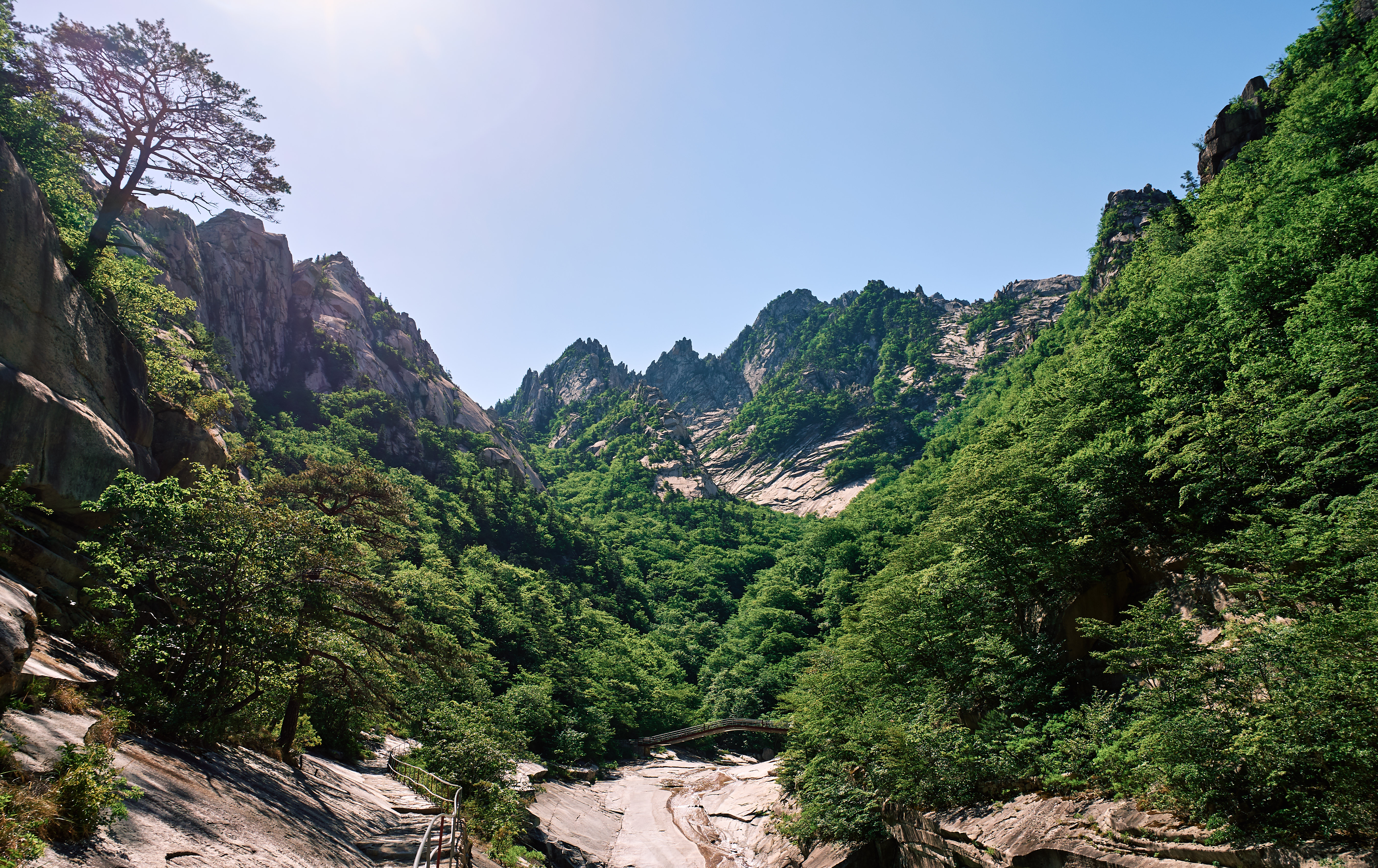
Mount Kumgang
Most mountains have one name. Mount Kumgang has four. In spring it is Kumgangsan, the Diamond Mountain. In summer, Pongraesan. In autumn, Phung'aksan. In winter, Kaegolsan. Korean poets and painters have been renaming it with the seasons since antiquity, each title reflecting how light and foliage transform its twelve thousand peaks -- a number that is traditional rather than literal, though with more than sixty summits above a thousand meters and countless sub-peaks, the count is not as fanciful as it sounds. In 2025, UNESCO designated the mountain a World Heritage Site, confirming what Korean culture has maintained for centuries: this is one of the most beautiful places on the peninsula.
Diamond in Three Facets
The massif stretches 40 kilometers east to west and 60 north to south, covering 530 square kilometers along the Taebaek range that forms the Korean Peninsula's spine. It divides into three zones, each with a distinct personality. Inner Kumgang, the western section, holds the main peak Pirobong at 1,638 meters and has traditionally been considered the heart of the mountain -- the zone that earned the Kumgang name. Outer Kumgang spreads eastward toward the coast, crowded with spires and waterfalls. Chipson Peak, literally 'rock of ten thousand forms,' is the centerpiece. Kuryong Falls -- the Nine Dragons Falls -- drops 74 meters and ranks among Korea's three great waterfalls. Then there is Hae Kumgang, Sea Kumgang, where the mountains meet the East Sea in lagoons and stone pillars. Much of the mountain is covered by mixed broadleaf and coniferous forest, and a 60,000-hectare national park protects habitat identified as an Important Bird Area for its population of endangered red-crowned cranes.
A Resort Between Two Koreas
In the late 1990s, the South Korean conglomerate Hyundai Asan developed a tourist resort on Mount Kumgang's eastern slopes, an audacious experiment in inter-Korean engagement. South Korean tourists crossed the border by bus and later by cruise ship to hike the mountain their ancestors had painted for centuries. The currency at the resort was neither won -- not South Korean, not North Korean -- but Chinese renminbi and U.S. dollars. Most hotel staff were ethnic Koreans from China, brought in for their language skills. For a few years, the arrangement held. Then, on the morning of July 11, 2008, a 53-year-old South Korean tourist named Park Wang-ja wandered into a restricted military zone by crossing a sand dune on the resort beach. North Korean soldiers shot her twice. She died. South Korea suspended all tours immediately.
Seized, Dismantled, Remembered
What followed was a slow unraveling. In March 2010, North Korea threatened 'extraordinary measures' if the tourism ban was not lifted. On April 23, 2010, the government seized five South Korean-owned properties at the resort, citing compensation for losses from the suspended tours. By late 2022, satellite imagery showed the resort's facilities being dismantled -- the golf course, the floating hotel, all of it -- reportedly on orders from Kim Jong Un. North Korea began running its own tours from Rason in the northeast, primarily for Chinese visitors. The mountain itself remains, indifferent to politics. In October 2010, Red Cross officials from both Koreas briefly agreed to hold family reunions at the resort's hotel -- one hundred families from each side, separated since the Korean War, meeting at a mountain resort that symbolized everything hopeful and everything broken about the divided peninsula.
Pilgrimage of Brush and Ink
Long before any tourist resort, Mount Kumgang was a destination for pilgrims of a different kind. During the Joseon period, from 1392 to 1910, poets and painters made the journey to Kumgangsan as an artistic rite of passage. The mountain appears across centuries of Korean art -- in ink wash paintings that capture the mist threading between granite spires, in poems that name individual peaks the way westerners name constellations. The 155 miles of barbed wire that now constitute the DMZ cut across the mountain's cultural significance like a wound. Koreans on both sides of the border claim Kumgangsan as a national treasure. For South Koreans in particular, the mountain represents a landscape they can study in paintings but cannot visit -- a place that exists more vividly in cultural memory than in lived experience. The UNESCO designation adds international weight to a reverence that needs no outside validation.
From the Air
Mount Kumgang (38.66N, 128.10E) is a prominent mountain massif on North Korea's east coast, rising to 1,638m at Pirobong peak. Located approximately 50 km north of Sokcho, South Korea, it sits within the Taebaek range. The DMZ runs to its south. This is restricted airspace -- North Korean sovereignty applies. From altitude on the South Korean side, the massif is visible as a dramatic granite cluster with deeply incised valleys. No civilian airports operate in the immediate vicinity on the North Korean side. Wonsan Kalma Airport (ZKWS) lies to the north.