Mount Longonot National Park
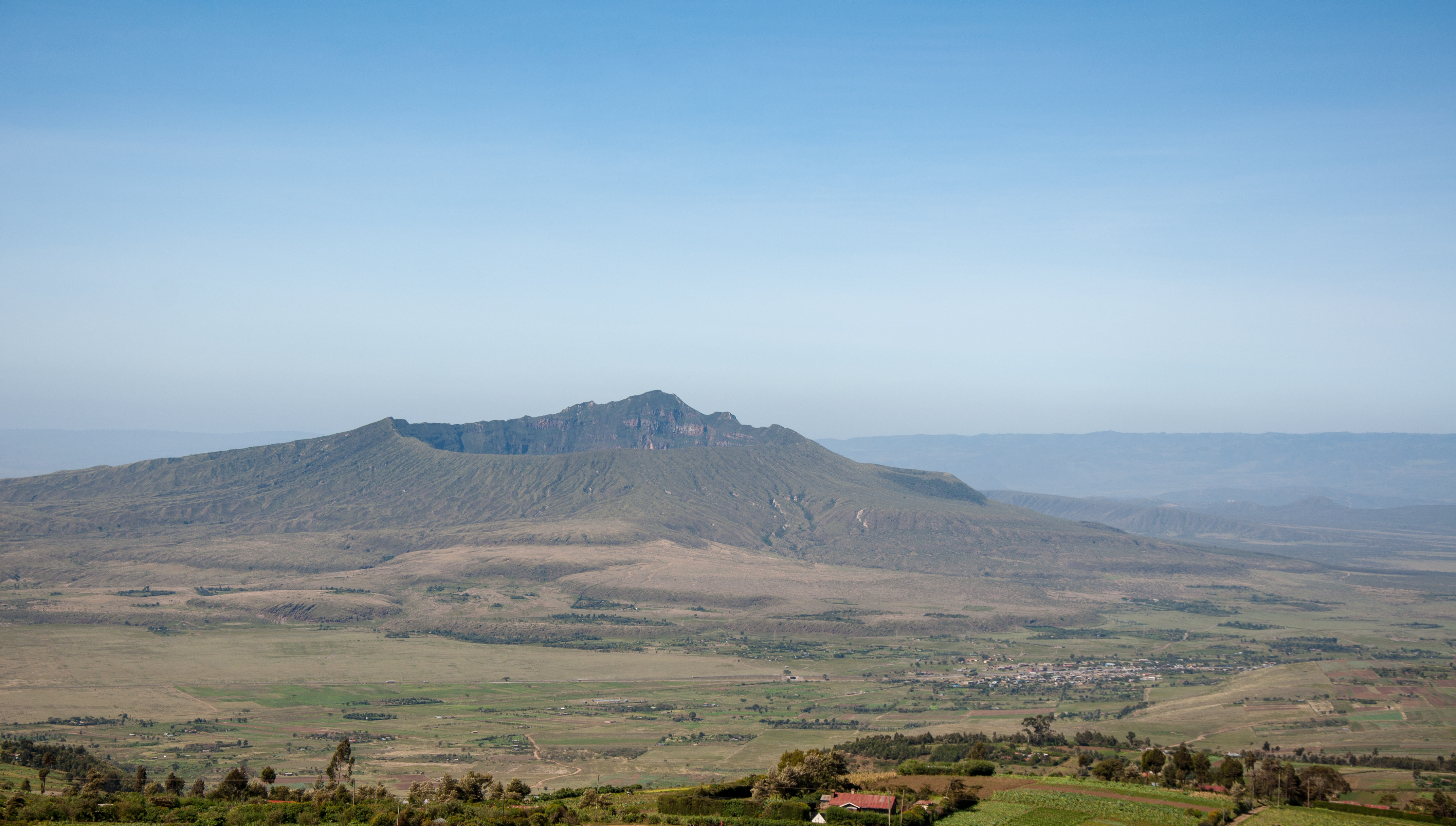
The Maasai called it Oloonong'ot -- "mountain of many spurs" -- for the ridges that radiate from its summit like the ribs of a half-opened umbrella. Mount Longonot is a young stratovolcano, its last eruption dated to the 1860s, and it still vents steam from fumaroles hidden inside its crater. At 2,776 meters, it is not Kenya's tallest peak, but it may be the most satisfying to climb: a steep, direct trail from the park gate at 2,160 meters to the crater rim, then a full circuit of that rim with views that stretch from Lake Naivasha to the Aberdare Range and, on clear days, all the way to Mount Kenya.
Born From the Rift
Mount Longonot rises from the floor of the Great Rift Valley, the geological fracture zone that runs from the Red Sea to Mozambique. The volcano is a textbook stratovolcano -- steep-sided, symmetrical, built from alternating layers of lava and ash over thousands of eruptions. Its most recent significant eruption, in the 1860s, left the crater floor covered in hardened lava flows and scattered fumaroles that still emit steam on cool mornings. The crater itself is roughly two kilometers in diameter, densely forested with African olive and other montane species that provide cover for buffalo, leopards, and bushbuck. From the air, the volcano's perfect cone shape and dark crater are unmistakable against the lighter browns and greens of the surrounding Rift Valley floor.
The Climb to the Corona
The trail begins directly behind the park gate at 2,160 meters and wastes no time on pleasantries. It climbs steeply through scrubby grassland, gaining over 500 meters of elevation in roughly an hour and a half of sustained effort. The path is well-worn but exposed -- there is no shade, and the equatorial sun at this altitude can be punishing. Carrying at least two liters of water is not a suggestion but a necessity. The reward arrives at the crater rim, where the ground drops away on one side into the forested crater and opens on the other to a panorama of the Rift Valley. From here, the rim trail runs counterclockwise, recommended because it places the steepest section -- the push to the summit peak at 2,776 meters -- in the first third of the circuit, when legs are still fresh.
Walking the Rim
The full crater rim circuit takes about three hours and never lets the views go stale. The trail undulates along the ridge, sometimes narrowing to a knife-edge where the inner crater drops steeply to the left and the outer slopes fall away to the right. To the west, Lake Naivasha glimmers below, its shores dotted with flower farms and the rooftops of resorts. To the south and east, the Rift Valley stretches toward Nairobi, and the neighboring silhouette of Hell's Gate National Park's cliffs is visible. On the crater's northern inner wall, around GPS coordinates -0.9116, 36.4504, steam sometimes rises from active fumaroles -- a quiet reminder that the mountain is dormant, not dead. Rangers advise against descending into the crater without an escort, both because of the steep, unstable terrain and because buffalo and leopards inhabit the dense forest below.
Nairobi's Backyard Volcano
Mount Longonot's appeal is inseparable from its accessibility. The park sits roughly 90 kilometers northwest of Nairobi, reachable by car in about an hour and a half on good roads. This makes it one of the most popular day-trip destinations for Nairobi residents and for tourists staying at Lake Naivasha lodges who want to pair a morning hike with an afternoon boat ride or a visit to Hell's Gate. The park gate has a basic shop selling water and snacks, and the entry fee is modest. There are no lodges inside the park, and camping in the crater requires advance arrangements with Kenya Wildlife Service rangers. Most hikers aim to start early -- by 7 or 8 AM -- to reach the summit before the midday heat sets in and to allow six hours for the full ascent, rim circuit, and descent. The record, held informally by the man who runs the gate shop, is under three hours.
From the Air
Mount Longonot is located at approximately 0.92°S, 36.46°E in Kenya's Great Rift Valley, immediately southeast of Lake Naivasha. From altitude, the volcano's symmetrical cone and dark, forested crater are distinctive landmarks. The summit reaches 2,776 meters (9,108 feet) MSL. Hell's Gate National Park lies to the northwest, and Lake Naivasha is visible to the west. The nearest major airports are Nairobi's Jomo Kenyatta International Airport (HKJK), approximately 45 nm to the southeast, and Wilson Airport (HKNW). The Rift Valley escarpment to the east creates significant terrain considerations. Afternoon thermal activity and convective weather buildup are common over the volcano, particularly during warmer months.