Mount Nikko-Shirane
The name gives it away. Shirane -- written with the characters for 'white' and 'root' -- describes exactly what you see from the Kanto Plain on a clear winter day: a dome of snow floating above darker slopes, so bright it looks almost artificial against the sky. At 2,578 meters, Mount Nikko-Shirane is the highest point in both Tochigi and Gunma prefectures, the tallest peak in all of northeastern Japan, and an active volcano that the Japanese government considers important enough to monitor continuously. It sits at the boundary between two prefectures inside Nikko National Park, surrounded by crater lakes, alpine moors, and ancient volcanic remnants that tell a story stretching back millions of years.
A Dome Among Giants
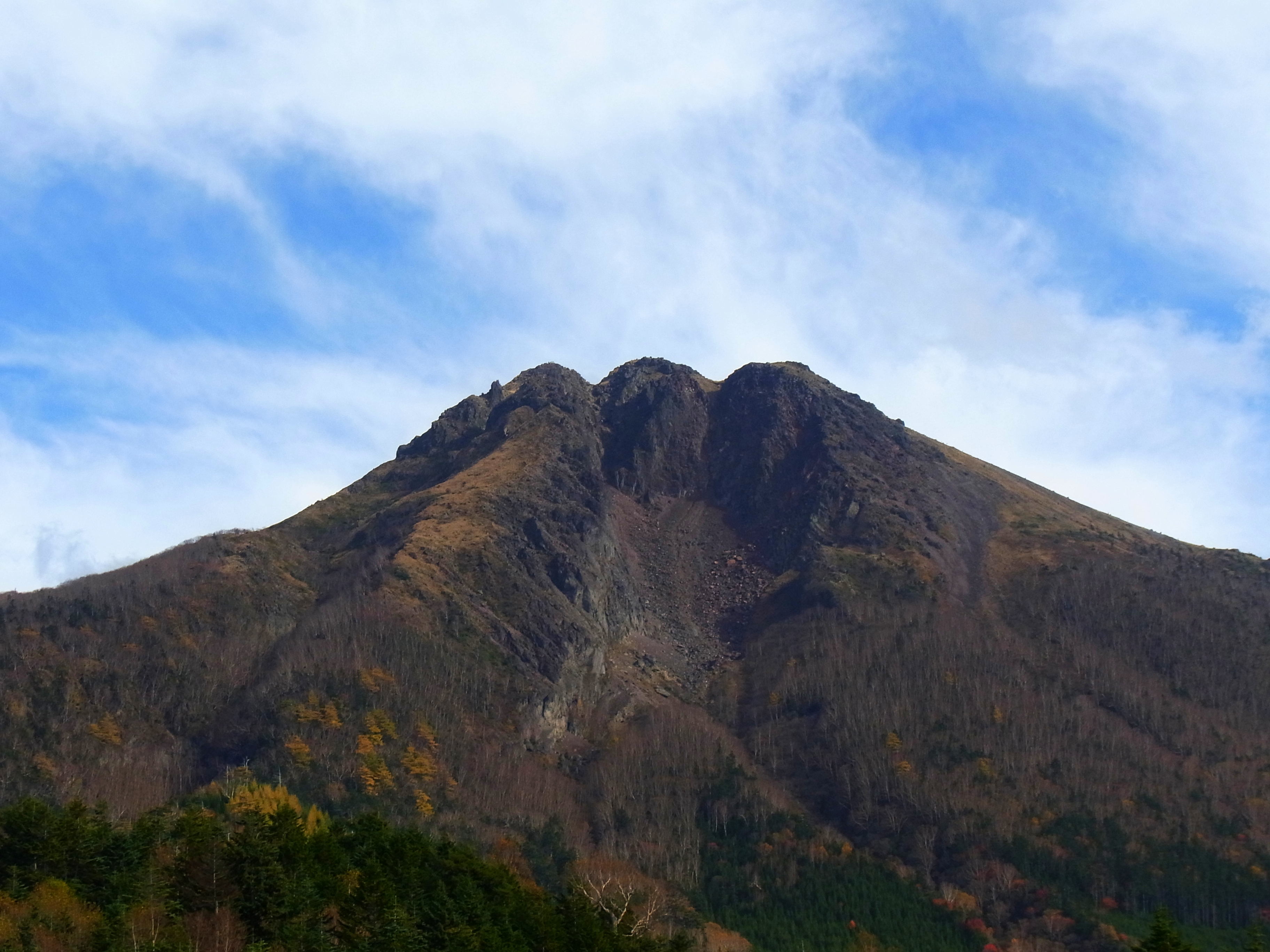
Mount Nikko-Shirane is not a single peak but the crown of a volcanic complex. Its summit, Okushirane -- meaning 'innermost Shirane' -- is a lava dome of andesite, a younger formation that pushed up through the older Neogene volcanic rocks of the surrounding Shirane volcano group. Mountains named Maeshirane, Goshikiyama, Sotoyama, and Shiranekakuzan encircle the main peak, themselves stratovolcanoes of an earlier era. The result is a mountain that often hides behind its own geology: clouds cling to the surrounding peaks throughout much of the year, and from the distant Kanto Plain only the dome-shaped summit peeks above the ridgeline. Kyuya Fukada included Nikko-Shirane in his famous list of 100 mountains that define Japan, and both Tochigi and Gunma prefectures claim it among their most celebrated summits.
Five Thousand Years of Fire
The Volcanic Eruption Prediction Council has designated Nikko-Shirane as a volcano requiring continuous monitoring. About 5,300 years ago, the mountain produced several large-scale eruptions that left thick sediment deposits across the region. Recorded history adds its own catalog of violence. A steam eruption in 1649 blasted a new crater 200 meters across and 10 meters deep at the summit, completely destroying the shrine that had stood at the top. In 1872, another eruption ripped open the southwest flank, carving out a crater of similar size. Further steam eruptions followed in 1873 and 1889. The mountain rumbled again in 1952 and experienced tremors and micro-seismic activity in the 1990s. After the 2011 Tohoku earthquake, seismic activity increased measurably in the surrounding area. The volcano is quiet now, but its instruments remain vigilant.
Goshiki and the Alpine Garden
The area surrounding Nikko-Shirane holds some of Nikko National Park's most distinctive landscapes. Goshiki Pond, Yuno Lake, Yu Falls, and the alpine moors of Senjo and Odashiro spread across the volcanic terrain, each shaped by the interplay of water and ancient lava flows. The national park designation protects the alpine plants and vegetation that cling to the high slopes, though not all threats respect legal boundaries. The sycamore mallow, once a natural feature of this mountain, has nearly vanished here and from surrounding peaks. Scientists attribute the decline to air pollutants drifting from the Tokyo metropolitan area, a reminder that even a peak this remote connects to the urban sprawl 150 kilometers to the south.
Knife Ridges and Frozen Shelters
Hikers approach Nikko-Shirane from both the Gunma and Tochigi sides, with routes running from Nikko Yumoto Onsen via Sotoyama Ridge, through Tengudaira, or up from Marunuma using the Nikko Shirane mountain ropeway, which lifts climbers to around 2,000 meters and makes the summit accessible to moderately experienced trekkers from mid-May through October. Winter transforms the mountain entirely. Temperatures at the summit plunge to minus 25 degrees Celsius. February brings the heaviest snowfall. Climbers who venture up in winter -- discouraged but not forbidden -- typically ascend from the ski fields at Yumoto or via the Marunuma ropeway, spending the night at the Goshiki emergency shelter about 100 meters below the summit. For those seeking a true challenge, the unmarked east ridge route offers a mixed snow-and-rock scramble along a knife-edge ridge leading directly to the top. Off-piste skiers descend the steep gullies along the east and southeast ridges, accepting the avalanche risk that comes with deep snow on slopes this steep.
From the Air
Located at 36.798N, 139.374E within Nikko National Park on the Tochigi-Gunma border. Summit elevation 2,578 meters (8,458 feet). The andesite lava dome is distinctive from the air, especially in winter when snow highlights the summit against darker surrounding slopes. Surrounding features include Goshiki Pond, Lake Yunoko, and the Senjo moor. The nearest major airport is Tokyo Narita (RJAA), about 160 km to the south-southeast, but Utsunomiya (RJTU) is closer at roughly 65 km east. Mountain weather is highly changeable; clouds frequently obscure the peak. Maintain safe altitude above the 2,578-meter summit and be aware of turbulence around the volcanic complex.