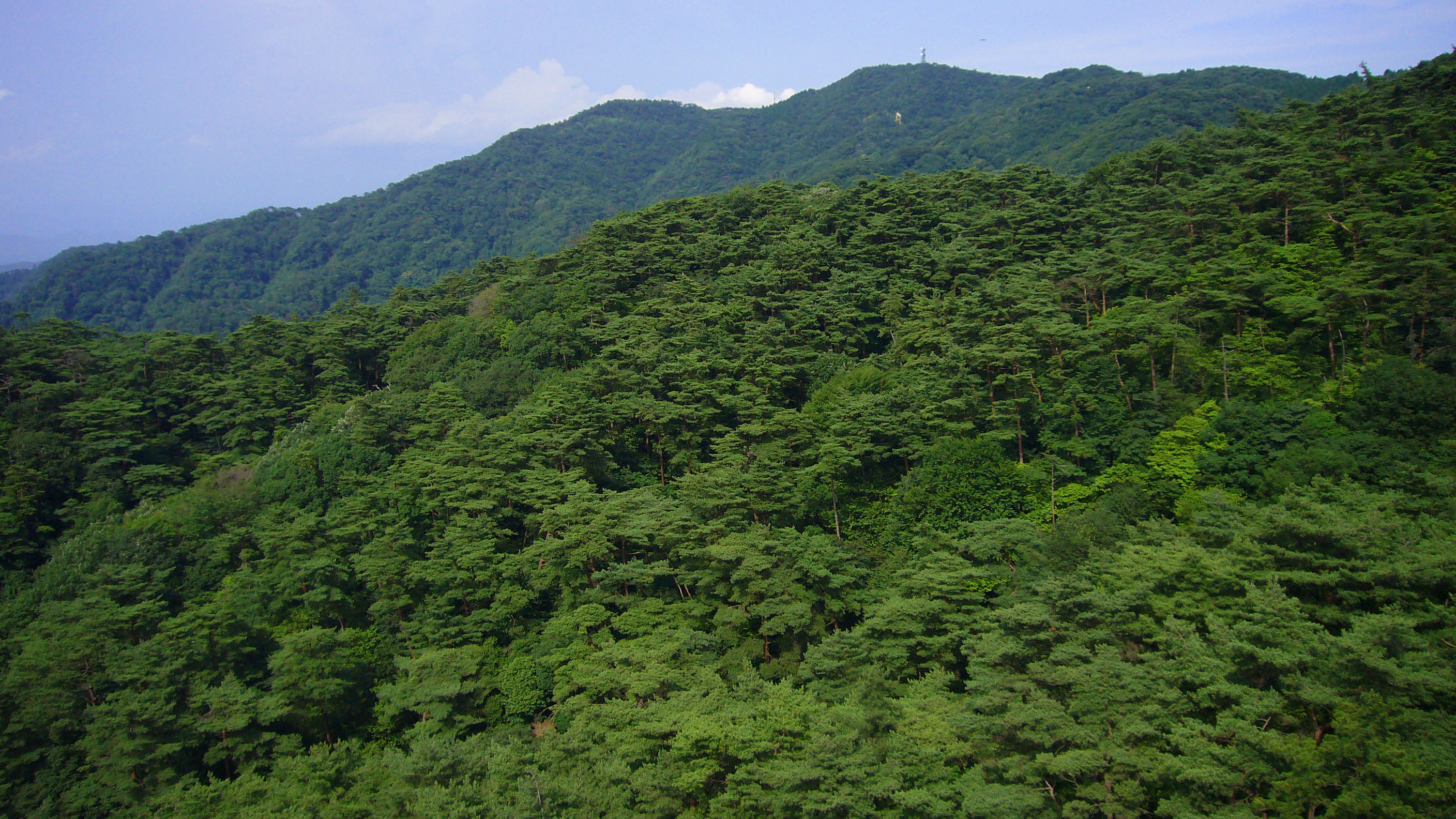
Mount Rokko
Every evening, the lights of Kobe and Osaka ignite across the bay like a circuit board flickering to life. From the summit of Mount Rokko, 931 meters above the city, this panorama has earned a nickname that sticks: the ten-million-dollar night view. But the mountains behind Kobe are more than a scenic overlook. The Rokko range stretches 56 kilometers east to west, from Sumaura Koen Park in western Kobe to the city of Takarazuka, and its peaks -- Mount Maya, Mount Kabutoyama, Mount Iwahara, Mount Iwakura -- have shaped the culture, recreation, and identity of the entire Kansai region. There is no single summit called Rokko. The name belongs to the whole range, and the story it tells is one of foreign adventurers, alpine flowers, frozen waterfalls, and a camera company that looked out the window for inspiration.
The Englishman's Fairway
In 1898, an English expatriate named Arthur Hasketh Groom recruited a group of mountaineers and began clearing rocks and brush on the high slopes of Rokko. They had no bulldozers, no heavy machinery -- just determination and leased land. By the fall of 1901, four holes were playable. On February 27, 1903, the Kobe Golf Club was officially established, becoming the first golf course in Japan. The course expanded to eighteen holes the following year. Because it was literally carved from a mountainside, the terrain remains demanding. Golf carts are prohibited, clubs are carried in canvas bags to ease the burden on caddies, and players are limited to eight clubs per round. Two decades later, in 1924, Kuzou Fujiki brought another foreign pursuit to Rokko's granite faces: rock climbing. He established Japan's first rock climbing club on these slopes, turning the mountains into a proving ground for Japanese alpinism.
Gardens in the Clouds
The altitude that makes Rokko dramatic also makes it temperate. While Kobe swelters through humid summers, the mountain ridges stay cool enough to sustain alpine plants from across Japan and Europe. The Rokko Alpine Botanical Garden cultivates these high-altitude species in a setting that feels worlds apart from the urban sprawl below. Nearby, the Nunobiki Herb Garden terraces the slopes with lavender, rosemary, and chamomile -- an aromatic counterpoint to the conifer forests higher up. Water defines the range as much as rock does. Nunobiki Falls, one of Kobe's most celebrated natural landmarks, cascades down the mountain's southern face. In winter, hikers trek to the Nanamagari Waterfall to see its flow frozen solid, a curtain of ice hanging in the cold mountain air. Lakes Hotaka and Mikuni dot the upper terrain, and Kamakura Valley and Horai Valley cut deep into the ridgeline.
A Mountain's Echo in Glass and Song
Kazuo Tashima, founder of the Minolta Camera Company, once looked out his office window across the ripening rice fields toward the Rokko range and decided the view deserved a legacy. He named his lenses Rokkor, after the mountains visible from the company's optics factory at Mukogawa near Osaka. Until 1981, every 35mm Minolta camera shipped with a Rokkor lens -- a name that traveled the world while the mountains that inspired it stayed rooted in Hyogo Prefecture. The range left its mark on sports culture too. The Hanshin Tigers, one of Japan's most passionately followed baseball teams, adopted the Rokko Oroshi as their fight song. The name translates roughly to 'the blast from Rokko' -- a reference to the fierce winds that sweep down from the mountains toward the coast. Rokko is listed among the 100 Views of Nature in Kansai, a distinction that recognizes both its natural beauty and its deep cultural resonance across the region.
The View From Above
Modern visitors reach Rokko's heights by cable car from Rokko Sanjo Station, by bus from the Kinenhidai stop on the Hankyu line, or by the Maya Cable to Hoshi no Eki Station. At the top, the Rokko Garden Terrace offers panoramic views across Osaka Bay to the distant mountains of Shikoku on clear days. The Rokkosan Pasture provides an unexpected pastoral scene -- grazing land perched high above one of Japan's busiest urban corridors. For hikers, the range offers trails at every difficulty level, from gentle paths through Futatabi Park to scrambles up exposed granite. The mountains serve the Kansai metropolis the way Central Park serves New York -- as a pressure valve, a place to breathe. Millions of residents from Kobe and Osaka treat Rokko as their backyard wilderness, and the mountain repays their devotion with alpine air, seasonal color, and that ten-million-dollar view every single night.
From the Air
Mount Rokko's highest peak sits at 34.78N, 135.26E, reaching 931 meters (3,054 feet) MSL. The range runs east-west for approximately 56 km and forms a dramatic ridgeline behind the Kobe waterfront. Kobe Airport (RJBE) lies approximately 10 nm south on an artificial island in Osaka Bay. Osaka Itami Airport (RJOO) is roughly 15 nm to the northeast, and Kansai International Airport (RJBB) is about 35 nm to the south-southeast. Expect terrain-induced turbulence on the leeward side during strong north winds (the rokko oroshi). Best viewed at 3,000-5,000 feet AGL approaching from the south over Osaka Bay, where the full ridgeline and city lights are visible.