Mount Royal
Jacques Cartier climbed it in 1535, guided by the people of Hochelaga through fields and forest to a summit overlooking the Saint Lawrence River valley. He named the hill for his patron, King Francis I -- Mont Royal, the royal mountain. Nearly five centuries later, those two words still echo in everything: the island, the city, the entire identity of Montreal. But Mount Royal is more than a namesake. Rising immediately west of downtown, this forested hill is Montreal's geological inheritance from the New England hotspot, a volcanic intrusion that pushed through the Earth's crust as the North American Plate drifted westward. It is one of the Monteregian Hills, a chain of isolated peaks scattered across southern Quebec, and it remains the most intimate -- four kilometres east to west, two and a half north to south, close enough to downtown that its autumn foliage frames every office tower.
A Cross, a Vow, and a Time Capsule
The first cross planted on Mount Royal came from a promise made during a flood. In 1643, Paul de Chomedey, Sieur de Maisonneuve, the founder of Ville-Marie, vowed to carry a cross to the summit if the Virgin Mary stopped the floodwaters threatening the settlement's palisades. The waters receded, and Maisonneuve made his pilgrimage. The cross that crowns the mountain today is not his -- it was installed in 1924 by the Societe Saint-Jean-Baptiste, a steel structure that rises above the tree canopy and glows over the city at night. It was converted to fibre-optic light in 1992 and then to LEDs in 2009. Its default color is white, but it can shift to purple upon the death of a pope, or to any color the occasion demands. Beside the cross sits a time capsule buried during Montreal's 350th anniversary in 1992. Inside are messages and drawings from 12,000 children imagining the city in 2142, the year the capsule is scheduled to be opened.
Olmsted's Unfinished Masterpiece
Frederick Law Olmsted, the landscape architect behind New York's Central Park, designed Mount Royal Park. It was inaugurated in 1876, though his vision was never fully realized. Olmsted's plan was subtle: dense shade trees at the base of the carriage road would create the feeling of a valley, while thinning vegetation near the summit would exaggerate the mountain's height. A depression in the mid-1870s gutted the budget, and the carriage way went up hastily without regard for his planting scheme. What survived was the bones -- winding paths, a semicircular belvedere with a chalet overlooking the skyline, and a forested canopy that has weathered Mayor Drapeau's controversial tree cuts of the 1950s and the devastating Ice Storm of 1998. The Kondiaronk Belvedere, named for the Petun chief whose diplomacy led to the Great Peace of Montreal in 1701, remains the park's most visited overlook. Beaver Lake, a small artificial pond, anchors the park's interior. From 1885 to 1920, a funicular railway carried sightseers to the peak; after it closed, Montreal's No. 11 streetcar took over the route until 1959.
Drums on Sunday
Every Sunday from spring through autumn, the eastern slope of Mount Royal fills with rhythm. The Tam-Tams -- sometimes called the Tam-Tam Jam -- began in the late 1970s with an African drumming workshop at a jazz bar on Ontario Street. It migrated to the park, took root near the George-Etienne Cartier Monument, and grew into one of Montreal's most distinctive public rituals. Dozens of djembe players set up in concentric circles, layering polyrhythmic patterns that carry across the hillside. Dancers weave through the crowd. Nearby, groups stage elaborate battles with foam-padded swords and shields. The gathering is not organized by the city, though municipal authorities eventually stepped in to manage vendors and safety. For years, the Tam-Tams carried a countercultural reputation and a permissive attitude toward cannabis, but the police presence that followed has been remarkably friction-free. It remains one of the few places in any major city where thousands of strangers regularly gather for nothing more than the pleasure of making noise together.
Four Seasons on the Mountain
Mount Royal has been a sporting venue since the 1920s, when one of Canada's best ski jumps stood near Cote-des-Neiges. The hill hosted the 1974 UCI Road Cycling World Championships and the road race at the 1976 Summer Olympics. The Grand Prix Cycliste de Montreal still runs its course along the mountain's hilly roads every year. In winter, the former alpine ski slope -- once equipped with a T-bar lift -- now serves as a snow tube and toboggan run. Seven groomed cross-country ski and snowshoe trails wind through the forest. The Montreal Snow Shoe Club, founded in 1840, once gathered weekly on Sherbrooke Street at nightfall, setting off through the park by torchlight in blue tuques. That tradition faded with the club, but the Les amis de la montagne organization revived it as the Tuques Bleues celebration. In June 2017, during Montreal's 375th anniversary, the city honored the hill's oldest use by naming a greenspace on the Outremont peak Parc Tiohtiake Otsira'kehne -- Mohawk for "the place of the big fire" -- acknowledging the beacon fires that First Nations people once lit on this summit long before any European climbed it.
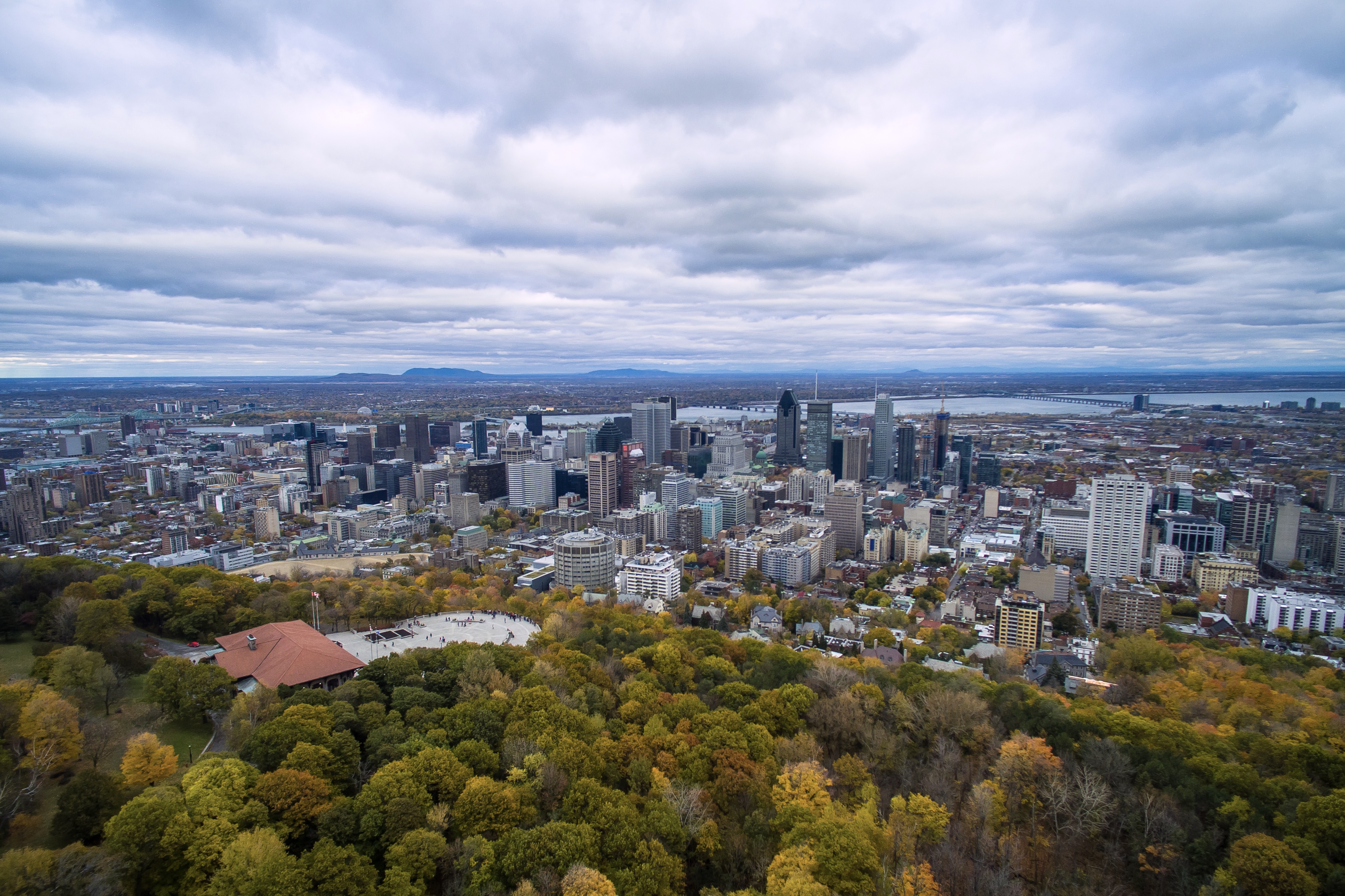
From the Air
Mount Royal sits at 45.51N, 73.59W, immediately west of downtown Montreal. From the air, the hill is unmistakable: a forested green dome (or snow-covered white dome in winter) rising above the urban grid, crowned by an illuminated cross and a broadcast candelabra tower. The CBC transmission facility on the summit is capped at 1,100 feet above sea level to maintain clearance for approaches to Montreal/Pierre Elliott Trudeau International Airport (CYUL), 10 nm to the west. Saint Joseph's Oratory, the largest church in Canada, is visible on the mountain's western slope. Best viewed at 2,000-3,000 feet AGL from the south or east, where the downtown skyline creates a dramatic backdrop behind the mountain.