Mount Shasta Wilderness
The Shasta owl's clover was presumed extinct for over eighty years. Harvard botanist Asa Gray first described it in 1848, and after a single collection in 1913, the delicate wildflower vanished from scientific record. Searches scoured the moist meadows and vernal pools where it supposedly grew. Nothing. Then in May 1996, Dean Taylor of UC Berkeley found eight individual plants clinging to a dry, sagebrush-covered hillside high on the flanks of Mount Shasta. The wilderness that harbors such botanical mysteries is equally full of surprises: a volcano so massive it generates its own weather systems, California's lowest-elevation glacier, and a stone causeway hand-built a century ago from volcanic rock.
The Mountain That Makes Weather
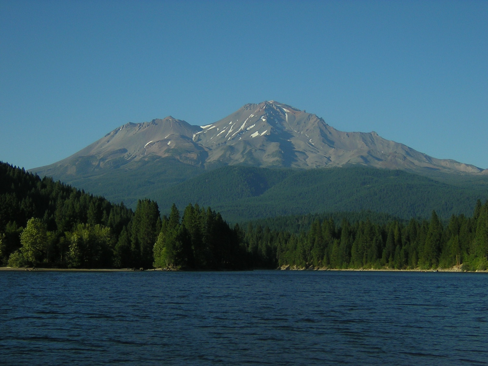
Mount Shasta stands alone. Rising from the surrounding plateau with a base diameter that dwarfs most mountains, this solitary giant intercepts air masses and spins them into sudden storms. Climbers have watched clear skies transform into whiteouts within minutes. The mountain's isolation creates orographic lift that squeezes moisture from Pacific systems, feeding seven glaciers that radiate from the summit like white spokes. The Wintun Glacier holds a peculiar distinction: it's the lowest-elevation glacier in California, clinging to the mountain at elevations that would be bare rock on any other peak. Shastina, a smaller volcanic cone at 12,330 feet, emerged after the ice age glaciers retreated, a reminder that this landscape continues to evolve.
Sacred Ground, Hard Climbs
Congress designated this wilderness in 1984, setting aside land that ranges from pristine old-growth forest to terrain once scarred by intensive logging. The volcano draws mountaineers from around the world, though calling any route 'easy' would be misleading. The popular Avalanche Gulch route still demands ice axes and crampons. Falling rocks pose constant danger above timberline, and the best climbing season falls in June and July when snow still blankets the routes. Ten trailheads offer access to the wilderness, but none lead to a marked summit trail. Every ascent is a cross-country journey requiring experience in ice and snow travel. Climbers must purchase a Summit Pass, pack out all human waste, and accept strict limits: no dogs, no campfires, groups of ten or fewer.
Forests of Red and Stone Pathways
Below the glaciers and lava flows, pure stands of Shasta red fir blanket the wilderness. Mixed conifer forests of white fir, Douglas-fir, sugar pine, and incense cedar fill the mid-elevations. The lava flows on the northeast flank support tougher species: mountain mahogany and juniper adapted to volcanic soils. Near timberline, whitebark pines grow in krummholz form, stunted and windswept. The Sierra Club maintains Horse Camp within the wilderness, where the Shasta Alpine Lodge has welcomed climbers since 1923. Built from volcanic rock and red fir wood, it serves as a base camp for summit attempts. Nearby, the Olberman Causeway stretches half a mile across fragile terrain, a stone walkway constructed in the 1920s by the first caretaker, Mac Olberman, using rocks gathered from the surrounding slopes.
Rare Blooms and Watchful Eyes
Golden eagles circle above the wilderness. Prairie falcons and red-tailed hawks hunt the slopes while black bears roam the forested flanks. But the true rarities here are botanical. The Mt. Shasta arnica and Siskiyou Indian paintbrush survive in this harsh terrain, the paintbrush drawing water and nutrients from the roots of neighboring plants through hemiparasitic adaptation. Most remarkable is that Shasta owl's clover, the tiny plant that fooled botanists for eight decades. Its rediscovery on that sagebrush hillside in 1996 revealed how little we understand about where life persists in this volcanic landscape. The wilderness protects not just scenic grandeur but mysteries still being solved.
From the Air
Mount Shasta Wilderness centers on the volcano at 41.42°N, 122.21°W, with the summit reaching approximately 14,179 feet. The mountain creates its own weather and should be approached with caution. Visible from great distances in clear conditions. Nearest airports: Montague-Yreka Rohrer Field (1O5) and Weed Airport (O46) to the north. The wilderness extends from forested slopes to glaciated summit, with Shastina (12,270 ft) visible one mile west of the main peak.