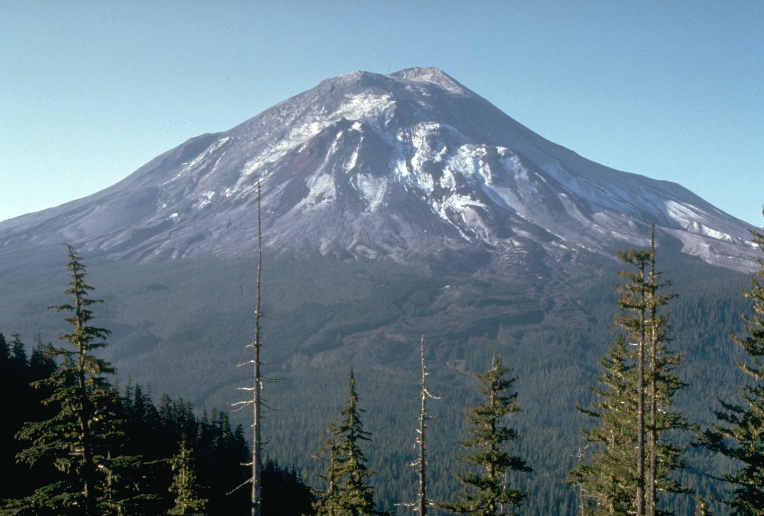
Mount St. Helens: The Mountain That Blew Its Top
The mountain gave warning. For two months before May 18, 1980, earthquakes shook Mount St. Helens, steam vented from its crater, and a bulge grew on the north face at five feet per day. Scientists monitored; authorities restricted access; Harry Truman refused to leave his lodge. At 8:32 AM on that Sunday morning, an earthquake triggered the collapse of the bulge, releasing pressure that blasted sideways with the force of 500 Hiroshima bombs. The lateral blast, moving at 300 mph, devastated 230 square miles in seconds. Fifty-seven people died, including volcanologist David Johnston, whose last radio transmission was 'Vancouver! Vancouver! This is it!' The mountain that had been 9,677 feet tall was now 8,363 feet, its summit replaced by a horseshoe crater.
The Warning
Mount St. Helens had been dormant since 1857, but scientists knew the Cascades contained active volcanoes. Earthquakes began in mid-March 1980, increasing in frequency and magnitude. Steam explosions opened a crater at the summit. Most ominously, the north face began to bulge outward, growing into a mass of unstable rock. Geologists recognized the danger: if the bulge collapsed, pressure beneath would release catastrophically. They established monitoring stations and advocated for evacuation zones. The red zone around the volcano excluded most people - but not all. David Johnston was monitoring from a ridge five miles north. Harry Truman stayed at his lodge on Spirit Lake. The warnings were given; the mountain decided when to erupt.
The Blast
At 8:32:17 AM on May 18, 1980, a magnitude 5.1 earthquake triggered the collapse of the north face. The largest landslide in recorded history - 0.7 cubic miles of rock - roared down the mountain. The sudden decompression released superheated gas and rock in a lateral blast that overtook the landslide, traveling at 300-670 mph, devastating everything within 19 miles. Trees 4 feet in diameter were snapped like matchsticks. Spirit Lake was buried under 600 feet of debris. The blast reached David Johnston's position in seconds; his body was never found. A vertical eruption column rose 80,000 feet, spreading ash across the Pacific Northwest and eventually around the world.
The Aftermath
Fifty-seven people died. The economic damage reached $1 billion (1980 dollars). Ash fall disrupted transportation and business across Washington, Oregon, and Idaho. The Toutle River choked with debris, threatening downstream communities. The mountain's profile was transformed - the once-symmetrical cone now bore a horseshoe-shaped crater opening north. Spirit Lake, beloved recreation site, was buried and reformed at 200 feet higher elevation, filled with floating logs. The devastation zone looked lunar: gray ash, flattened forests, no apparent life. The explosion was so well-documented that it transformed volcanology, providing data on eruption dynamics that had only been theorized.
The Return
Life returned faster than expected. Within weeks, plants sprouted through ash. Pocket gophers, surviving underground, churned buried soil to the surface. Elk migrated into the blast zone within months. Scientists established monitoring plots and watched ecosystems rebuild. The process taught lessons: disturbance creates opportunity; life is resilient; recovery follows patterns but surprises constantly. Mount St. Helens National Volcanic Monument was established in 1982, preserving the blast zone as a living laboratory. The mountain continues to rebuild its dome, with minor eruptions as recently as 2008. The volcano that killed 57 people is now a classroom for understanding both destruction and recovery.
Visiting Mount St. Helens
Mount St. Helens National Volcanic Monument is located in southwestern Washington, approximately 50 miles northeast of Portland via Interstate 5 and Highway 504. The Johnston Ridge Observatory, at the end of Highway 504, offers crater views and interpretive exhibits. The observatory is open seasonally (May-October). The Coldwater Ridge and Hoffstadt Bluffs visitor centers provide additional interpretation. Trails into the monument range from easy walks to challenging climbs; permits are required for summit attempts. The south side approach (Climbers Bivouac) accesses the crater rim. Allow a full day for the Johnston Ridge experience; multiple days for backcountry exploration. The devastation remains visible; the recovery is observable; the volcano is still active. The experience combines geology lesson with ecological field study.
From the Air
Located at 46.19°N, 122.18°W in the Cascade Range of southwestern Washington. From altitude, Mount St. Helens' distinctive profile is immediately apparent - the horseshoe crater opening north, the lava dome rebuilding within. The blast zone is visible as gray terrain distinct from surrounding green forest, recovery still incomplete four decades later. Spirit Lake, once pristine, now contains floating log rafts. The Toutle River drainage shows lahar deposits. Mount Adams rises to the east; Mount Hood to the south in Oregon. The Cascade chain extends north toward Mount Rainier, visible on clear days. What appears from altitude as a damaged mountain is an active volcano, temporarily quiet, inevitable to erupt again.