Mount Talinis
The Spanish called it Cuernos de Negros -- the Horns of Negros -- and the name captures something essential about this mountain range. Seen from the Tanon Strait, the volcanic peaks jut against the sky like the horns of some massive creature surfacing from the island's interior. At 1,862 meters, Mount Talinis is the tallest of these peaks, the second highest mountain on Negros Island after Mount Kanlaon. But Talinis is not a single summit. It is a complex volcano with multiple cones, crater lakes, steam vents, and a geothermal field that generates enough electricity to power an entire province.
Fire Beneath the Forest
The Philippine Institute of Volcanology and Seismology classifies Cuernos de Negros as a potentially active volcano, part of the Negros Volcanic Belt that runs the length of the island. With a base diameter of 36 kilometers, the complex is enormous -- a sprawl of andesite and basalt peaks including Talinis, Magaso, Guinsayawan, Yagumyum Peak, and the Guintabon Dome. Steam hisses from solfataras and fumaroles scattered across its slopes, evidence of the heat still churning underground. At Palinpinon, the Southern Negros Geothermal Production Field harnesses that volcanic energy to generate 192.5 megawatts of electricity, supplying the energy needs of Dumaguete and southern Negros. The mountain is simultaneously wild landscape and industrial power plant, its geological restlessness turned to human advantage.
Lakes in the Caldera
Tucked within the volcanic complex lie some of the most striking bodies of water in the Visayas. The twin crater lakes of Balinsasayao and Danao sit separated by a narrow mountain ridge inside the Guintabon Caldera, protected since 2000 as a national park and recently designated an ASEAN Heritage Park. Lake Balinsasayao spans 76 hectares and reaches depths of 90 meters; the smaller Danao covers 30 hectares and descends to 58 meters. A third lake, Kabalin-an, lies nearby. Higher up, near the summit, Lakes Nailig and Mabilog fill their own craters. Lake Yagumyum occupies the saddle between Yagumyum Peak and the main summit. These are not placid lowland lakes -- they are volcanic pools cradled by dipterocarp forest, accessible only by trail, their waters fed by underground springs. Together, they form the watershed for five major river systems that irrigate all of southern Negros Oriental.
The Bleeding-Heart's Refuge
The forests of Mount Talinis harbor 91 documented tree species, including commercially valuable tigerwood, wild orchids, broad-leafed tree ferns, and edible berries. But it is the fauna that makes Talinis irreplaceable. The mountain shelters species found nowhere else: the critically endangered Negros bleeding-heart pigeon, the Visayan warty pig, the Philippine spotted deer, and the Philippine tube-nosed fruit bat. Tarictic hornbills call from the canopy. Leopard cats prowl the understory. This biodiversity faces pressure from illegal logging, slash-and-burn agriculture -- known locally as kaingin -- and the gradual encroachment of settlements into forested areas.
Trails Through the Vents
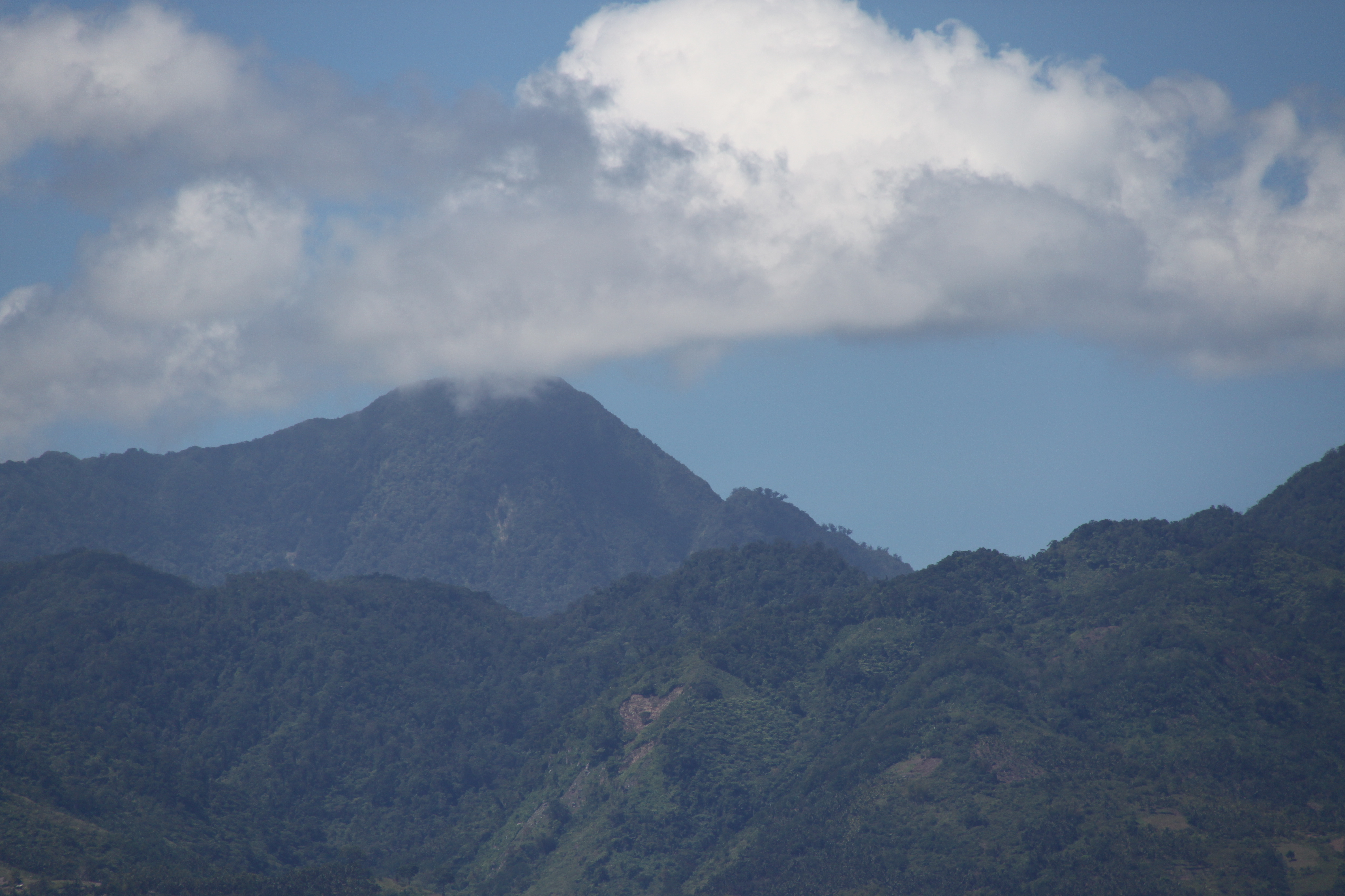
Hikers approach Talinis from trailheads at Bidjao in Dauin and Apolong in Valencia, the municipality that sits just nine kilometers northeast of the volcano. The routes pass through dense forest where wild orchids cling to tree trunks and the calls of sunbirds and cuckoo-shrikes echo through the canopy. On the Apolong trail, hikers encounter the Kaipohan sulfur vents -- an otherworldly landscape of dead trees and bleached rocks where volcanic gases seep from the earth, a reminder of the geological forces simmering below. Lake Nailig serves as the primary camping ground, with the summit reachable in a 30-minute push from there. The peak itself is heavily forested and frequently wrapped in fog, offering more atmosphere than panorama. But the journey is the point: crater lakes, sulfur fields, endemic wildlife, and the constant awareness that this mountain is alive and restless beneath your feet.
From the Air
Mount Talinis dominates the southern interior of Negros Island at 9.25N, 123.17E. The volcanic complex is visible from considerable distance, its multiple peaks recognizable against the island's profile. The summit is frequently cloud-covered. The nearest airport is Dumaguete-Sibulan Airport (RPVD), approximately 20 km to the east. Maintain safe altitude -- the terrain rises steeply and mountain weather can change rapidly. The twin lakes of Balinsasayao are visible from altitude in the Guintabon Caldera on the eastern slopes.