Mount Tanigawa: Japan's Deadliest Peak
Eight hundred and five names are carved into a wall at the base of the mountain, beside a sculpted piton the size of a monument. Each name belongs to someone who went up Mount Tanigawa and did not come back. By comparison, roughly 200 climbers have died on Everest over a comparable timeframe. Tanigawa stands just 1,977 meters tall -- barely half the height of Mount Fuji -- yet it has earned the name that no peak wants: the Mountain of Death. The paradox sharpens when you learn that the easiest route to its summit involves a cable car, and that on any given holiday, families with small children stand at the top, eating onigiri and taking photographs of the clouds below.
Where Weather Goes to War
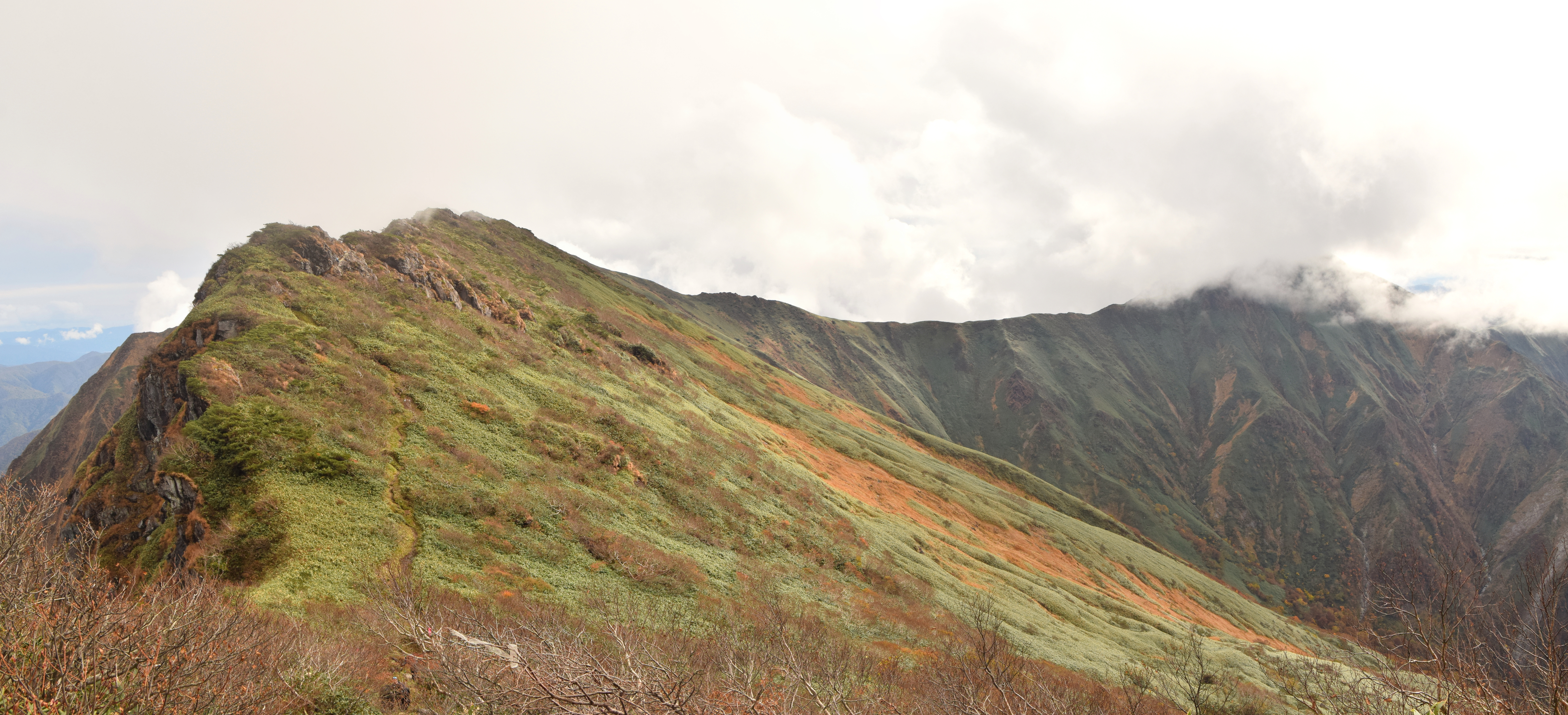
The killing power of Tanigawa lies not in its altitude but in its position. The mountain sits precisely on the border between Gunma and Niigata Prefectures, at the exact collision point where weather systems from the Asian continent meet Pacific air masses in violent confrontation. The results are sudden and extreme. Snow cornices along the summit ridge can extend more than 20 meters outward, silent overhangs waiting to fracture. When they break and avalanches form, the mountain's steep terrain and over 1,000 meters of vertical relief give the sliding mass terrifying momentum. Storms roll in without warning, turning a clear summer climb into a whiteout in minutes. Religious ascetics have walked these slopes for centuries, long before anyone thought to record a first ascent, but the mountain has never been tamed.
The Faces That Swallowed Climbing Parties
The southern route is a family outing. The eastern ridges are something else entirely. Rock climbing routes along the east face are graded on Japan's ice climbing scale from I to VI, with routes that start as low as a few hundred meters above sea level and top out near the 1,977-meter summit. The relief is dramatic and relentless. In 1943, an entire climbing party vanished on the mountain. Their remains were not discovered for thirty years, stumbled upon by another group of climbers in 1973. In the 1960s, a famous rescue attempt on the main face ended in grim improvisation: the climbers had died of exposure while roped to the wall, and when conventional retrieval proved impossible, the Japanese Self-Defense Forces cut the ropes with gunfire to bring the bodies down. Commemorative plaques are scattered at every elevation, some marking individual deaths, others entire groups.
The Deepest Train Station in Japan
The closest train station to Mount Tanigawa is Doai, and arriving there is itself a descent into the mountain. The northbound platform sits 70 meters underground, buried inside the 13,500-meter Shin-Shimizu Tunnel. There are no elevators and no escalators -- just 486 concrete steps spiraling downward into the earth, a ten-minute walk from daylight to platform. Locals call it Japan's Number One Mole Station. In 2021, JR East reimagined the struggling rural stop, opening a glamping facility called Doai Village and converting the old ticket office into a cafe. The station has become a destination in its own right, attracting visitors who come not for the mountain but for the strange thrill of descending into a tunnel to catch a train.
Mountain as Cultural Mirror
Tanigawa's hold on the Japanese imagination extends well beyond mountaineering circles. The mountain provides the central drama in Yokoyama's novel Seventeen (known as Climber's High in Japanese), which was adapted into an NHK documentary in 2005 and a feature film in 2008. The anime series Encouragement of Climb places its emotional core on Tanigawa's slopes, where the protagonists Aoi and Hinata first discover their love for the mountains. The outdoor equipment company Snow Peak takes its name from the mountain's snow-clad ridgeline. Even in Gunma's Jomo Karuta -- a traditional card game used to teach children about their prefecture -- Mount Tanigawa appears on the 'mi' card. The mountain is woven into everyday Japanese life: a place of beauty, a place of danger, a reminder that the two are often the same.
From the Air
Located at 36.837N, 138.930E on the Gunma-Niigata prefectural border. The peak rises to 1,977 meters (6,486 feet) with dramatic vertical relief on the east face. From altitude, the mountain is identifiable by its stark rocky ridgelines and, in winter, by heavy snow cornices extending from the summit ridge. The Tanigawadake Ropeway is visible on the southern approach. Nearest significant airport is Niigata Airport (RJSN) approximately 100 km to the north. Tokyo Haneda (RJTT) lies roughly 150 km to the south. Mountain weather is notoriously unpredictable due to the continental-Pacific weather collision zone; expect turbulence and sudden cloud formation. The Shin-Shimizu Tunnel and Joetsu rail corridor run beneath the mountain's eastern flank.