Mount Tongariro
At 11:50 p.m. on August 6, 2012, Mount Tongariro erupted from the Te Mari craters with no warning. Geologists had been watching neighboring Ruapehu for signs of trouble. Tongariro was not on their list. An ash cloud rose high into the night sky and drifted east, depositing grit across farmland and highways. The smell of sulphur reached Napier, Hastings, Wellington, Nelson, and Blenheim - cities scattered across hundreds of kilometers. State Highways 1 and 46 were closed under layers of ash. Air New Zealand cancelled flights to six cities. The only significant property damage was to the Department of Conservation's Ketetahi Hut, shattered by volcanic debris. No one was injured, but the eruption was a reminder: this mountain keeps its own schedule.
A Quarter-Million Years of Construction
Tongariro is not a single volcano but a compound one - a sprawling massif built by eruptions from multiple vents aligned along the Taupo Volcanic Zone. The oldest identified materials date to roughly 512,000 years ago, but the current stratovolcano began taking shape about 275,000 years ago, layering andesite lava and tephra into the steep slopes visible today. Eruptive centers stretch from the Te Maari craters in the northeast to the Tama Lakes in the southwest. Mount Ngauruhoe, often treated as a separate peak, is geologically just another vent in the Tongariro complex, as is North Crater, a smaller symmetrical cone. Both formed after the last ice age, when retreating glaciers left room for new cones to build. Moraines and cirques on Tongariro's western flanks record the presence of valley glaciers during the last glacial cycle, before they melted away approximately 18,000 years ago.
Emerald Water, Blue Water, Boiling Water
Tongariro's craters have filled with water to create some of New Zealand's most unearthly landscapes. The Emerald Lakes glow a vivid green from dissolved volcanic minerals - iron, sulphur, and silica tinting the water in colors that shift with the light. Blue Lake sits nearby, sacred to the Maori and designated tapu. Red Crater, which last erupted ash in 1926, still vents active fumaroles that hiss steam and sulphur dioxide into the thin alpine air, depositing yellow sulphur crystals around their edges. The springs in this area are often scalding hot and laced with dissolved metals, making most natural water on the mountain undrinkable. These are not gentle alpine pools. They are geochemical experiments, their colors and temperatures shifting as the volcanic plumbing beneath the mountain opens and closes pathways to the surface.
A Gift Made Sacred
In 1887, Te Heuheu Tukino IV, paramount chief of the Ngati Tuwharetoa iwi, gifted the volcanic peaks to the New Zealand government to protect them from European settlement and land sales. The gesture was described as making the mountains sacred - set apart from commerce and development. Tongariro National Park became New Zealand's first national park and one of the earliest in the world, predated only by Yellowstone, Royal, and Banff. In 1993, it became the first property inscribed on the UNESCO World Heritage List under revised criteria recognizing cultural landscapes, earning dual status for both its natural volcanic features and its intangible cultural significance to the Maori people. The spiritual connection between the iwi and the mountains predates the park by centuries, and the dual designation acknowledges what Te Heuheu Tukino IV understood when he made his gift: these peaks belong to something larger than any nation.
When the Mountain Speaks
The 2012 eruption was not Tongariro's first surprise. Te Mari had last erupted in 1897, and the 115-year gap had bred a false sense of quiet. When the craters blew again in August 2012, blocks up to a meter in diameter were hurled across the landscape. The Ketetahi Hut, 1.5 kilometers from the explosive craters, took a direct hit. Three months later, in November 2012, Te Maari erupted again, sending an ash cloud 4,000 meters high in a five-minute burst. About 100 people were in the vicinity, including 20 thirteen-year-old students from Gulf Harbour School. No one was hurt. The Tongariro Alpine Crossing, which passes directly through the blast zone, was closed for four days. The mountain's severe alpine climate adds its own dangers: between March and October, snowfall, rain-turned-ice, and sudden storms can make the exposed terrain lethal. Peter Jackson filmed parts of The Lord of the Rings across Tongariro's landscapes, and the mountain played its role with characteristic unpredictability.
From the Air
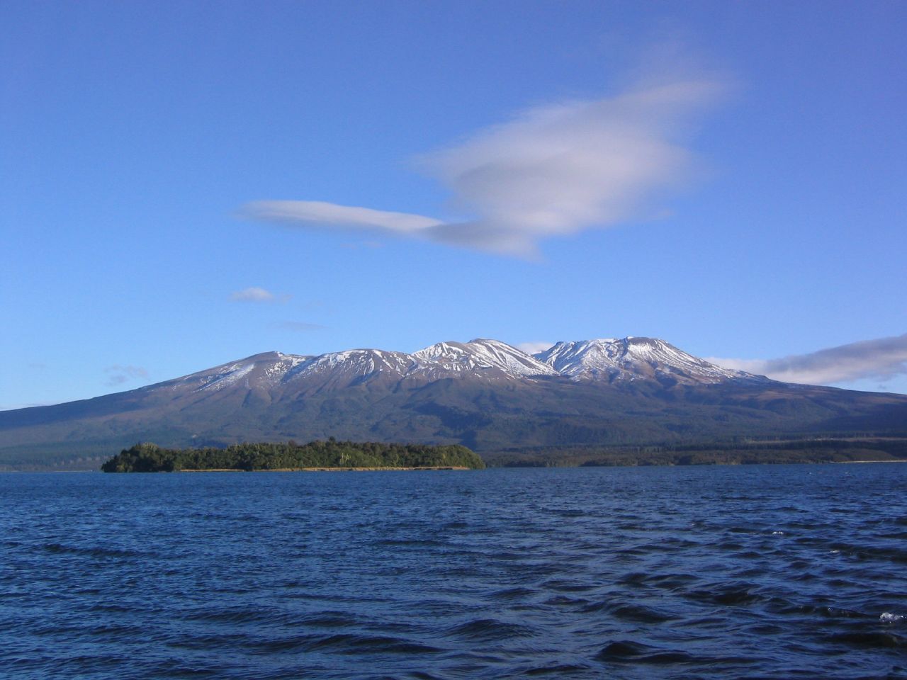
Mount Tongariro at 39.13°S, 175.64°E rises to 1,967 m (6,453 ft) as the northernmost of three active volcanoes dominating the central North Island. The Emerald Lakes and Blue Lake are visible from altitude in clear conditions as vivid spots of color against the dark volcanic terrain. The Te Maari craters on the northeastern flank are the most recently active vents. Lake Taupo lies to the northeast. Nearest airport is Taupo (NZAP). The Tongariro Alpine Crossing track is visible as a thread across the volcanic landscape. Active volcanic hazard zone - check NOTAMs for eruption advisories and temporary flight restrictions.