Mt. Rich Petroglyphs
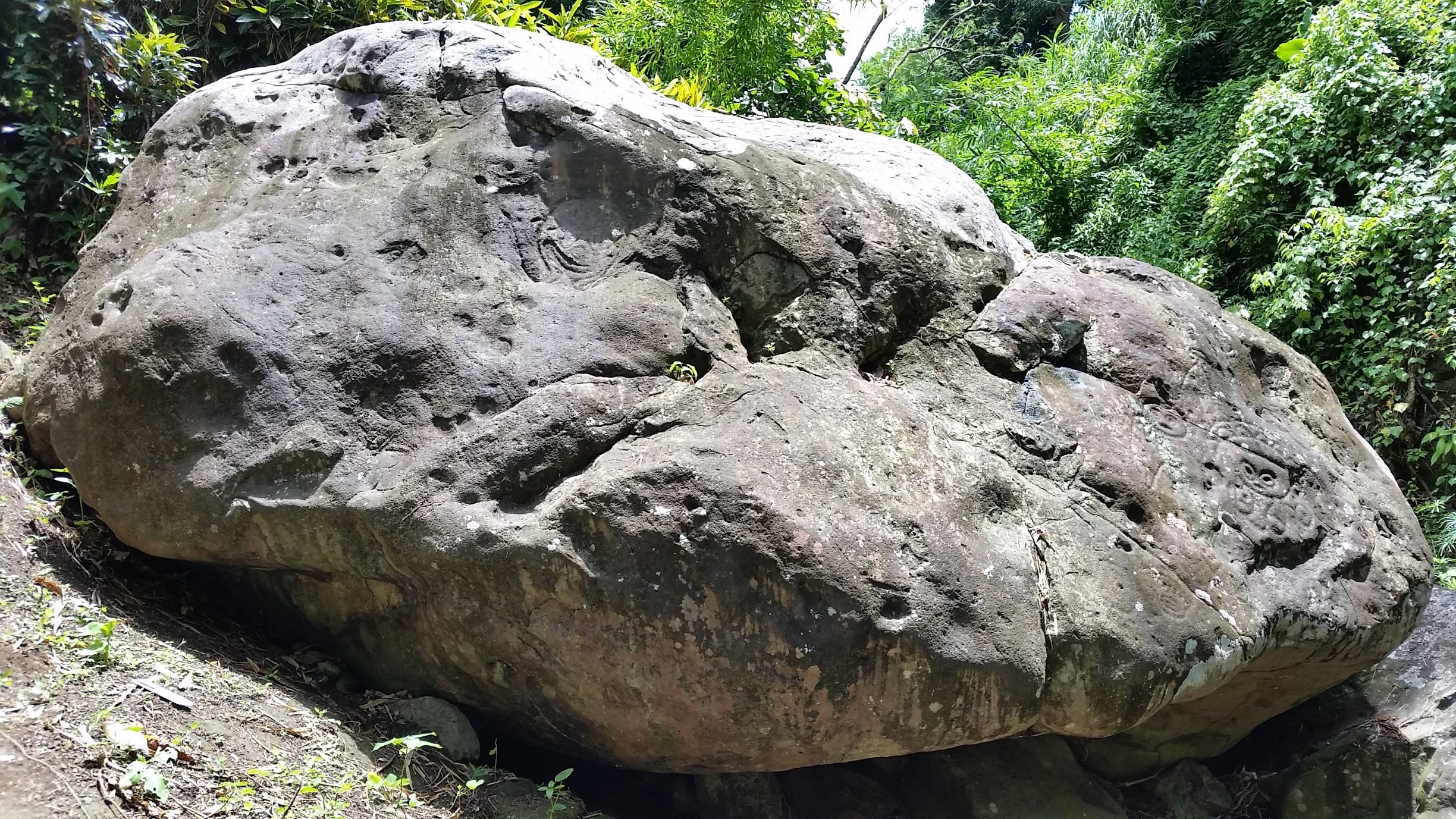
The largest boulder holds more than sixty carvings, and it has been holding them for over a thousand years. Deep in a ravine along the Saint Patrick River in northern Grenada, the Mt. Rich Petroglyphs are easy to miss and impossible to forget - faces staring out from the rock, some plainly human, some with the features of animals, some blurred by time into shapes that resist interpretation. The people who carved them left no written explanation. They left only the stone itself, the river beside it, and the silence of a place that was clearly, unmistakably, important.
Carved Between River and Sky
The petroglyphs sit on several boulders in the ravine, but the main stone dominates. Its surface is dense with engravings - over sixty documented images that archaeologists have sorted into three broad categories: simple faces, elaborate faces with zoomorphic or animal-like features, and geometric patterns. Nearby, two workstones contain six cupules, small circular depressions ground into the rock. Ceramic data from the nearby Montreuil archaeological site suggests the carvings date no earlier than AD 700, and other evidence linking climatic aridity with population movements across South America and the southern Caribbean narrows the most likely period to AD 750-900. The people who made them were part of the broader Amerindian cultures that inhabited the Caribbean long before European contact - peoples now commonly (if imprecisely) associated with the Arawak and Carib linguistic groups. They chose this spot for reasons that had nothing to do with chance.
Where Shamans Spoke to Ancestors
Caribbean archaeologists have identified patterns across petroglyph sites throughout the region: they occur near water, they often have workstones nearby, and their imagery includes both naturalistic and abstract forms. The prevailing interpretation is that these were ritual spaces. Amerindian groups in the Caribbean practiced animism - a worldview in which the spiritual and physical worlds are not separate, and communication with ancestors is not metaphor but practice. If Mt. Rich was a ritual site, the workstones may have served as mortars where shamans prepared hallucinogenic mixtures to open channels to the spirit world before carving or re-carving the stone. The re-carving matters. Some images appear to have been traced over older ones, suggesting the site was used across generations, each shaman adding to or refreshing the work of predecessors. The petroglyphs were not decoration. They were conversation - ongoing, layered, conducted across centuries between the living and the dead.
Rediscovered, Again and Again
The earliest written mention of the Mt. Rich stones appears in an 1833 note in the Grenada Magazine, which describes "several hieroglyphical characters" carved on a stone below the Mount Rich sugar works. In 1903, German geologist Karl Sapper visited the site with Reverend Thomas Huckerby, sketching several of the images. Huckerby, a Methodist minister who had already documented petroglyphs on neighboring St. Vincent, published a booklet in 1921 through the Museum of the American Indian in New York - now part of the Smithsonian - containing photographs and analysis of the Mt. Rich glyphs and two other sites near Victoria, Grenada. Since then, researchers have returned periodically. In 1986, archaeologist Ann Cody recorded the site in an island-wide inventory. Each generation of scholars adds new documentation, new theories, new urgency about preservation - because the stones, though ancient, are not indestructible.
Guardians of the Ravine
In 2014, a local youth group called MYCEDO received a grant to renovate an old lookout building overlooking the petroglyph site and transform Mt. Rich into a heritage attraction. By 2018 they had opened it to visitors, offering a viewing platform, interpretive information, and guided tours of the village and the abandoned plantation estates nearby. The site is now part of the Ministry of Tourism's Petroglyph Path, a route linking several of Grenada's rock art locations. Yet formal protection remains elusive. Like all of Grenada's prehistoric and historic archaeological sites, Mt. Rich has no clear legal designation despite decades of recommendations for a national heritage register. The National Museum Act of 2017 technically covers such sites, but it has been only partially implemented. What protects the petroglyphs most, for now, is the ravine itself - the difficulty of access, the river that keeps flowing past, and a youth group that decided the carvings their ancestors left behind deserved better than neglect.
From the Air
Located at 12.19N, 61.64W in Grenada's northern interior, in the parish of Saint Patrick along the Saint Patrick River. The site is in a forested ravine and not visible from the air, but the Mt. Rich area can be identified by the river valley cutting through the green hillsides of northern Grenada. Maurice Bishop International Airport (TGPY/GND) is approximately 20 km to the southwest. The nearby coast at Victoria, Grenada is a useful visual reference. Northern Grenada is lush and mountainous, with elevations reaching over 800 meters at nearby Mount St. Catherine - Grenada's highest peak.