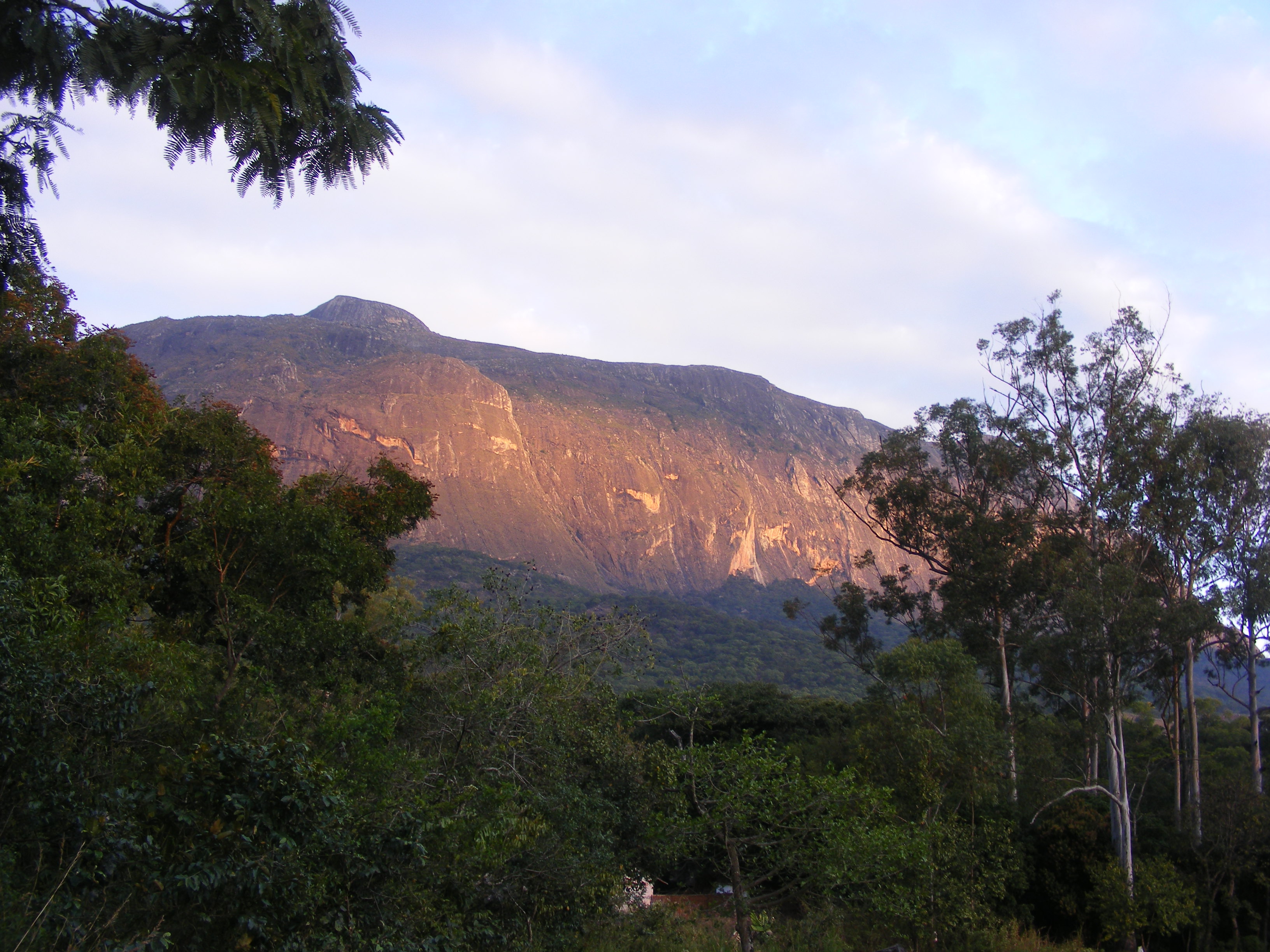
Mulanje Massif
Malawi's national tree is dying. The Mulanje cedar, Widdringtonia whytei, grows only on this mountain and possibly one neighbouring peak, and by 2019 scientists estimated that fewer than fifty mature specimens remained. Armed forestry teams now patrol the cedar stands to stop illegal pit-sawyers. Meanwhile, 250,000 seedlings are planted each year in plastic-covered greenhouses scattered across the plateau -- a race between human greed and human effort that plays out at 1,800 metres on the flanks of a massif that has been standing here for 130 million years. The Mulanje Massif, also known as Mount Mulanje, is a granite inselberg in southern Malawi, 65 kilometres east of Blantyre. Its highest point, Sapitwa Peak, at 3,002 metres, is the roof of Malawi. In 2025, UNESCO designated it a World Heritage Site.
Granite Born from Fire
The massif formed when magma intruded into the Earth's crust roughly 130 million years ago. The surrounding softer rock eroded over the millennia, leaving behind the erosion-resistant igneous core that now rises sharply from the surrounding plains of Phalombe and the Mulanje district. Much of the plateau consists of rolling grassland between 1,800 and 2,200 metres, intersected by deep forested ravines. Individual peaks exceed 2,500 metres, and Chambe Peak's West Face is the longest rock climb in Africa. The mountain is tall enough to disturb upper-level airflow and generate its own rain clouds, making it the headwater source for almost every river running through this part of Malawi. David Livingstone was the first European to report seeing the massif, in 1859, but archaeological evidence on the Thuchila shelf -- tool-making sites dating to the Middle Stone Age, roughly 100,000 years ago -- confirms that people have been coming here far longer.
Peoples of the Mountain
The Mang'anja people arrived from the Congo Basin in the 1600s and settled around Mulanje, farming the soil and trading with coastal Arabs, Portuguese, and Yao merchants. That relative peace ended when the Yao migrated south in the 1800s, fleeing their own internal conflicts and intensifying the slave raids that devastated Mang'anja villages. Livingstone witnessed the destruction and called for help. Scottish missionaries and settlers responded, establishing a mission on the mountain's slopes and founding the tea estates that would become the first significant cultivation of tea outside its countries of origin. Conflict with the Yao led the British to establish forts at Lister and Anderson, staffed with Indian soldiers -- the beginning of Malawi's lasting ties to the Indian subcontinent. Later, Lomwe people fled Portuguese colonial rule and the Mozambican civil wars, settling among the estates and missions. Today, three distinct cultural groups live around the mountain in one of the highest rural population densities in Africa.
The Cedar That Carries a Country
President Hastings Banda proclaimed the Mulanje cedar Malawi's national tree in 1984. Named after Alexander Whyte, a colonial government botanist, Widdringtonia whytei grows up to fifty metres tall, with pale red wood that is straight-grained, fragrant, and naturally resistant to termites, wood-boring insects, and fungi. Its sap is poisonous to insects. These qualities made it commercially irresistible from the 1940s onward, as Laurens van der Post described in his book Venture to the Interior. The cedar forests were estimated in 2004 to have been reduced to 8.5 square kilometres -- half their original extent. The sawing season has been closed since 2007, but the illegal market persists. The IUCN classified the species as critically endangered in 2011, and a 2019 assessment found fewer than fifty mature trees remaining. Yet the cedar is a pioneer species: after fire clears competing vegetation, it is the first tree to reestablish. The seedling programme plants hundreds of thousands each year, and the survival rate is improving.
Walking the Roof of Malawi
Sapitwa Peak was first climbed in 1894 and remains the most popular ascent on the plateau, best accessed from Chisepo hut. The Malawi Mountain Club and the Forestry Department maintain a network of rustic mountain huts across the massif -- Sombani, Chinzama, Minunu, Tuchila, Chombe, Lychenya, and others -- offering hikers and climbers basic shelter in a landscape that can shift from sunny grassland to cloud-wrapped forest in minutes. The massif's endemic species reward the observant: the cholo alethe and white-winged apalis among the birds, a dwarf chameleon, geckos, skinks, the squeaker frog, and a rare limbless burrowing skink. Invasive species -- golden Himalayan raspberry and Mexican weeping pine -- press in from the surrounding lowlands. The mountain generates its own weather, its own ecosystems, and its own urgency. What happens to the Mulanje cedar, to its endemic wildlife, and to the communities that have lived around this granite island for centuries will define whether conservation can outrun extraction on one of Africa's most extraordinary landforms.
From the Air
Located at 15.90S, 35.65E in southern Malawi, approximately 65 km east of Blantyre. The Mulanje Massif is impossible to miss from altitude: a massive granite inselberg rising abruptly from relatively flat plains to 3,002 metres at Sapitwa Peak. The plateau is often capped with clouds generated by the massif's own weather patterns. Chileka International Airport (FWCL) near Blantyre is the nearest major airfield, roughly 65 km to the west. The tea estates surrounding the base appear as green geometric patterns. Chambe Peak's dramatic West Face is visible from the west. Pilots should expect turbulence and rapidly changing weather conditions near the massif.