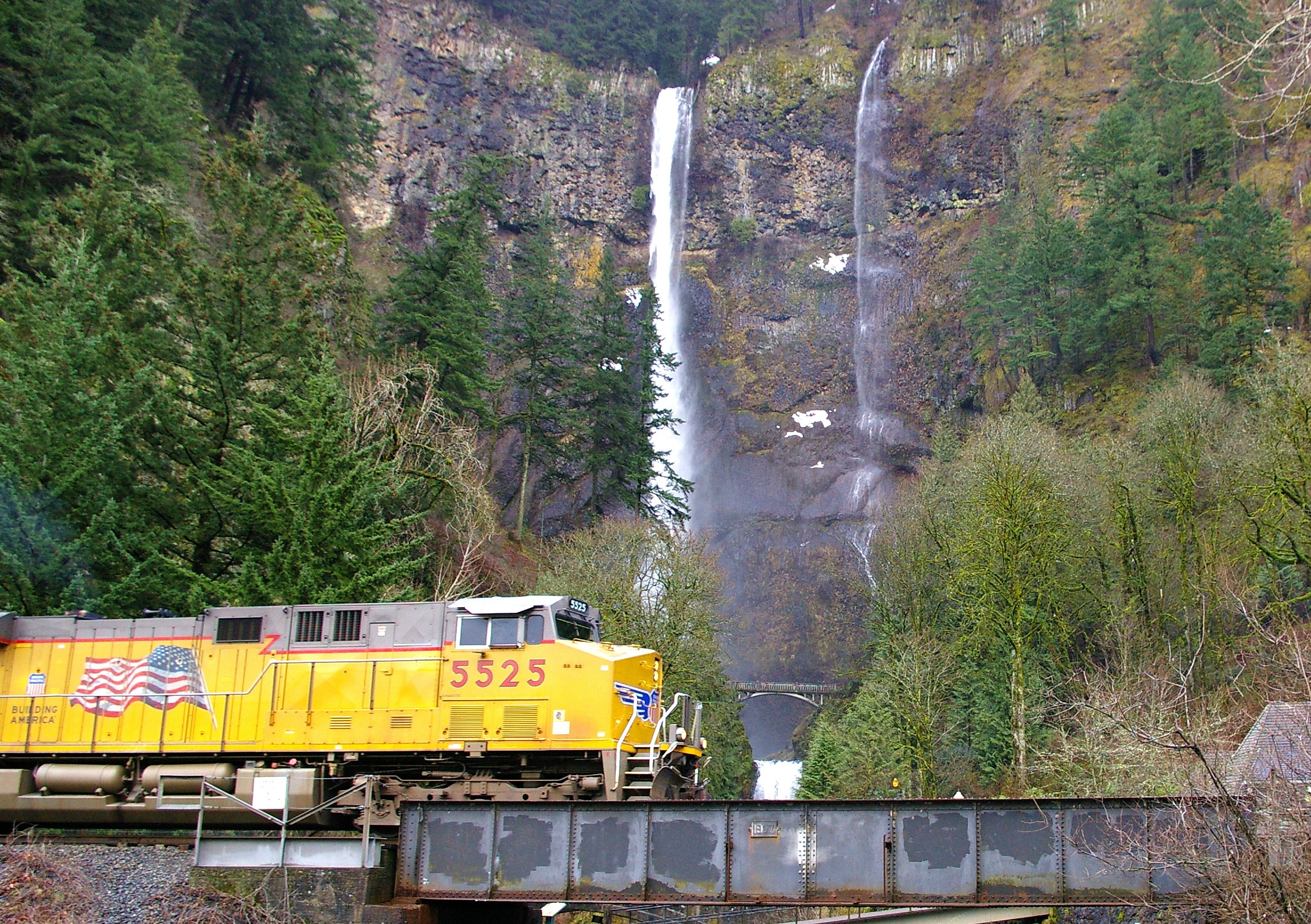
Multnomah Falls
The water falls forever here, or so it seems. Fed by underground springs from Larch Mountain, Multnomah Falls never runs dry - even in the driest summers, when other Gorge waterfalls fade to trickles. At 620 feet, it drops in two distinct plunges separated by a brief rest on a rock ledge, where the Benson Footbridge arcs gracefully across the mist. This is Oregon's tallest waterfall, and one of the most visited natural sites in the Pacific Northwest, drawing over two million people each year to stand in its perpetual spray and feel the thunder of water on rock.
The Never-Ending Falls
What makes Multnomah Falls remarkable isn't just its height - it's its constancy. While most waterfalls depend on rainfall and snowmelt, this one draws from underground springs that filter through Larch Mountain year-round. The falls formed roughly 15,000 years ago, carved into basalt cliffs during the catastrophic Missoula Floods that shaped the Columbia River Gorge.
After heavy rains or during spring snowmelt, the falls transform. What's normally a graceful plume becomes a thundering curtain, spray rising in clouds that soak viewers on the observation deck. At flood stage, the water seems less like falling liquid than like a solid force - white chaos pouring over black rock. Even in summer, the mist creates a microclimate where moss thrives and visitors find relief from heat.
A Philanthropist's Gift
In 1915, lumber baron Simon Benson donated over 300 acres around the falls to the city of Portland, including the falls themselves and nearby Wahkeena Falls. Benson had made his fortune in the timber industry, but he understood that some forests were worth more standing than logged. His gift preserved one of Oregon's natural treasures for generations.
Architect A.E. Doyle designed the Multnomah Falls Lodge, completed in 1925 in a "Cascadian" style using native split fieldstone. The building features steep cedar-shingled roofs and massive chimneys, designed to harmonize with the basalt cliffs rising behind it. The lodge and surrounding footpaths were added to the National Register of Historic Places in 1981. Doyle's lodge continues to welcome visitors nearly a century later.
The Bridge in the Mist
The Benson Footbridge spans the lower falls 105 feet above the ground, offering views directly into the upper falls that seem to pour from the sky itself. Built in 1914 as a timber bowstring truss bridge, it was later rebuilt in concrete. Standing on the bridge, mist dampening your face, you understand why this spot has captivated visitors since Lewis and Clark noted the falls in their journals in 1805.
The bridge became internationally famous in unexpected ways. When a rockfall damaged it in January 2014, the Falls were temporarily closed for repairs. In 2017, the Eagle Creek Fire threatened the entire area, closing the falls for months. When trails finally reopened in 2018, visitors returned with renewed appreciation for what had nearly been lost.
Sacred Waters
Long before European settlers arrived, the Multnomah people knew this place. According to their creation story, a young woman sacrificed herself to the Great Spirit, jumping from the cliff to save her village from a plague. After her death, water began to flow from above the cliff, creating the waterfall that now bears her people's name.
The falls take their name from the Multnomah tribe, though the exact origin of the naming is debated. Scholar Lewis A. McArthur suggested that S.G. Reed, a Portland merchant, may have first applied the name to popularize sites along the Columbia River for steamboat excursions. Whatever its etymology, the falls remain a place where the power of nature commands reverence.
From the Air
Located at 45.58N, 122.12W in the Columbia River Gorge, east of Portland. The falls are visible as a distinctive white streak on the basalt cliffs on the Oregon side of the Gorge. The Historic Columbia River Highway and I-84 run along the base of the cliffs. Look for the characteristic two-tier drop with the footbridge spanning the gap between levels. Lake McDonald sits at the base where Multnomah Creek meets Benson Lake. Nearest airports: Portland International (KPDX) 30 miles west; Troutdale (KTTD) 15 miles west. The Gorge can experience strong winds and turbulence, especially near Crown Point. Marine layer common in mornings during warmer months.