Munduruku Indigenous Territory
The villages along the Cururu River appear and disappear. Not in any dramatic sense -- no floods wash them away, no armies displace them. They dissolve and reconstitute, as the Munduruku people have lived for generations, forming communities when conditions call for gathering and dispersing when the logic of the forest suggests otherwise. This fluidity confounds census-takers but reflects a deeper truth about the Munduruku Indigenous Territory: the people here do not merely occupy the land. They move through it, shaping and being shaped by its rivers, its seasons, and its rhythms across 2,382,000 hectares of the upper Tapajos basin in western Para state.
Rivers as Boundaries, Rivers as Roads
The territory's borders are written in water. The Tapajos River and its tributary the Teles Pires define the north and west boundaries. To the north lies the Sai Cinza Indigenous Territory; to the south, the Kayabi Indigenous Territory extends toward Mato Grosso. The eastern edge abuts the Crepori National Forest and Rio Novo National Park, creating a continuous stretch of protected land. Within these boundaries, the Munduruku orient themselves not by compass points but by watersheds. The Cururu River, a tributary of the Tapajos, hosts the densest concentration of villages. Beyond it, the landscape is mapped by the Anipiri, the Cadiriri, the Cabitutu, the das Tropas, the Kaburua, and a web of igarapes -- the small forest streams whose names, Wareri and Parawadukti and Macaranduba, belong to the Munduruku language rather than to Portuguese cartography.
A Mosaic of Forest and Savanna
The territory lies entirely within the Tapajos river basin and the Amazon biome, but its vegetation is far from uniform. Open rainforest covers about a quarter of the land, while dense rainforest accounts for roughly seventeen percent. The largest category -- savanna-rainforest contact zones at nearly thirty-eight percent -- reflects a landscape where the Amazon's wet green canopy yields to the drier, more open formations that characterize Brazil's cerrado. Another fifteen percent consists of savanna-seasonal forest transitions, with smaller patches of deciduous forest and pioneer formations filling the gaps. This ecological mosaic supports the subsistence patterns that have sustained the Munduruku and neighboring peoples for centuries: hunting in the forest, fishing in the rivers, and cultivating crops in the clearings between them.
Six Peoples, Eighty Villages
Though the territory bears the Munduruku name, it is home to multiple indigenous groups. The Apiaca, Kayabi, Kayapo, Tembe, and Rikbaktsa peoples also live within its boundaries, part of a broader indigenous population estimated at 10,065 in the upper Tapajos region as of 2002, spread across roughly eighty villages. The territory's own population has grown steadily -- from 2,420 in 1990 to 5,075 in 1995 and 6,518 by 2012. Two indigenous organizations, the Associacao Da'uk and the Conselho Indigena Munduruku do Alto Tapajos, provide community governance. The Brazilian state maintains a presence through Funai, the federal indigenous affairs agency, and FUNASA health bases equipped with malaria testing laboratories, hospitalization rooms, and staff quarters. The Catholic Church's Missao de Sao Francisco adds another institutional thread to a social fabric woven from diverse traditions.
The Dam That Cannot Be Built
Officially recognized by decree on February 26, 2004, the Munduruku Indigenous Territory almost immediately became a battleground. The proposed Chacorao Dam on the Tapajos River would flood 18,700 hectares of Munduruku land, affecting the Munduruku, Kayabi, and Apiaca peoples. But Brazil's constitution contains a provision that dam builders cannot easily circumvent: indigenous communities may not be forcibly relocated from their recognized territories. As of 2010, Eletronorte, the state power company, had not even applied to begin feasibility studies. A company spokesman acknowledged the constitutional barrier directly -- without a change to the foundational law of the land, projects in indigenous territories simply cannot proceed. The standoff encapsulates a larger tension running through the Brazilian Amazon, where the rivers that sustain indigenous life are the same rivers that energy planners covet for their hydroelectric potential. For now, the Tapajos flows unobstructed through Munduruku territory, and the villages along the Cururu continue their ancient pattern of gathering and dispersal.
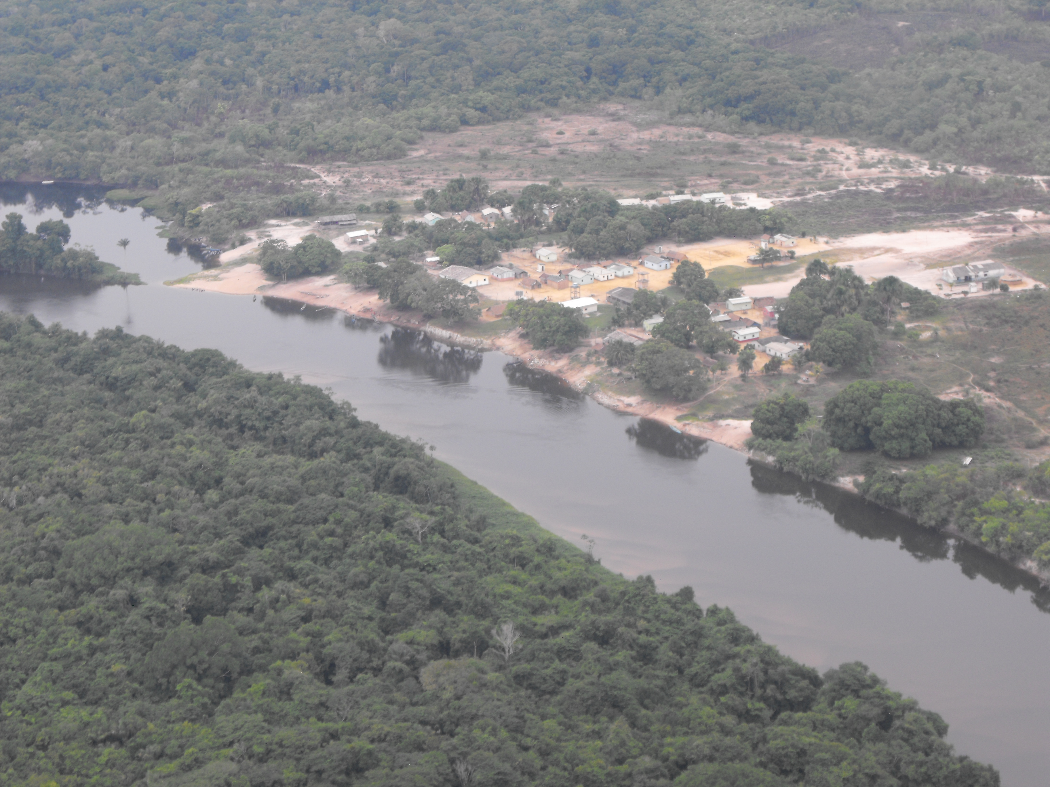
From the Air
Located at 7.23S, 57.67W in western Para state, Brazil. The territory covers 2.38 million hectares along the upper Tapajos River, with the Teles Pires River forming the western boundary. From altitude, the Tapajos and its tributaries are the primary landmarks -- broad river corridors cutting through the canopy. The nearest airport is Jacareacanga (SBEK), a small town on the Tapajos just northwest of the territory. Itaituba (SBIH) offers a larger facility further downstream. Manaus (SBEG) is approximately 600 km to the northwest. Recommended viewing altitude: FL350 for the full territorial extent; 5,000-8,000 feet to observe village patterns along the Cururu River.