Museum Nord, Narvik
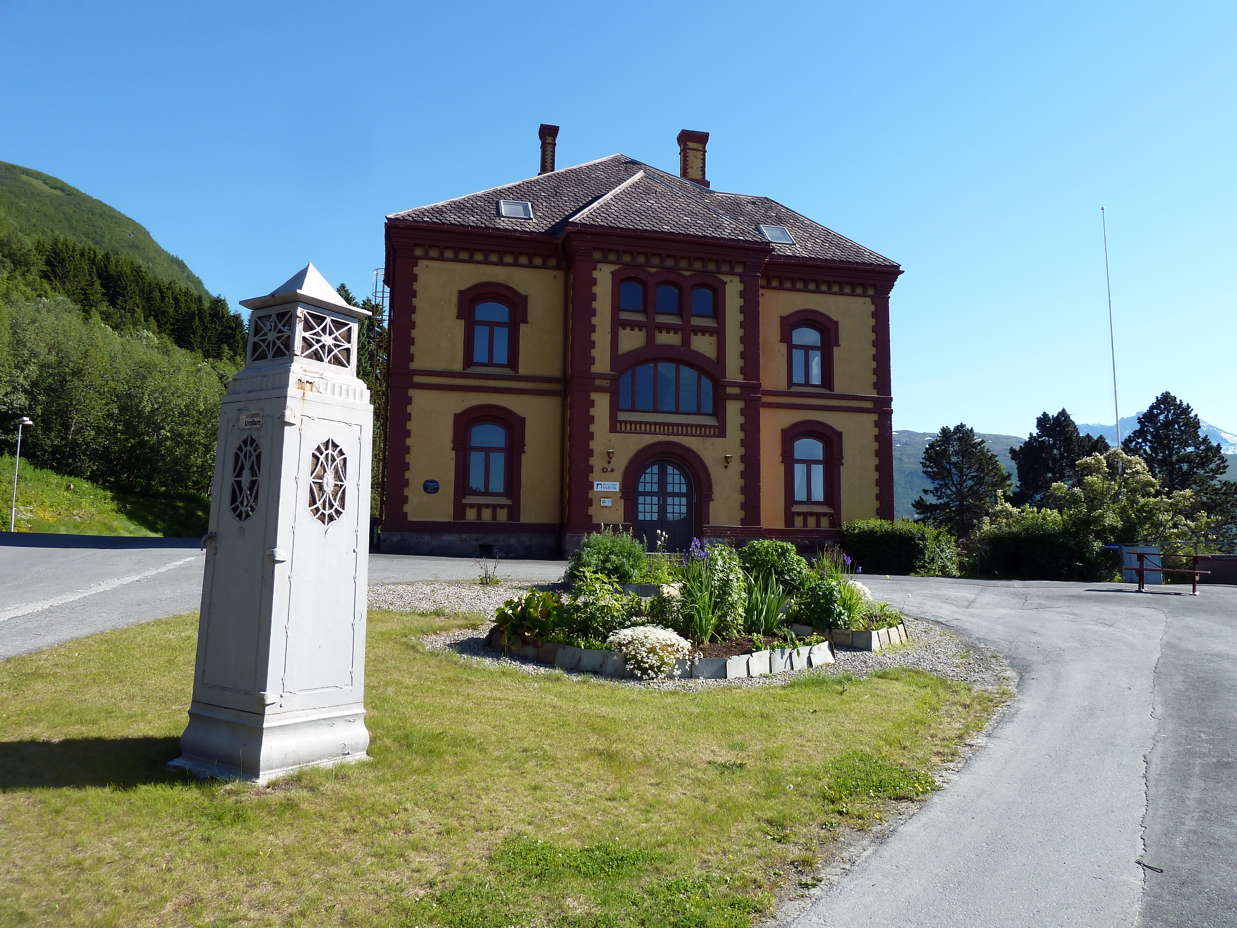
In 1902, the building that now houses Museum Nord, Narvik served as the head office of the Norwegian state railway company, Norges statsbaner. Architect Paul Due designed it to project permanence and authority at the edge of the known world, a statement of institutional confidence in a town that barely existed. Narvik itself had been founded that same year, conjured into being for a single purpose: to serve as the ice-free railhead where Swedish iron ore, hauled across the mountains from Kiruna, could be loaded onto ships bound for the blast furnaces of Europe.
An Ice-Free Fortune
The logic behind Narvik was geographical and meteorological. The Gulf Stream pushes warm water along the Norwegian coast, keeping the port of Narvik ice-free year-round even at 68 degrees north. The Swedish mining corporation LKAB needed a winter port for its iron ore, and the Baltic harbors at Luleå froze solid for months each year. So LKAB built the Iron Ore Line, the Malmbanan, from the mines in Kiruna to the Norwegian border, where the Ofoten Railway carried the ore the final kilometers down to the fjord. The port was large enough to accommodate vessels 208 meters long with drafts of 27 meters. Since 1902, this combined rail system has hauled iron ore across the Scandinavian mountains without interruption, save for the destruction wrought by the Battles of Narvik during World War II.
Paul Due's Railway Palace
The museum building sits one kilometer from the harbor, close enough to the docks to supervise operations but far enough to maintain the dignity of a headquarters. Paul Due, one of Norway's prominent architects of the era, gave the structure the solidity that railway administration buildings of the period demanded. Inside, Museum Nord now preserves the material culture of this industrial corridor: scale models of the bridges and landing stages that made the ore route possible, and an archive of 200,000 historic photographs documenting the transformation of a barren fjord shore into a functioning town. The collection traces not just engineering achievements but the human story of the workers, administrators, and families who populated a settlement built on rock and iron.
A Century of Reinvention
What makes Narvik's story unusual is the speed of it. The town went from uninhabited coastline to industrial hub in a matter of years, then survived near-total destruction during the fierce naval and land battles of 1940, then rebuilt, then adapted as the economics of ore transport shifted under it. The museum captures these layers of change. It is recognized as an anchor point on the European Route of Industrial Heritage, placing it alongside sites like the Ruhr Valley and the English Midlands as a place where the raw mechanics of industrial capitalism reshaped the landscape. But Narvik's version of that story is uniquely compressed and uniquely northern, played out in midnight sun and polar darkness at the edge of a fjord that most Europeans could not locate on a map.
Iron Ore and Arctic Light
The museum tells the story of LKAB as much as it tells the story of Narvik, because the two are inseparable. The Swedish mining company's operations drove the construction of the railway, the founding of the town, and the development of the harbor. Even today, Malmtrafik, LKAB's rail subsidiary, runs up to twelve freight trains daily across the Ofoten Line, and the ore port handles millions of tonnes each year. Museum Nord preserves the memory of how this system came to be, from the first concession grants in the 1880s through the electrification of the line in the 1920s to the wartime devastation and postwar recovery. For a visitor arriving in Narvik, the museum offers the essential context: this is not a scenic fishing village but an industrial town built with purpose, and the photographs and models inside explain exactly what that purpose was.
From the Air
Museum Nord, Narvik is located at 68.43°N, 17.43°E in the town of Narvik along the Ofotfjorden in northern Norway. The museum is near the harbor where ore ships load. Nearest airport: Harstad/Narvik Airport, Evenes (ENEV), about 60 km southwest. From the air, look for the long ore quay and railway infrastructure stretching from the harbor toward the mountains. The Ofoten Line runs visibly through the town. Best viewed at 2,000-4,000 feet.