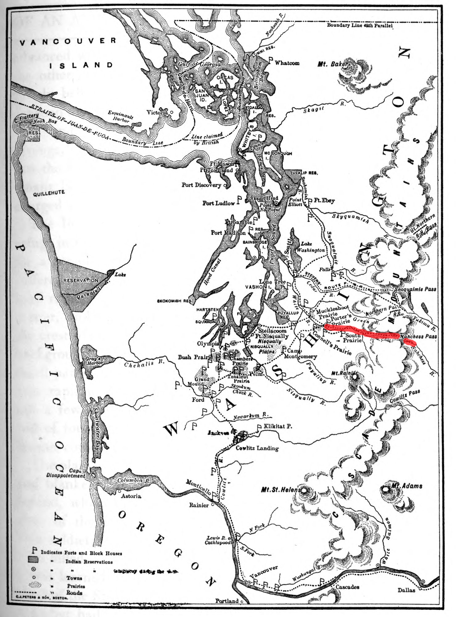
Naches Trail
One at a time, the wagons went over the edge. Men wrapped ropes around tree trunks and paid out line, bracing against the pull of gravity as each wagon inched down a near-vertical drop of several hundred yards. Women and children took a longer path, picking their way down a narrow footpath the Yakama had worn into the mountainside over generations. It was October 1853, and more than thirty families were attempting something no wagon train had done before: cross the Cascade Range at Naches Pass to reach the promised farmland of Puget Sound. The trail they followed, stretching from the Naches River in the dry country east of the mountains to the Greenwater River on the forested western side, had been a trade route for the Yakama and Interior Salish people long before any American settler set foot on it.
A Path Older Than Its Name
The Yakama people and Interior Salish people traveled this corridor through the Cascades for centuries, connecting the grasslands of the upper Yakima Valley to the damp lowlands of what is now Pierce County. The first written account of the route came in 1841, when Lieutenant Robert E. Johnson of the United States Navy crossed the pass as part of the Wilkes Expedition, a sprawling naval survey of the Pacific. Johnson's report described a rugged but navigable mountain crossing, and word of the route filtered east through the networks of westward migration. By the early 1850s, emigrants heading for the Oregon Territory were looking for alternatives to the long Columbia River route, and Naches Pass offered a more direct line to the growing settlements around Puget Sound.
Thirty Wagons Over the Edge
James Longmire led his family out of Indiana on March 6, 1853, bound for the Pacific Northwest. By late September, his party of more than thirty wagons had reached the upper Yakima Valley, where the Yakama under Chief Owhi offered hospitality in the Wenas Valley. The emigrants followed the Naches River for four days, crossing it fifty-two times as the canyon narrowed and the mountains closed in. At the summit, they found what an 1853 survey had already declared impassable for wagons: a precipitous, nearly vertical cliff face with no road and no alternative route. The settlers improvised. They tied ropes to the wagon axles, looped the other end around a tree trunk, and lowered each wagon one at a time while men braced the line. Every wagon made it down except the Lanes', whose family finished the journey on horseback. After more hard traveling along the Greenwater and White rivers, the party reached Fort Steilacoom on October 9, 1853.
The Road That Never Was
Despite the Longmire crossing, Naches Pass never became a proper road. The dense old-growth forest blanketing the western slopes made construction prohibitively expensive, and when the territorial legislature evaluated the route in 1853, engineers judged it infeasible. Snoqualmie Pass, farther north, won out as the preferred crossing, eventually carrying U.S. Route 10 and then Interstate 90. Naches Pass was proposed as Washington State Route 168 as early as the 1930s, but the designation has never been acted upon. The trail remained unpaved, and as of 2017 it consists of United States Forest Service roads popular with off-road enthusiasts who navigate the same rocky terrain that nearly broke those emigrant wagons more than a century and a half ago.
What Longmire Left Behind
James Longmire settled on Yelm Prairie after the crossing, but the mountain that had nearly stopped his wagons kept pulling him back. In 1883, at the age of sixty-three, he reached the summit of Mount Rainier. That same year he discovered the mineral hot springs on the mountain's southern flank that still bear his name. The Longmire family developed the springs into a tourist destination, and the settlement of Longmire became the first developed area in what would become Mount Rainier National Park. The trail itself endures as a ghost of the emigrant era, its ruts still visible in places beneath the second-growth timber. From the air, Naches Pass is a low saddle in the Cascade ridgeline north of Rainier, a gap that looks deceptively gentle from cruising altitude but hides the vertical drama that tested every family who ever rolled a wagon to its edge.
From the Air
Naches Pass sits at approximately 47.10N, 121.47W in the Cascade Range, north of Mount Rainier. From the air, look for the low saddle in the ridgeline between the Naches River drainage to the east and the Greenwater River valley to the west. Mount Rainier (14,410 ft) dominates the view to the south. The pass itself is at roughly 4,900 feet elevation. Nearest airports: Bowers Field (KELN) in Ellensburg approximately 30nm northeast, Tacoma Narrows (KTIW) approximately 45nm west. The forest roads through the pass are visible as thin lines cutting through dense conifer forest.