Namib-Naukluft National Park
Somewhere in the southern Namib, the dunes turn the color of rusted iron. They are among the tallest on Earth, and they have been forming for roughly five million years -- long enough that the sand itself has oxidized, each grain coated in a thin film of iron oxide that deepens from pale apricot at the crest to dark burgundy at the base. The Namib-Naukluft National Park wraps around nearly 50,000 square kilometers of this landscape, making it Africa's largest and the world's fourth-largest nature reserve. Much of it has no roads. Much of it is forbidden to enter on foot. From the air, it looks like another planet entirely.
Sand That Remembers
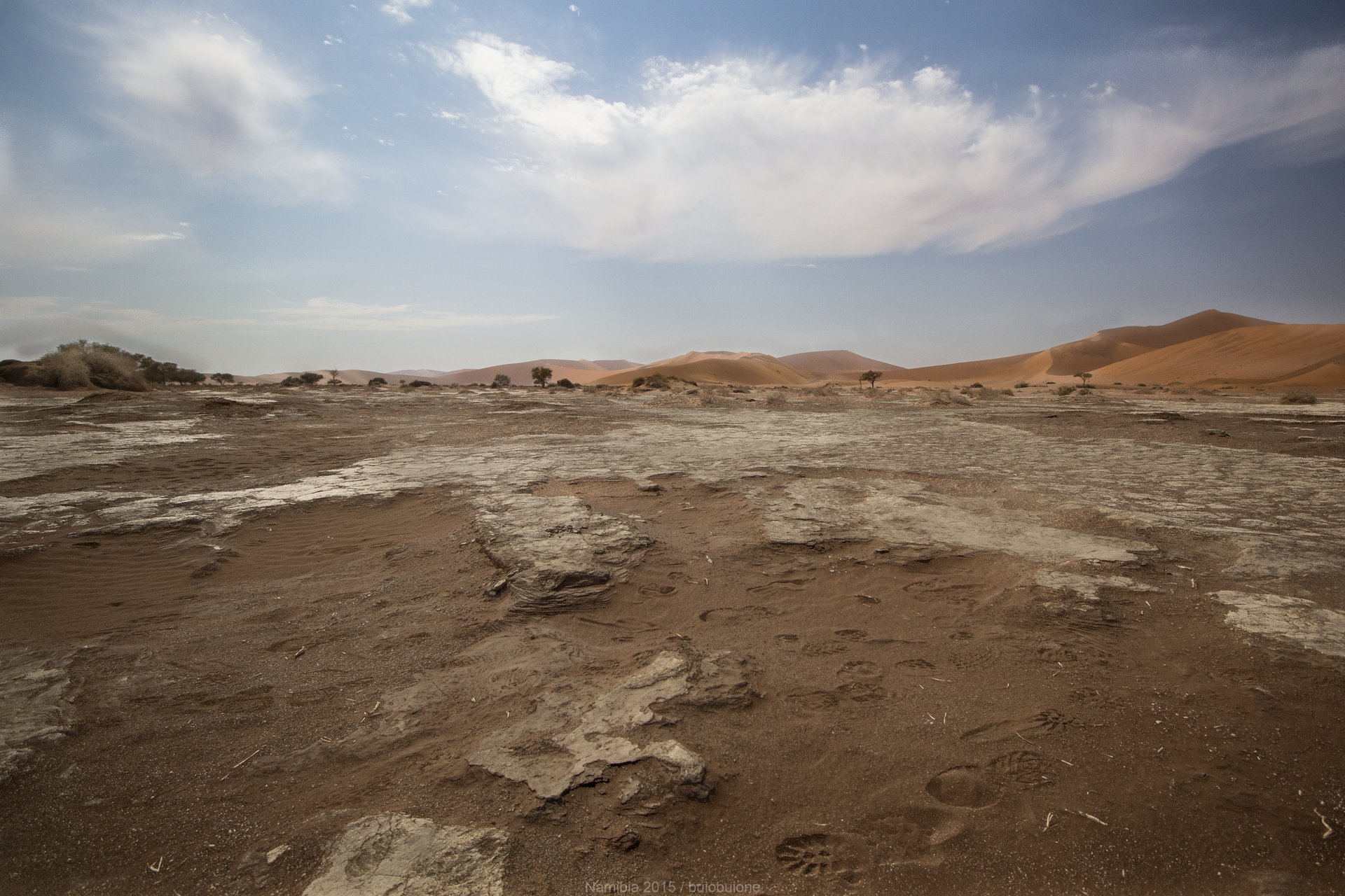
The western portion of the park, the Namib Sand Sea, earned UNESCO World Heritage status for a reason that has little to do with scenery. This is the world's only coastal fog desert with extensive dune fields, and the interaction between Atlantic fog, wind, and sand has produced an ecosystem found nowhere else. Fog rolls inland from the cold Benguela Current, providing moisture to organisms that have evolved to harvest it -- beetles that stand on their heads to let condensation trickle down their backs, lichens that survive on air alone. The dunes themselves are not static. They shift, merge, and reshape under winds that reverse seasonally, creating star-shaped formations visible from orbit. Sossusvlei, the park's most visited destination, sits in a clay pan surrounded by some of these colossal dunes, their red flanks rising over 300 meters above the valley floor.
The River That Vanishes
Cutting east to west through the heart of the park, the Kuiseb River is the boundary between two worlds. To the south lie the sand dunes. To the north stretch flat gravel plains, dark and stony, that extend to the horizon without interruption. The Kuiseb rarely reaches the Atlantic -- its water sinks into the sand long before it arrives -- but its subterranean flow sustains a ribbon of green in the otherwise barren landscape. Along this corridor, the Topnaar people have lived for centuries, gathering the fruit of the !nara melon, a spiny plant that grows in the sand and has sustained their community through droughts that would have driven others away. Queen Victoria guaranteed the Topnaar rights of residence here more than a century ago, and they remain inside the park to this day.
A Colonial Inheritance
Protection of this land predates Namibian independence by decades. In 1907, the German colonial government proclaimed three nature reserves, one of which became the nucleus of today's park. Its original boundaries ran between the Swakop and Kuiseb rivers. Over the following eighty years, successive administrations expanded the reserve piece by piece until it reached its current size in 1986. Tourism, however, came late. Visitors were rare before the late 1970s, and even now, large sections remain inaccessible. The evidence of human presence here runs far deeper than colonial history: Stone Age artifacts along the Kuiseb River date back 200,000 years, and archaeological evidence suggests semi-nomadic communities used the area whenever rainfall brought enough grazing for their herds.
Where the Desert Meets the Sea
South of Walvis Bay, the park's coastline reveals one of its strangest features: Sandwich Harbour, a lagoon where towering dunes tumble directly into the Atlantic Ocean. Flamingos wade in the shallows while jackals hunt along the waterline. Reaching it requires a four-wheel-drive vehicle, precise knowledge of the tides, and a healthy respect for the Atlantic -- at high tide, the narrow passage between dunes and surf becomes impassable, and more than one vehicle has been swallowed by the sea. Further inland, at the settlement of Solitaire, visitors can rise above it all in a hot-air balloon. On the many windless mornings, the balloon climbs a few hundred feet, hovers over the desert in perfect silence, and descends to the exact spot where it launched.
Gravel Roads and Sharp Stones
The park is notorious for car accidents, almost all involving tourists and almost all caused by speed on gravel roads. The posted limit is 100 kilometers per hour, but locals will tell you there is scarcely a stretch where half that speed is safe. Sharp stones lurk beneath loose sand, river crossings have no bridges, and a burst tire at highway speed on gravel can flip a vehicle before the driver has time to react. The Namibians have a word for the ridge of loose material between tire tracks -- the middlemannetjie -- and driving over it is one of the surest ways to shred a sidewall. For those who slow down, the reward is a landscape of such stark beauty that it needs no embellishment: red dunes against blue sky, gravel plains stretching to infinity, and a silence so complete that the only sound is wind moving across sand.
From the Air
Located at 24.55S, 15.33E. The park stretches along roughly 400 km of Namibia's Atlantic coast. From cruising altitude, the transition from gravel plains to sand sea is dramatic -- a sharp line running roughly along the Kuiseb River. Sossusvlei's red dunes are unmistakable from above. Nearest airports: Walvis Bay (FYWB) to the northwest and Luderitz (FYLZ) far to the south. Windhoek Hosea Kutako International (FYWH) is approximately 350 km to the northeast. The park has several dirt airstrips; panoramic flights can be arranged from Swakopmund or Walvis Bay.