Narmada River
Of all the rivers in India, only the Narmada is venerated through parikrama -- a circumambulation of the entire river, walking one bank to the sea and the other bank back to the source. The pilgrimage takes roughly three years on foot, covering both shores of a river that runs 1,312 kilometers from the Amarkantak Plateau in Madhya Pradesh to the Gulf of Khambhat on the Arabian Sea. The Narmada is India's fifth-longest river and the longest that flows westward, a geographic peculiarity explained by the rift valley it occupies between the Vindhya and Satpura mountain ranges. That same rift valley makes the Narmada the traditional boundary between North and South India -- not a political border, but a geological and cultural one that has shaped the subcontinent for millennia.
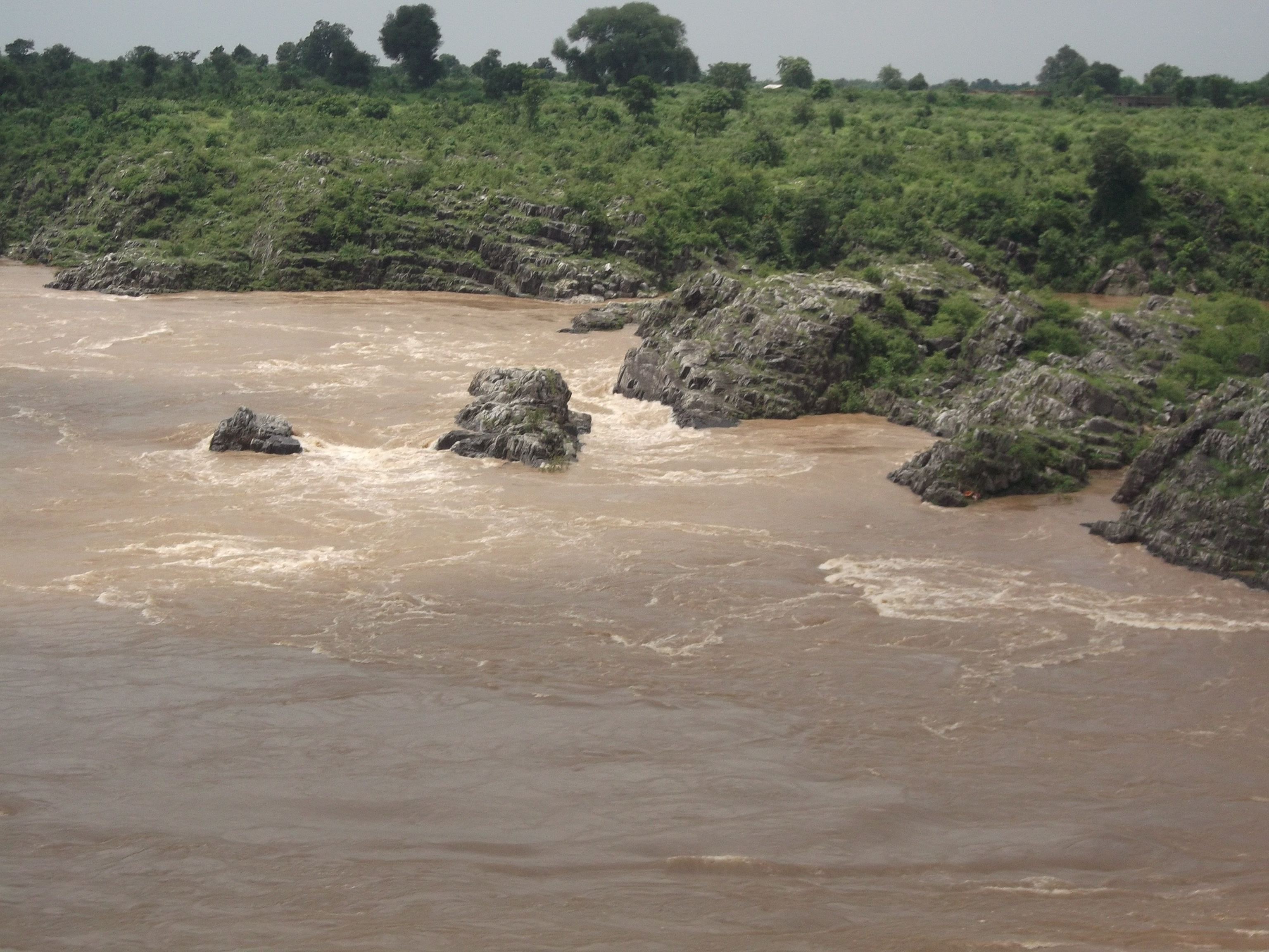
Born from a Plateau, Carved through Marble
The Narmada begins as a small reservoir called the Narmada Kund at Amarkantak, on a plateau in Madhya Pradesh's Anuppur district. Almost immediately, the river announces its character. It descends from Sonmuda, tumbles over the Kapildhara waterfall, then meanders through hilly terrain past the ruined palace of Ramnagar before straightening toward Jabalpur. Near that city, the river plunges 9 meters over the Dhuandhara falls -- the name means "mist-fall" -- and then squeezes through the Marble Rocks of Bhedaghat, where magnesium limestone and basalt compress a 90-meter-wide river into a channel just 18 meters across. The white marble walls rising on either side have made Bhedaghat one of central India's most photographed natural features. Beyond the gorge, the Narmada enters a broader valley between the Vindhya scarps to the north and the Satpura range to the south, winding through three successive narrow valley segments separated by converging hill lines.
The River That Divides India
Because the Narmada occupies a rift valley rather than a river-cut floodplain, it behaves differently from most Indian rivers. It does not form a delta where it meets the sea; instead, it creates an estuary at the Gulf of Khambhat, 30 kilometers west of the city of Bharuch. The rift valley geography also means the Narmada flows through Madhya Pradesh for 1,077 kilometers, then traces the border between Madhya Pradesh and Maharashtra for 39 kilometers, the border between Maharashtra and Gujarat for 74 kilometers, and finally runs 161 kilometers through Gujarat proper. Along the way, it serves as more than a water source. The river is the lifeline of both Madhya Pradesh and Gujarat -- a phrase used so often it has become cliche, but one that carries weight in a region where 75 percent of Gujarat's command area is classified as drought-prone.
Three Years on Foot
The Narmada Parikrama is unlike any other river pilgrimage on Earth. Pilgrims walk the entire length of one bank from source to sea, cross to the opposite bank, and walk back -- a journey of roughly 2,600 kilometers that traditionally takes three years. Along the way, they visit ghats including Shaherav, Rengan, Rampura, and Tilakwada, each with its own rituals and history. Hindu scripture ranks the Narmada alongside the Ganges and the Yamuna but with a distinction: the Puranas state that while liberation comes from bathing in the Ganges or drinking the Yamuna's water, merely seeing the Narmada is sufficient. One stretch of the river in Gujarat's Narmada region is considered especially sacred because the river briefly flows northward -- an unusual direction that Hindu belief endows with particular spiritual power. This northward-flowing section is the focus of the annual Uttarvahini Panchkoshi Narmada Parikrama, a month-long pilgrimage along 14 kilometers of riverbank.
Teak Forests and Gharials
The lower Narmada valley and its surrounding uplands cover roughly 170,000 square kilometers of dry deciduous forest. Teak is the dominant canopy tree, growing alongside Diospyros melanoxylon, Anogeissus latifolia, and Boswellia serrata. Along the riverbanks, where water flows year-round, moist evergreen strips harbor Terminalia arjuna and Syzygium cumini. The ecoregion supports 76 mammal species and 276 bird species. Satpura National Park, established in 1981 in Narmadapuram district, protects a significant portion of this habitat. The Narmada itself sits between moister forests to the northeast and southeast and the drier scrublands of the Deccan plateau to the south, making its valley a biological corridor between distinct ecological zones -- a green thread stitching together landscapes that would otherwise have little connection.
Dammed but Not Tamed
Twenty-five major dams are planned or completed along the Narmada, the largest being the Sardar Sarovar Dam near Kevadia in Gujarat and the Indira Sagar Dam in Madhya Pradesh. Together with the Narmada Canal network -- stretching roughly 75,000 kilometers across Gujarat alone -- these structures have transformed the river from a natural waterway into managed infrastructure. The transformation has been fiercely contested. The Narmada Bachao Andolan movement drew global attention to the displacement of communities upstream of the Sardar Sarovar Dam, and the World Bank withdrew its funding in 1994. From the air, the dams are unmistakable interruptions in the river's westward course, their reservoirs pooling behind walls of concrete in a valley that has carried sacred water for thousands of years. The tension between utility and reverence, between irrigation for millions and pilgrimage for the faithful, defines the Narmada as much as its geology does.
From the Air
The Narmada flows west across central India from 22.67N, 81.75E (Amarkantak source) to approximately 21.64N, 72.80E (Gulf of Khambhat estuary). The river article coordinates center near 22.08N, 74.90E in the middle reach. The Marble Rocks at Bhedaghat near Jabalpur are a distinctive white-walled gorge visible from altitude. Major dams (Sardar Sarovar, Indira Sagar) create large reservoirs visible as blue expanses in the rift valley. Nearest airports along the course: Jabalpur (VAJB), Indore (VAID), Vadodara (VABO). Best viewed at 5,000-10,000 feet AGL to appreciate the river's course between the Vindhya and Satpura ranges.