Natchitoches, Louisiana
Nobody pronounces it the way it looks. The name Natchitoches -- say "Nack-uh-tish" -- comes from the indigenous Natchitoches people who lived along the Red River long before a French Canadian explorer named Louis Juchereau de St. Denis arrived in 1714 and founded what would become the oldest permanent settlement within the borders of the Louisiana Purchase. Three centuries later, this small city in northwestern Louisiana still wears its French colonial origins like a badge of honor, its mile-long downtown a tapestry of wrought iron balconies, stucco facades, and red brick buildings hugging the shore of the crescent-shaped Cane River Lake.
Born on the Red River
Natchitoches began as a French trading outpost on the Red River, positioned to do business with Spanish-controlled Mexico. French traders had been in the area as early as 1699, but the formal post established in 1714 near a Natchitoches Indian village gave the settlement its permanent footing. French Catholic settlers and Creoles -- ethnic French born in the colony -- soon acquired surrounding lands, developing cotton plantations like Magnolia and Oakland, both now preserved as National Historic Landmarks. After the Louisiana Purchase of 1803, Americans of English and Scots-Irish ancestry flooded in, establishing their own cotton plantations along the Red River and relying on the labor of enslaved people brought through the domestic slave trade. Through the 1820s and early 1830s, Natchitoches served as a vital freight transfer point: cotton from East Texas crossed the Sabine River by land, then floated down the Red River to New Orleans. The town thrived as a commercial hub -- until the river betrayed it.
When the River Walked Away
One day, the Red River shifted its course and simply bypassed Natchitoches, severing the town's lucrative connection to the Mississippi and the world beyond. What remained was an oxbow lake, a crescent of still water that became known as Cane River Lake. The loss was devastating. Without river commerce, Natchitoches slowed to a crawl. The Civil War inflicted further wounds: retreating Union soldiers set the town ablaze, though Confederate cavalry arrived in time to help extinguish the flames before the historic core was destroyed. Through the 20th century, agricultural mechanization drained the surrounding parish of its population. By the early 1970s, a staggering 65 percent of the commercial district sat vacant and boarded up. The city that predated the United States itself appeared to be fading into irrelevance.
Steel Magnolias and Stubborn Preservationists
Salvation came in the form of stubbornness and Southern charm. In the mid-1970s, Mayor Bobby DeBlieux and a coalition of preservationists recognized that Natchitoches's antiquity was not a liability but an asset. They pushed to designate a National Historic District along the mile-long French colonial downtown fronting Cane River Lake, worked to establish what became the Cane River Creole National Historical Park, and coaxed building owners to transform shuttered storefronts into antique shops, restaurants, and bed-and-breakfasts -- at one point 32 of them, the most in Louisiana. Hollywood took notice. In 1989, Steel Magnolias, starring Julia Roberts, Sally Field, Dolly Parton, and Shirley MacLaine, was filmed here, drawing national attention to the town's photogenic streets. The 2013 film 12 Years a Slave used nearby Magnolia Plantation as a location. Today, commercial vacancy downtown hovers near just 1 percent, and the city draws over one million visitors annually.
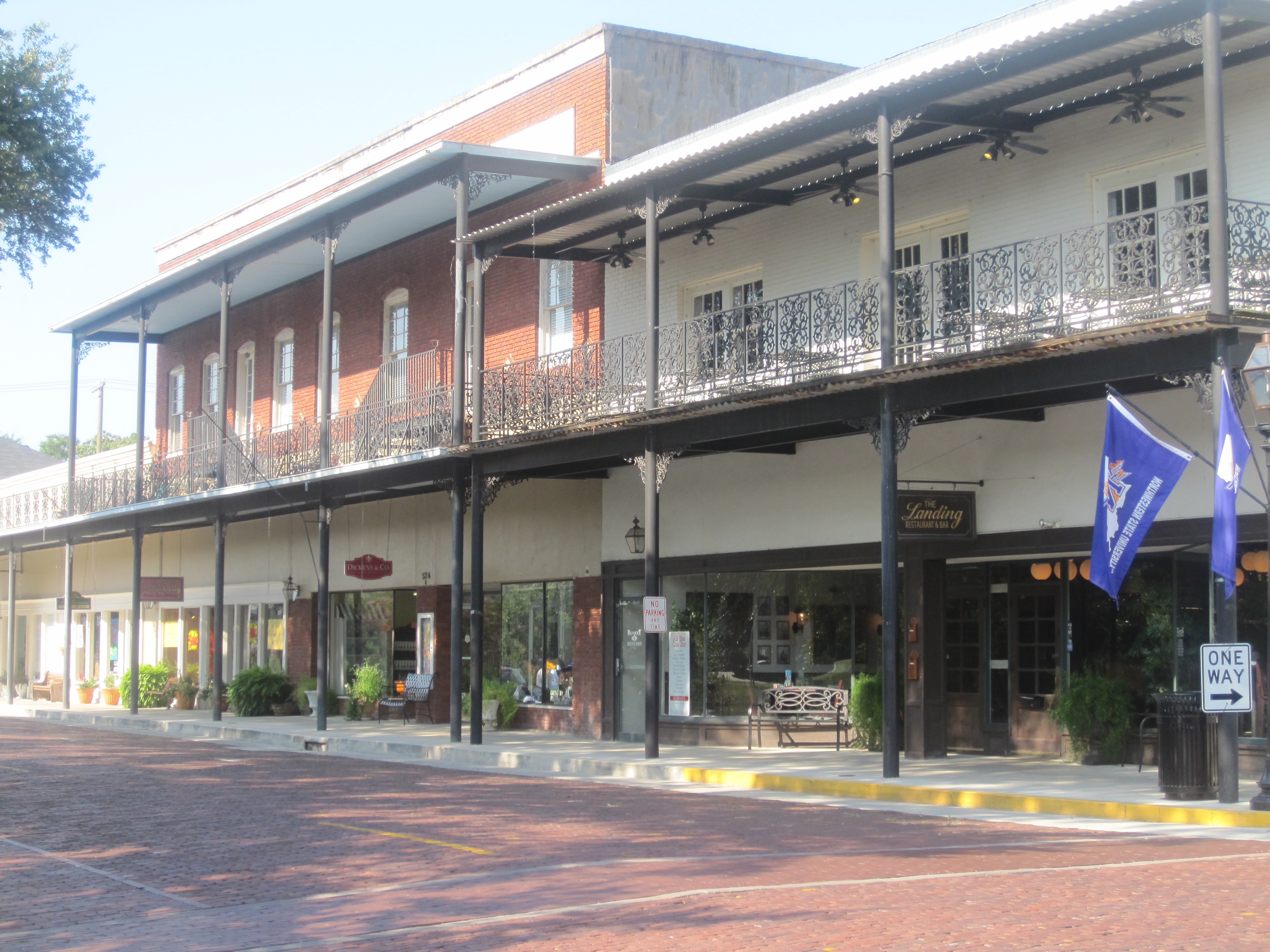
Every Brick Has a Number
Front Street is the crown jewel of Natchitoches. One of the city's original brick-paved roads, it overlooks the riverwalk along Cane River Lake and is lined with shops and boutiques sheltered under wrought-iron galleries. When the street recently needed repair, workers removed each century-old brick one by one, numbered it, cleaned it, then replaced it exactly after the utilities and foundation beneath were restored. That meticulous devotion to the past defines this city. Each December since 1927, the Christmas Festival of Lights transforms the riverfront into a spectacle of over 300,000 lights and fireworks that draws visitors from across the South. The city also claims the Natchitoches Meat Pie -- a savory, hand-held pastry -- as one of Louisiana's official state foods. And at the local airport, a somber marker recalls that singer-songwriter Jim Croce died here in 1973 when his plane crashed after a concert at Northwestern State University.
A Place That Refuses to Be Forgotten
Natchitoches occupies a singular place in American history. It is older than New Orleans, older than San Antonio, older than any other permanent settlement in the vast territory the United States acquired from France. Its sister city, Nacogdoches, Texas, shares a parallel origin story along the same colonial frontier. Today, the Cane River National Heritage Area protects a wealth of sites -- Oakland and Melrose Plantations, Fort St. Jean Baptiste, the Kate Chopin House, and Los Adaes, the once-capital of Spanish Texas. The Louisiana African American Heritage Trail runs through it. University crew teams train on Cane River Lake each spring. Northwestern State University anchors the local economy and gives the town a youthful energy that balances its ancient streets. In Natchitoches, history is not something behind glass -- it is the living fabric of a city that lost its river but found a way to endure.
From the Air
Natchitoches is located at 31.75°N, 93.11°W in northwestern Louisiana. From the air, look for the distinctive crescent-shaped Cane River Lake curving through the city center, with the compact historic district along its western bank. Natchitoches Regional Airport (KIER) sits just south of town. Alexandria International Airport (KAEX) is approximately 52 nm to the southeast, and Shreveport Regional Airport (KSHV) is about 76 nm to the north. The surrounding terrain is gently rolling piney hills of the Kisatchie National Forest to the south and agricultural lowlands along the Red River.