Nelson
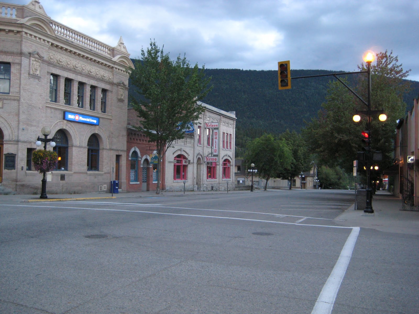
Baker Street climbs through downtown Nelson with the kind of architectural grace that most cities demolished decades ago - granite civic buildings designed by Francis Rattenbury, heritage storefronts restored to their 1890s elegance, a concentration of period architecture that earned this mountain town its role as the primary filming location for Steve Martin's 1987 film Roxanne. Nelson calls itself 'The Queen City,' a title from its silver rush glory days when railways converged here, hotels rivaled Vancouver's, and an electric streetcar connected the lakeside to the hills. That wealth is gone, but the beauty remains, and a different kind of prosperity has followed.
The Silver Rush Heritage
Silver discovered at nearby Toad Mountain in 1886 transformed Nelson from nothing into a sophisticated city in barely a decade. Two railways built through, making Nelson a transportation hub. The merchants who supplied the mines needed impressive buildings, and they hired impressive architects - Francis Rattenbury, who would go on to design Victoria's Parliament Buildings, created chateau-style civic buildings in granite that anchor the downtown today.
By 1900, Nelson had fine hotels, a Hudson's Bay Company store, and infrastructure that rivaled much larger cities. The town built its own hydroelectric system. English immigrants planted orchards along the lake. Doukhobors from Russia - sponsored by Leo Tolstoy and the Quakers - tilled the valley benchlands. The diversity was remarkable for such a remote place, and some of it persists in the Doukhobor Museum near neighboring Castlegar.
The Reinvention
When the local sawmill closed in the early 1980s, Nelson faced potential decline. But the city made a choice that transformed its future: instead of demolishing aging buildings for modern replacements, it stripped the aluminum facades that 1960s merchants had installed and restored the original architecture. By 1985, Baker Street had been transformed, its heritage revealed rather than hidden.
Steve Martin's choice to film Roxanne here in 1986 affirmed the transformation. The local fire hall became a primary set; historic buildings provided the backgrounds. The publicity marked Nelson's shift from resource town to arts and tourism destination. Today the city is recognized as 'Number One Small Town Arts Community in Canada,' home to a diverse artisan community whose galleries and studios fill the restored storefronts.
Adventure Base Camp
Nelson's setting makes it a base for year-round outdoor adventure. The west arm of Kootenay Lake flows past town, its shoreline accessible at Lakeside Park where the Big Orange Bridge - 'BOB' to locals - connects to the north shore. The lake offers swimming, paddling, and the long views across water that define Kootenay country.
In winter, the area transforms into a powder destination. Over twenty cat-skiing, heli-skiing, and ski-touring operators work from Nelson and the surrounding region. In 2012, Nelson and nearby Rossland were jointly voted best ski locales in North America by Powder Magazine readers - an honor earned by the deep, reliable snowfall that blankets these mountains. Summer brings mountain biking on a variety of trails, rock climbing at local crags, and hiking ranging from gentle rail trails to serious alpine routes in the Selkirk Mountains.
Getting to Nelson
Reaching Nelson requires commitment - it's a nine-hour drive from Vancouver, seven from Calgary, not on any major highway. The Crowsnest Highway passes nearby, and the scenic option from the east involves the Kootenay Lake Ferry at Balfour, the longest toll-free ferry in the world. West Kootenay Regional Airport in Castlegar offers scheduled flights but is notorious for fog cancellations.
The remoteness is part of the appeal. During the Vietnam War, American draft dodgers found their way here, their influx of liberal, educated perspectives shaping the community's character. Today their legacy persists in a downtown where natural food stores and art galleries outnumber chain retailers, where the Saturday market draws farmers and artisans from throughout the region, where the streets still feel like 1986 - or maybe 1896 - depending on which buildings you're looking at.
From the Air
Located at 49.50N, 117.28W in the West Kootenay region of British Columbia, on the west arm of Kootenay Lake. The compact downtown is visible climbing the hillside from the lakeshore. Look for the distinctive orange bridge crossing the lake outlet. Nelson is remote - approximately 650 km east of Vancouver, 600 km west of Calgary. West Kootenay Regional Airport (CYCG) in Castlegar, 40 km west, has scheduled service but frequent fog cancellations. The Crowsnest Highway (Highway 3) passes through the region. The Selkirk Mountains rise to the west and north. Kootenay Lake extends northeast toward Balfour and the ferry crossing.