Newberry Springs, California
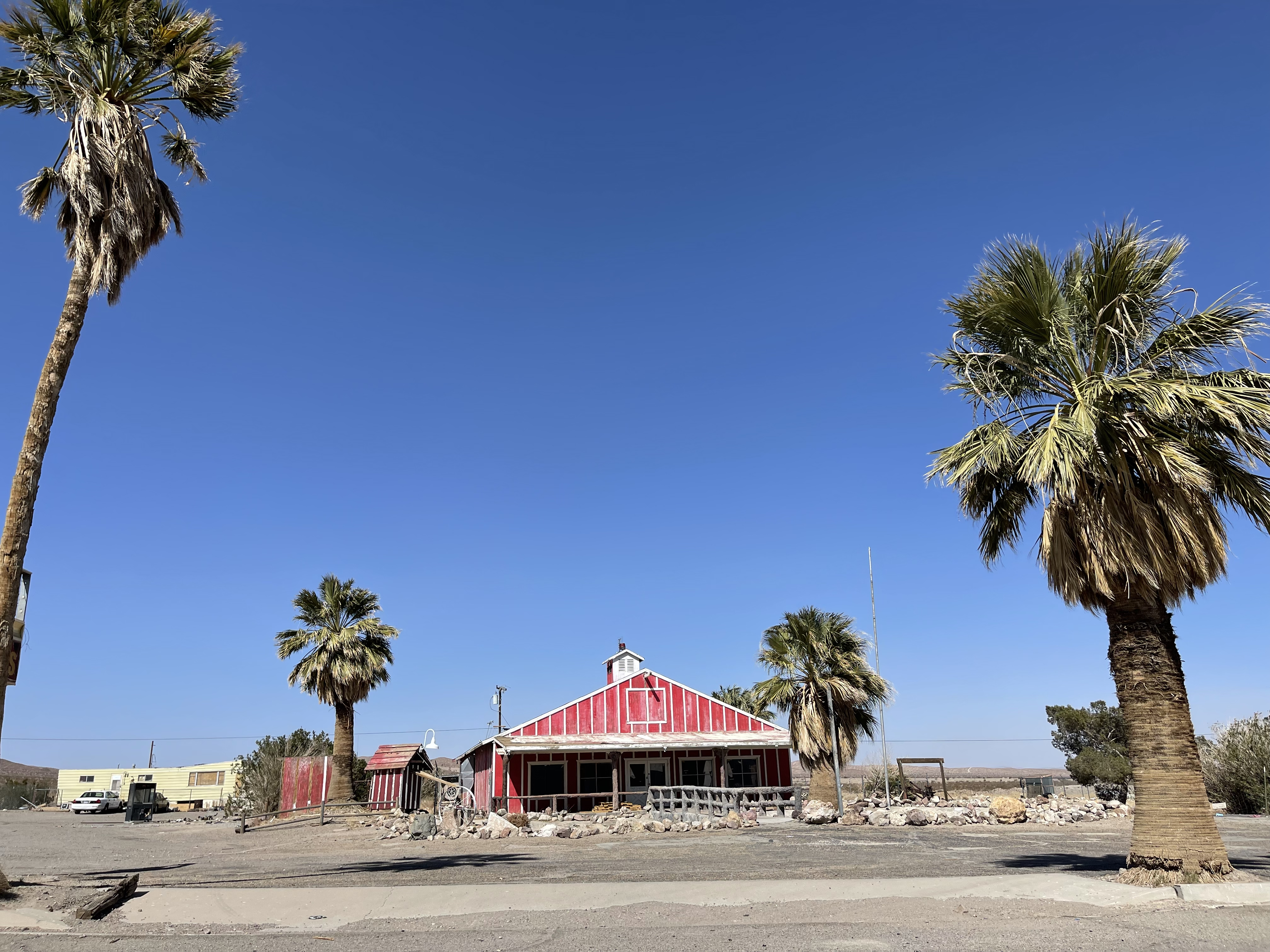
The Bagdad Café in Newberry Springs became famous in 1987 not because of what it was, but because of what a German filmmaker saw in it. Percy Adlon shot his movie there — a story about displacement and human connection set against the specific desolation of the Mojave Desert — and afterward people came from Germany, France, Japan, and a dozen other countries to eat at a roadside diner in an unincorporated community of about 2,000 people. The café had existed before the film and continues to exist after it, which is more than can be said for most of the places Route 66 once made famous.
The Water Beneath the Sand
Newberry Springs sits above the Mojave Aquifer — one of the largest groundwater systems in the western United States. This is a geological fact that shaped the community's name and explains its existence in a landscape that otherwise offers very little to sustain settlement. Water piped from these springs supplied the ghost town of Stedman miles away when that mining camp was active. The aquifer continues to be the subject of significant debate: a proposed commercial water project sought to pump billions of gallons annually from beneath the Mojave and ship it to coastal cities, with Newberry Springs in the middle of the argument about what the desert's water belongs to.
Above ground, summer average temperatures hit 107 degrees Fahrenheit. The community endures through a combination of the aquifer below, the highway running through, and the stubbornness of people who choose desert life over the alternatives.
Route 66 and the Films That Found It
Route 66 runs through Newberry Springs — the old road that connected Chicago to Santa Monica, bypassed by I-40 in the 1970s and left to become its own kind of attraction. The town's most famous building is the Bagdad Café, which sits along the route and accumulated its international reputation from the 1987 film. The film was a German production shot on an American highway through a Mojave Desert community, which says something about how places acquire meaning from unexpected sources.
Don't Worry Darling, the 2022 film directed by Olivia Wilde, also filmed in the Newberry Springs area, extending the community's inadvertent career as a backdrop for stories about people in unusual circumstances in the desert. The Mojave, with its quality of light and its radical simplicity, has a way of making filmmakers want to use it.
Community and Isolation
Newberry Springs is unincorporated, which means it exists without the formal apparatus of city government — no mayor, no city council, no municipal budget. It is governed by San Bernardino County from a great distance. The community developed around the springs, the railroad junction, and eventually the highway, accumulating the businesses and residences that accumulate wherever people stop long enough to establish themselves.
The isolation that makes filmmakers reach for their cameras is the same isolation that defines life here. The nearest significant city is Barstow, about 20 miles west. Beyond that is the rest of the Mojave, and beyond that, eventually, everywhere else. People who live in Newberry Springs have made a specific choice about distance and quiet that the Bagdad Café's international clientele finds either romantic or incomprehensible, depending on which side of the journey they're on.
The Café That Stayed
The Bagdad Café has operated continuously through the decades since the film, serving food to the Route 66 travelers and international visitors who arrive specifically because of what Percy Adlon saw in this particular roadside stop. It has become a destination in the way that very few small-town businesses ever become — not because of what it offers, but because of what it represents: the idea that a place can be both utterly ordinary and, in the right frame, extraordinary.
The walls inside are reportedly covered in postcards and messages from visitors who came from far away. The desert outside looks the same as it always has. The aquifer keeps refilling, slowly, from rains that fall in mountains miles distant and take years to seep this far.
From the Air
Located at 34.828°N, 116.688°W in the Mojave Desert east of Barstow along historic Route 66. The community is visible from low altitude as a cluster of development in open desert, with Interstate 40 running parallel to the south. Nearest airport: Barstow-Daggett Airport (DAG), approximately 20 miles west.