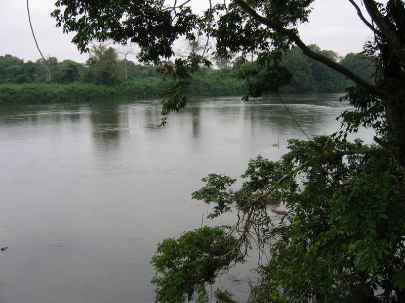
Ngounie River
The Gisir and Punu call it Durembu-du-Manga. The Apindji, Eviya, and Tsogo know it as Otembo-a-Manga. The Kele say Melembye-a-Manga. In every language, the second word is the same: manga, referring to the dwarf palm trees that crowd the river's banks. The French rewrote the Vili name Ngugni into Ngounie, and that is the name the maps carry today. But along 400 kilometers of southwest-central Gabon, where this river meanders through one of Central Africa's great floodplain valleys, the older names persist -- each one a reminder that a river belongs to the people who live beside it.
Down from the Chaillu
The Ngounie rises in the Chaillu Mountains, a forested massif straddling the border between Gabon and the Republic of Congo. For its first 60 kilometers, the river flows south and then west, forming a natural boundary between the two countries. At the confluence with the Polo River, it changes course, turning northwest and dropping through three waterfalls before settling into the long, flat valley that defines the rest of its journey. The river's basin covers approximately 33,100 square kilometers, making it the second-largest tributary of the Ogooue, Gabon's principal waterway. After meandering more than 400 kilometers across the valley floor between the Moukande Mountains and the Massif du Chaillu, the Ngounie joins the Ogooue just upstream of Lambarene. The floodplain it creates -- an estimated 150,000 hectares of seasonally inundated land -- supports both agriculture and a rich mosaic of grassy vegetation between the forested hills.
The Empress Falls
Five kilometers from the town of Fougamou, the Ngounie bends and drops over Imperatrice Falls, also known as Samba Falls or Empress Eugenie Falls. The falls are approximately 10 meters high, set within granite gneiss formations where the river widens to about 150 meters and splits around small islands. The surrounding landscape belongs to the Peneplain Chaillu, a region of weathered granite hills and rocky bays that give the falls their rugged setting. The falls have attracted more than scenic interest. Engineers have proposed a hydroelectric project at Empress Eugenie Falls, designed as a run-of-the-river scheme with an initial capacity of 56 megawatts across four generating units. Two additional 14-megawatt units have been planned, which would bring the station's total installed capacity to 84 megawatts. The project would harness the main waterfall and a series of rapids across a 2,000-meter stretch of river, creating a total hydraulic head of 20 meters.
Explorers and Etymologists
The French name Ngounie traces back to the mid-1800s, when Vili-speaking communities near the falls used the word Ngugni to describe the northern boundary of their district, Nsina-Ngugni. When the explorers Robert Bruce Napoleon Walker and Paul Du Chaillu arrived in the area, they recorded the name as Ngouyai or Ngunyé, and the French colonial administration eventually settled on Ngounie. Du Chaillu, a Franco-American explorer famous for his encounters with gorillas, traveled extensively through this region in the 1850s and 1860s, and his accounts helped introduce equatorial Africa's interior to European audiences. The river's many indigenous names -- Durembu-du-Manga, Otembo-a-Manga, Melembye-a-Manga -- all share a common structure: a word meaning 'body of water' in each language, followed by manga. The consistency across unrelated language groups suggests the dwarf palms along the riverbank were the landscape's most defining feature.
A Valley of Towns and Tributaries
The Ngounie's floodplain hosts a chain of towns that owe their existence to the river. Mouila, the largest, sits along the middle course where development has been most concentrated. Fougamou guards the falls. Sindara lies between them. Upstream, the tributary Louetsié passes through Lebamba and Mbigou; the Dollé flows past Ndendé; and the Ikoy, fed by the Ikobe and Oumba rivers, drains the eastern slopes. The region within this valley is known simply as Ngounie, giving its name to the surrounding province. The left bank's sandy clay soils support farming, while the floodplain's seasonal inundation cycles sustain fisheries and wetland habitats. From the forested heights of its source to the broad waters of its confluence with the Ogooue, the Ngounie threads together a cross-section of Gabonese life -- mountain, forest, floodplain, and town.
From the Air
The Ngounie River's confluence with the Ogooue is located near 0.79S, 10.49E, close to Lambarene. From altitude, the river is visible as a winding waterway flowing northwest through a broad valley between the Chaillu Mountains and the Moukande Mountains. Imperatrice Falls are located approximately 5 km from Fougamou. The nearest airports are Lambarene Airport (FOGR) and Mouila Airport (FOGM). Expect dense tropical vegetation flanking the river, with grassland in the valley and forest-covered hills on both sides. Tropical weather with heavy rain from October to April.