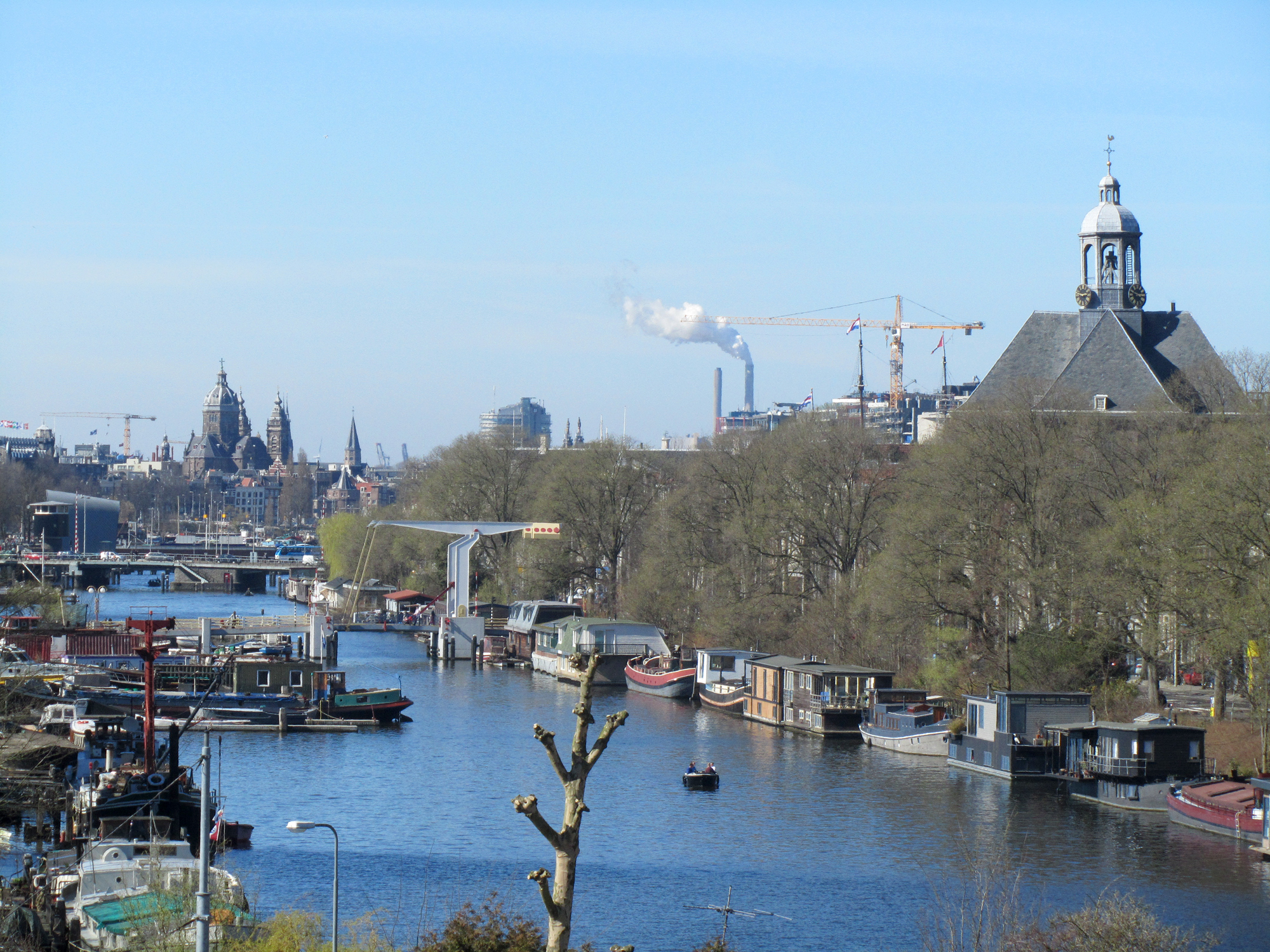
Nieuwe Vaart
In 1649, Amsterdam had a silting problem. The city had just built Kattenburg, a brand new island outside the existing dykes, to make room for the East India Company's shipyards. The trouble was that Kattenburg jutted so far into the IJ that it slowed the water down. Mud started piling up against the new docks. So the city's engineers cut a new canal, in a sweeping arc behind the new island, to keep the current moving. They called it the Nieuwe Vaart - the New Channel. Three hundred and seventy-five years later it is still there, still flowing, still doing the same hydrological job, with everything from drawbridges to houseboats arranged along its length like notes on a score.
Behind the Eastern Islands
The Nieuwe Vaart starts at the Kattenburgerplein, just in front of the Nederlands Scheepvaartmuseum - the Maritime Museum, housed in what used to be the Amsterdam Admiralty's seventeenth-century arsenal. From there the canal runs southeast between two strips of made-land: the Oostelijke Eilanden, the Eastern Islands of Kattenburg, Wittenburg, and Oostenburg, on the north side; the Kadijken on the south. Smaller canals join from both sides - the Kattenburgervaart and Wittenburgervaart from the north, through culverts; the Entrepotdok from the south, through the Entrepotdoksluis. Just west of that lock sits the Nieuwe Vaartbemaling floodgate, a piece of working infrastructure that can be closed against storm surges from the IJ. The Nieuwe Vaart is not a tourist canal. It is a working one.
Peter the Great Slept Here
In 1697, the young Tsar Peter the Great of Russia traveled incognito to the Netherlands to learn how to build ships. He worked for four months as a carpenter in the Dutch East India Company shipyards on Oostenburg, half a kilometer from the Nieuwe Vaart. By tradition he lodged in a building called the Admiraliteitslijnbaan, a seventeenth-century structure on the canal that had originally served as the front building of the Admiralty of Amsterdam's ropewalk - the long, low workshop where rope was twisted from hemp. The building is now a convention center. Whether Peter actually slept in those particular rooms or merely worked nearby is the kind of question Dutch historians enjoy arguing about over coffee. The Admiraliteitslijnbaan remains. So does the long-narrow footprint that betrays its origins as a rope-twisting hall.
The Carpenters' Rebellion
In the autumn of 1787, the Nieuwe Vaart became briefly famous. Politics in the Dutch Republic had split along increasingly bitter lines - the Patriots, who wanted to limit the powers of the Prince of Orange and broaden civic government, against the Orangists, who supported the prince. The carpenters of Kattenburg, working-class shipbuilders to a man, were fiercely Orangist. When the Patriot city council moved against them, the Kattenburg residents raised their drawbridge - in those days the island had only one - and shut themselves off from the city. The episode became known as the Bijltjesoproer, the Hatchet Riot, from the *bijltje* (small axe) that was the ship's carpenter's working tool. It is a small story. But it is the kind of thing the Nieuwe Vaart enables: a working canal that, in a pinch, can be turned into a moat.
Steam, Warehouses, Houseboats
Through the seventeenth and eighteenth centuries the Nieuwe Vaart was an artery of Dutch shipbuilding. The arrival of steamships in the second half of the nineteenth century brought bigger vessels and bigger sheds. The canal's western reach turned into a harbor basin for large ships, and the old yards gave way to warehouses. The Kromhout Shipyard, founded in the eighteenth century, kept building marine engines on its plot - the Westkap is still used as a working shipyard while the Oosthal next door has been converted into a museum. The Oosterkerk, a brick church from 1671, became a concert hall for contemporary and classical music; from its tower the De Gooyer windmill is visible downstream. In January 2011, the houseboat residents of the western Nieuwe Vaart organized themselves into the Vereniging de Nieuwe Vaart to defend their berths against redevelopment plans by the Centrum district. The fight continues, in the slow Dutch way.
Bridges
The Nieuwe Vaart is short by Amsterdam standards but lavishly bridged. The Kattenburgerbrug marks its western end, connecting the Prins Hendrikkade to the Kattenburgerplein. Halfway along the western stretch the Overhaalsgang - a pedestrian bridge - lets walkers cross to the islands. The Dageraadsbrug carries tram line 7 across the canal at a busy traffic square. East of that, three more bridges - Brug 1966, the Slachthuisbrug, and the Ad Grimmonbrug - serve the canal's eastern reach. A railway bridge for the Eastern Line, the line that runs from Amsterdam Centraal to Muiderpoort, crosses the water just west of the Slachthuisbrug. Stand on any of them and you are standing on a piece of seventeenth-century hydraulic problem-solving that is still solving the same problem.
From the Air
Located at 52.37 N, 4.92 E, the Nieuwe Vaart is a roughly 1.5 km canal in central-east Amsterdam, running southeast from the Kattenburgerplein (in front of the Maritime Museum) toward the Singelgracht. From altitude it reads as a curving dark line bordering the rectangular grid of the Eastern Islands. The De Gooyer windmill - a tall wooden post mill visible downstream - is a useful landmark. Nearest airport: Schiphol (EHAM), 13 km southwest.