Ninety Mile Beach: The Highway That Isn't Ninety Miles
The name is wrong, and everyone knows it. Te-Oneroa-a-Tohe / Ninety Mile Beach stretches 88 kilometers along the western coast of the Aupouri Peninsula, which works out to about 55 miles. The most popular explanation holds that early European travelers, crossing the beach on horseback, assumed their horses were covering the usual thirty miles per day. After three days of riding, they declared the beach ninety miles long. They had failed to account for the drag of sand on hooves. The error stuck, and in the way of these things, the wrong name became the real one.
A Road Made of Sand
Ninety Mile Beach is officially classified as a public highway in New Zealand, an alternative route to State Highway 1 north of Kaitaia. In practice, this means that rental car insurance policies specifically exclude it. Tour buses drive its length at low tide, threading between the surf line and the dry sand, while the actual highway follows the spine of the peninsula inland. The beach road comes into its own when landslides or floods close the main road, transforming from tourist novelty to genuine transportation infrastructure. At the northern end, the Te Paki dunes rise in enormous sweeps of sand that look more like the Sahara than the South Pacific. Tourists ride boogie boards down these dunes, a form of sandboarding that requires no snow, no skill, and very little dignity.
Tohe's Beach
The Maori name tells a different story entirely. Te-Oneroa-a-Tohe means "the long beach of Tohe," named for the Ngati Kahu ancestor who walked south from the sacred places near Cape Reinga, naming more than a hundred locations along the western coast. This dual name was formally adopted in 2014 following a Treaty of Waitangi settlement between the New Zealand government and Ngati Kuri, the iwi of the area. The English name measures distance and gets it wrong. The Maori name honors a journey and remembers who made it. Both names now carry equal official standing, a small act of correction applied to a very long beach.
When the Beach Was a Runway
In 1932, the hard-packed sand of Ninety Mile Beach served as a runway for some of the earliest airmail services between Australia and New Zealand. The beach offered what few purpose-built airstrips in the remote far north could: a flat, unobstructed surface long enough for heavily loaded aircraft. The same qualities that make it drivable at low tide made it flyable. Before the beach carried tourists, it carried letters across the Tasman Sea. In the days of sailing ships, the beach's exposed western face caught vessels that strayed too close; a number were wrecked on the sand. The beach has always been a thoroughfare, whether the travelers moved by horse, ship, car, or aircraft.
Clarkson's Race
In 2013, Top Gear brought its particular brand of automotive spectacle to Ninety Mile Beach. Jeremy Clarkson drove a Toyota Corolla down the full length of the sand while racing an AC45 catamaran crewed by Olympic sailor Sir Ben Ainslie and the winning team from the 2010 America's Cup, with James May aboard for good measure. The beach's scale made the stunt possible: fifty-five miles of unbroken sand, wide enough at low tide to drive at speed, flat enough to pretend you are on a proper road. The race was absurd by design, which suited a beach whose defining characteristic is its cheerful inaccuracy about its own dimensions.
The Peninsula From Above
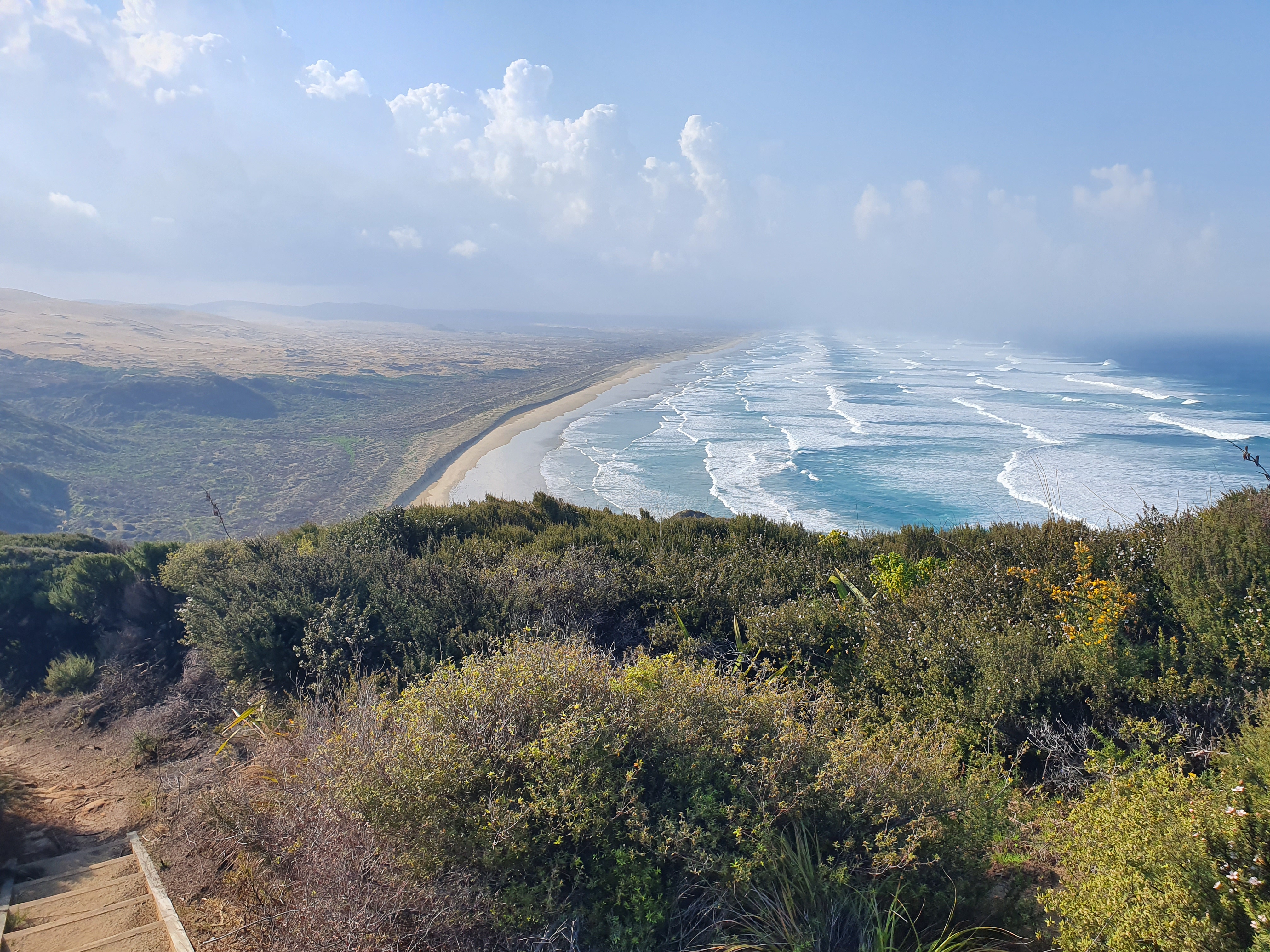
From altitude, the Aupouri Peninsula is startling. It extends northwest like a blade, barely wide enough to support habitation, with Ninety Mile Beach forming its entire western edge. The sand is a pale line between the Tasman Sea's deep blue and the peninsula's green scrub. The Te Paki dunes appear as a patch of golden desert at the northern end, incongruous against the surrounding vegetation. The beach runs from near Ahipara Bay in the south to Scott Point, ending just a few miles short of Cape Reinga and Cape Maria van Diemen. From above, the peninsula's narrowness makes the beach's role as a highway seem less eccentric than inevitable: when the land itself is barely wider than a road, why not drive on the beach?
From the Air
Located at 34.78°S, 172.98°E along the western coast of the Aupouri Peninsula. From altitude, the beach is a continuous pale strip running 88 km along the peninsula's western edge, unmistakable against the dark blue of the Tasman Sea. The Te Paki dunes at the northern end appear as a bright sandy patch. Nearest airport is Kaitaia Aerodrome (NZKT) near the southern end of the beach. Cape Reinga is visible at the peninsula's tip. Best viewed at 5,000-10,000 feet where the full length of the beach and the peninsula's knife-edge thinness are apparent.