Nitinat Lake
Most lakes are freshwater. Nitinat Lake kept that secret for centuries. Tucked into the rugged southwestern coast of Vancouver Island, this 23-kilometer body of water looks every bit the mountain lake -- ringed by old-growth forest, fed by the Nitinat River, framed by the peaks of Carmanah Mountain and Nitinat Cone. But taste the water and the deception ends. The main volume of Nitinat Lake is salt water, with only a thin lens of less dense fresh water floating on top, a geological quirk created by the Nitinat Narrows, a narrow tidal passage that connects the lake directly to the Pacific Ocean just north of the Strait of Juan de Fuca.
Where the Ocean Breathes Inland
The Nitinat Narrows are the lake's defining feature and its greatest hazard. Through this constricted channel, the Pacific pushes tidal bores -- ocean waves that travel up the narrows and into the lake itself, their height determined by the tides outside. The effect is dramatic: a lake that rises and falls with the ocean, salt water surging inland through a passage barely wide enough to feel like a river. The small First Nations village of Whyac sits on the southern lakeshore beside the narrows, overlooking this daily collision between ocean and lake. Just to the south, the village of Clo-oose perches on the exposed coast, where the full force of the Pacific meets Vancouver Island's western shore.
A Wilderness of Parks and Peaks
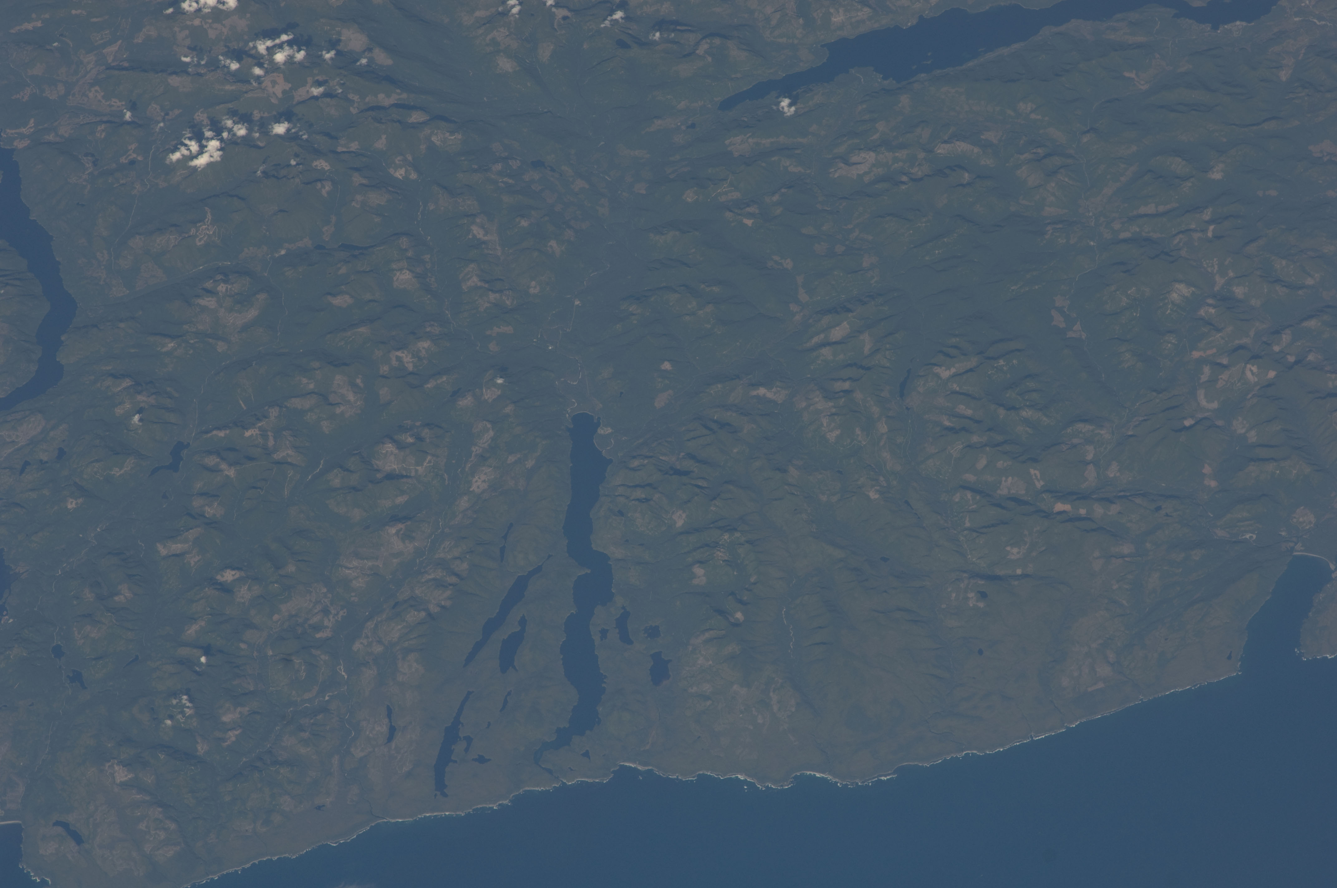
Nitinat Lake occupies a rare position at the intersection of several protected areas. Its southern end lies within Pacific Rim National Park Reserve, while Hitchie Creek Provincial Park and the Nitinat Lake Ecological Reserve guard portions of its northern shores. To the east, the slopes of Carmanah Mountain rise toward Carmanah Walbran Provincial Park, home to some of the tallest Sitka spruces on Earth. The lake itself is dotted with smaller companions -- Hobiton Lake, Squalicum Lake, Tsuiat Lake, and Cheewhat Lake all lie fully within the national park reserve, while Doobah and Sprise lakes fill the valleys between the park boundaries. Seen from the International Space Station in 2009, the lake appeared as a dark ribbon threaded through an unbroken carpet of green, a reminder of how much wilderness still holds on along this coast.
The Wind Factory
What brings visitors to this remote corner of Vancouver Island is not the scenery alone -- it is the wind. Nitinat Lake has earned a reputation as one of the premier kiteboarding and windsurfing destinations in North America, drawing riders from around the world who seek its consistent, powerful thermal winds. The geography explains the phenomenon: the lake's orientation funnels Pacific air through the surrounding valleys, creating conditions that blow reliably through the summer months. On any given afternoon, the lake's surface transforms from mountain calm to whitecapped chaos, kites arcing overhead against a backdrop of ancient forest. Access remains rugged, reached only by logging roads northwest of Victoria or southwest from the town of Lake Cowichan, and that remoteness is part of the appeal.
Salt, Wind, and Time
Nitinat Lake defies easy categorization. It is a lake that behaves like an inlet, a freshwater body filled with salt, a wilderness setting that doubles as a world-class wind sports venue. The tidal bores that surge through the narrows are a hazard to boaters and a spectacle for those who watch from shore. The old-growth forests that ring its banks are among the last unlogged valleys on southern Vancouver Island, protected by a patchwork of parks and reserves that reflect decades of conservation battles. For the First Nations communities of Whyac and Clo-oose, this is ancestral territory, a place where the boundary between land and ocean has always been negotiated rather than fixed. From above, the lake reads as a dark channel cutting through the green -- a place where the Pacific reaches inland and the forest holds its ground.
From the Air
Located at 48.75N, 124.75W on southwestern Vancouver Island. The lake is a distinctive long, narrow body of water oriented roughly north-south, visible from cruising altitude as a dark ribbon in dense forest. The Nitinat Narrows at the southern end connecting to the Pacific are a key visual landmark. Nearest airports: CYYJ (Victoria International, ~100 km SE), CAP5 (Tofino/Long Beach, ~80 km NW). Best viewed at 3,000-5,000 ft AGL for the full lake and surrounding park boundaries.