Norman Island
In August 1750, the crew of a Spanish treasure galleon named Nuestra Senora de Guadalupe mutinied off the coast of North Carolina. Fifty-five chests of silver coins were loaded onto smaller vessels, and a man named Owen Lloyd sailed one of them south to a quiet, uninhabited island at the tip of the British Virgin Islands. He buried the treasure. Word got out. Residents of Tortola crossed the water and dug it up for themselves. Soldiers came to recover it. A fisherman may have found gold doubloons in a sea cave during a storm. And a century later, Robert Louis Stevenson may have drawn on the whole saga when he wrote Treasure Island. Norman Island has been trading on its secrets ever since.
The Guadalupe Affair
The documented history is dramatic enough without embellishment. In August 1750, the Nuestra Senora de Guadalupe, a Spanish treasure galleon, sought shelter from a storm near the coast of North Carolina. The crew mutinied and loaded the treasure, said to include 55 chests of silver coins among other valuables, onto two bilanders. One vessel was lost. Owen Lloyd escaped aboard the other to St. Croix, where he disposed of some of the money before proceeding to Norman Island to bury the rest. Lloyd and his crew were eventually arrested in Sint Eustatius, but by then word of the buried treasure had spread across the Caribbean. Residents of Tortola sailed to Norman Island and excavated the hoard. Gilbert Fleming, Lieutenant-General of the Leeward Islands, traveled to Tortola with two companies of soldiers and persuaded the acting lieutenant governor, Abraham Chalwill, to issue a proclamation: return the treasure and receive a one-third share as reward. Part of the booty was recovered. The rest vanished into local hands.
The Fisherman's Storm
There the historical record ends, but local legend picks up where documents leave off. A member of a well-known Tortolan family, the story goes, was fishing near Norman Island when a storm forced him to shelter in one of the sea caves along the western coast. Through the night, the surge slammed his small boat against the cave walls while the water rose several feet. When morning came, rocks had broken loose from the walls into his craft, and with them, a small chest allegedly filled with gold doubloons. No legal application for treasure trove was ever filed, which makes the story unverifiable. But it is noted that members of the family stopped fishing around that time, left Tortola, and opened shops in Charlotte Amalie on St. Thomas. Rumors of more pirate gold persist to this day. No one has filed a treasure trove claim, but no one has stopped looking, either.
Stevenson's Blueprint
Norman Island is one of several Caribbean locations claimed as the inspiration for Robert Louis Stevenson's Treasure Island, published in 1883. The connection is more than wishful thinking. The estimated timeframe of the novel's plot closely matches the period of the Guadalupe affair, and the island's geography, with its protected harbor, sea-level caves, and hilly, scrub-covered terrain, fits Stevenson's descriptions with uncanny precision. Whether Stevenson knew the specific story of Owen Lloyd and the silver chests is debated, but the broad outlines of Caribbean pirate treasure being buried on an uninhabited island and subsequently dug up by rival parties map neatly onto the novel's premise. Tourism operators in the British Virgin Islands have no interest in resolving the question definitively. The mystery is the attraction.
Caves, Goats, and the Willy T
Norman Island today is uninhabited by humans, though wild goats have claimed the interior of its roughly 600 acres. The island is privately owned by Henry Jarecki and stretches about 2.5 miles long. Its large harbor, the Bight, offers one of the most protected anchorages in the Virgin Islands, making it a magnet for cruisers and charter boats. The main draw for visitors is a trio of water-level caves at the base of cliffs just west of the Bight, where snorkelers swim into deepening darkness that mimics a night dive. Two restaurants, Pirates Bight and The Club, serve the boating crowd. For years, a modern replica of an old schooner called the Willy T operated as a floating bar and restaurant anchored in the Bight. Hurricane Irma destroyed the original vessel in 2017, and a replacement was built, though its return to Norman Island involved a dispute with the BVI government that was eventually resolved in 2019.
The Treasure That Remains
Norman Island is part of the 'Little Sisters,' a chain of smaller, lower, more arid islands that includes Pelican Island, Peter Island, Salt Island, Dead Chest Island, and Ginger Island. Dead Chest Island itself carries its own pirate legend, supposedly the origin of the sea shanty 'Fifteen men on a dead man's chest.' The waters around these islands are clear and shallow enough for snorkeling, deep enough for diving, and dotted with enough caves, wrecks, and hidden bays to sustain the treasure-hunting imagination indefinitely. In 2018, the BVI government entered a development agreement with Jarecki's Audubon Holdings to develop Norman Island as an environmentally conscious luxury destination. The plan envisions sustainable tourism that preserves the island's wild character. For now, though, Norman Island remains what it has been for centuries: an uninhabited place where the line between history and legend is pleasantly blurred, and where the possibility of buried treasure, however remote, still draws people to its shores.
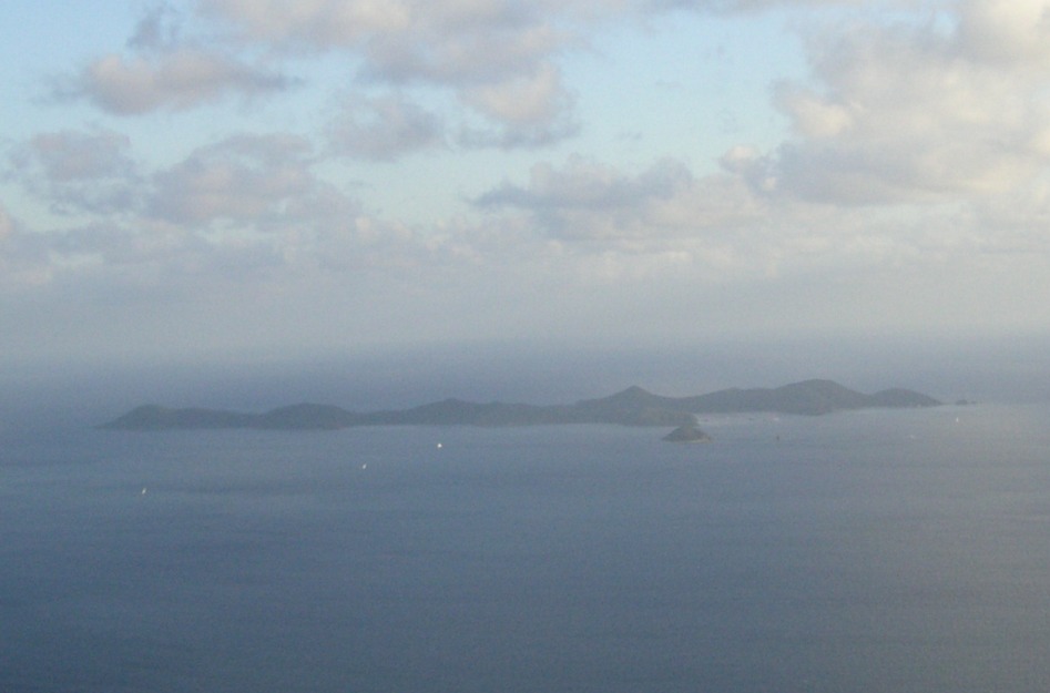
From the Air
Norman Island lies at 18.32°N, 64.61°W at the southern tip of the British Virgin Islands archipelago. From the air, the Bight harbor is clearly visible as a large, sheltered indentation on the northern shore. The island's scrubby, hilly terrain and lack of development distinguish it from the more built-up islands to the north. Tortola and Beef Island Airport (TUPJ) are approximately 8 nm to the north-northeast. The sea caves along the western cliffs are not visible from altitude, but the cluster of anchored boats in the Bight usually marks the island's location. Peter Island and Dead Chest Island are visible nearby to the east.