North Iceland
The waterfall appears suddenly, a horseshoe of thunder carved into dark basalt. Goðafoss - the Waterfall of the Gods - earned its name a thousand years ago when Iceland's law speaker threw his Norse idols into the falls upon converting to Christianity. The drama feels appropriate: North Iceland is a region that deals in extremes. Volcanic craters dot Lake Mývatn like something from another planet. Glaciers cap the jagged peaks of Tröllaskagi. Whales breach in Skjálfandi Bay while travelers watch from Húsavík's wooden boats. And just offshore, the tiny island of Grímsey straddles the Arctic Circle itself - a place where the midnight sun truly never sets.
Fire and Ice
Mývatn is not quite of this world. The lake's name means 'midge lake' - a warning for summer visitors - but the real strangeness lies in the landscape. Pseudocraters ring the water, formed when lava flowed over wetland and the trapped steam exploded upward. The Dimmuborgir lava formations twist into towers and arches that locals call the Gates of Hell. At Námaskarð, sulphurous steam hisses from the earth in a landscape of boiling mud and mineral-stained rock.
The volcanic heat has its uses. The Mývatn Nature Baths offer geothermal soaking with none of the crowds of the famous Blue Lagoon. Hot springs bubble up along river banks. The earth itself provides the heat for the greenhouses that grow tomatoes and cucumbers in a land where nothing should grow. This is Iceland's volcanic heart, still very much alive.
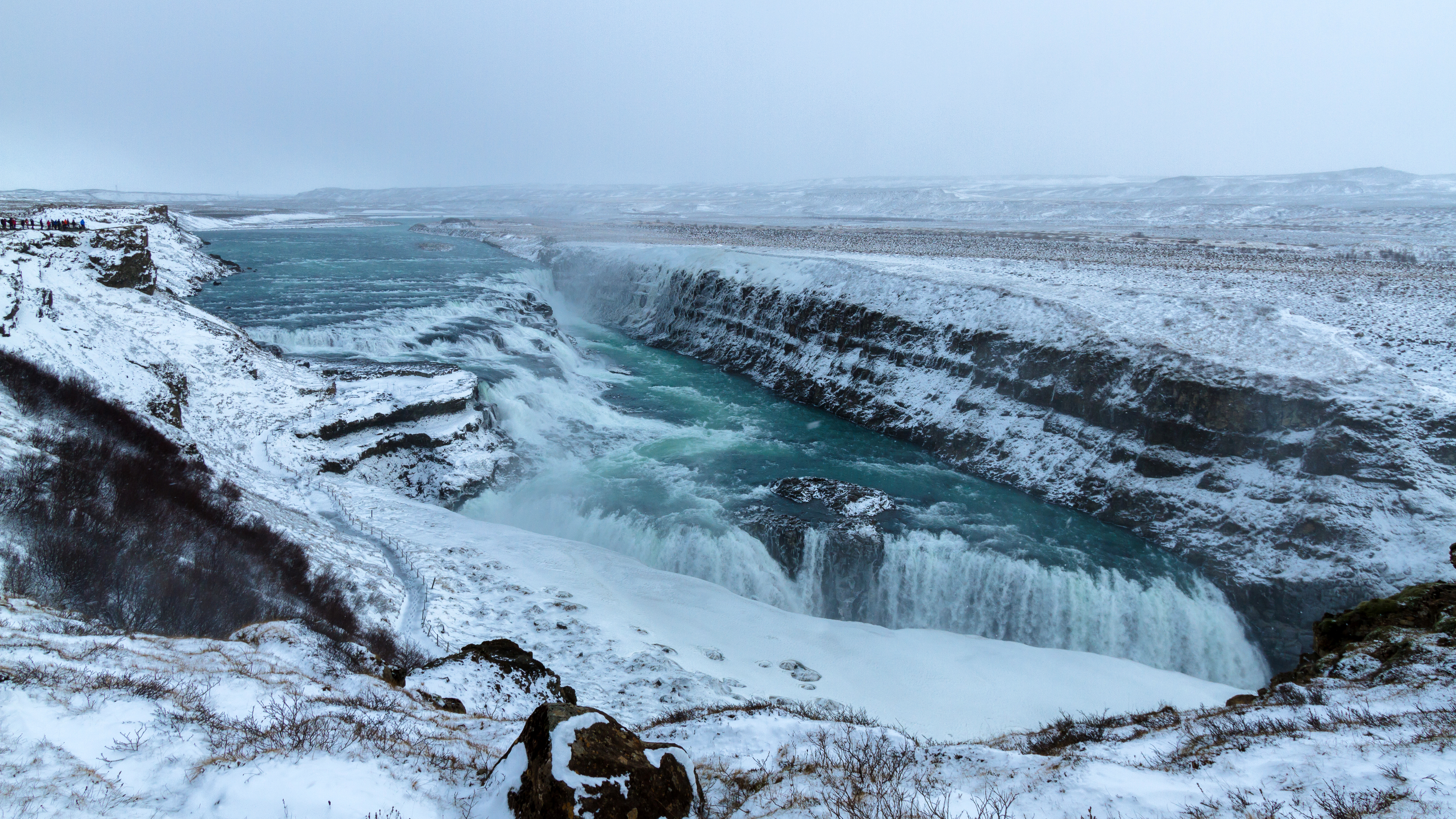
The Diamond Circle
The Diamond Circle route loops through North Iceland's greatest hits: Goðafoss, Mývatn, Dettifoss (Europe's most powerful waterfall), and the whale-watching port of Húsavík. The roads wind through landscapes that shift from lush valley to lunar desert within kilometers. The northeastern highlands feel genuinely empty - vast expanses of moss and stone where the only movement is the wind.
Húsavík has become Iceland's whale-watching capital. Humpbacks, minkes, and occasionally blue whales feed in the rich waters where the Greenland Sea meets the coast. The town itself is a colorful cluster of wooden buildings, dominated by a church built from Norwegian timber. Whale museums compete with whale-watching boats. The smell of salt and old fish haunts the harbor. This is Iceland before tourism rewrote everything - a fishing village that happens to have whales.
The Capital of the North
Akureyri is Iceland's second city, which means 20,000 people clustered at the head of a 60-kilometer fjord. It feels impossibly lush for 65° north - botanical gardens bloom with flowers that have no business surviving this close to the Arctic. The surrounding mountains trap warmth. The town itself has cafes, bookshops, a university, and nightlife that occasionally rivals Reykjavík's.
The fjord - Eyjafjörður - is one of Iceland's longest, slicing deep into the northern highlands. The Ring Road crosses the head on a causeway, but the coastal roads on either side offer better views: fishing villages, historic farms, the island of Hrísey sitting mid-fjord like a green jewel. Akureyri's small airport has seasonal flights from London and Amsterdam. For many visitors, this is where Iceland begins.
Horse Country
Skagafjörður is Iceland's horse heartland. The Icelandic horse - small, shaggy, developed from Viking-era stock brought by settlers - has been isolated here for a thousand years. No horse that leaves Iceland may return, protecting the breed from disease. These horses can tölt, a smooth four-beat gait that makes long rides comfortable. Visitors come from around the world to ride them.
The valley is green and surprisingly gentle, a pastoral interlude in Iceland's drama. Farms dot the lowlands. Rivers braid across the floodplain, perfect for rafting when the glacial melt runs high. The mountain road to Siglufjörður - once one of Iceland's most isolated towns - now tunnels through the peaks, but the sense of remoteness persists. In winter, these valleys fill with snow. In summer, the light barely fades.
Edge of the Arctic
Grímsey is a sliver of rock 40 kilometers offshore, population around 60, bisected by the Arctic Circle. A ferry runs from Dalvík; small planes land on a grass strip. The main attraction is simple: stand on the line where the sun officially never sets on midsummer's night, never rises on midwinter's day. A concrete sphere marks the spot, though the actual circle creeps slowly northward each year.
The island is treeless, windswept, and thick with seabirds - puffins nest in the cliffs, arctic terns dive-bomb visitors who stray too close. There's a church, a school, a guesthouse. Life moves to the rhythm of fishing and seasons. Visitors stay long enough to say they've been, to collect their 'I crossed the Arctic Circle' certificates, to watch the endless summer twilight. Then they return south, leaving Grímsey to its birds and its silence.
From the Air
Located at approximately 65.6°N, 18.0°W, the North Iceland region spans from the western Skagafjörður valley to the eastern Mývatn volcanic zone. Akureyri Airport (AEY/BIAR) is the main gateway, with the longest runway outside Reykjavík and seasonal international flights. The airport sits at the head of Eyjafjörður, Iceland's longest fjord (60km). Key visual landmarks: the horseshoe-shaped Goðafoss waterfall, the volcanic craters and steam vents around Mývatn, the glacier-capped Tröllaskagi peninsula, and tiny Grímsey island on the Arctic Circle 40km offshore. The Ring Road is visible as a continuous line through the region. Look for the contrast between green valleys (Eyjafjörður, Skagafjörður) and barren highlands to the east. Weather highly variable - clear skies can turn to low cloud quickly. Best visibility often in morning. Winter brings limited daylight; summer offers midnight sun above the Circle.