North Complex Fire
At 3:15 p.m. on September 8, 2020, residents of Berry Creek received no warning at all. The evacuation order came instantly, urgently, without the gradual escalation that usually precedes such disasters. Within hours, 1,197 of the community's 1,200 homes would be reduced to ash. Only three structures remained standing in the small Butte County town, a grim testament to the explosive power of the North Complex Fire as it tore through the Sierra Nevada foothills of Northern California.
Twenty-One Strikes
The fire began not as one event but as many. On August 17, 2020, dry thunderstorms rolled across the Plumas and Lassen National Forests, their lightning igniting 21 separate wildfires in a single morning. These storms carried moisture from Tropical Storm Fausto far to the south, but the rain that should have accompanied the lightning never reached the parched Sierra landscape. Within days, the largest of these fires, the Claremont and Bear Fires, would begin their deadly convergence along the canyon of the Middle Fork Feather River. The Bear Fire started in particularly treacherous terrain, in the roadless Wild and Scenic section of the Middle Fork, where steep canyons made firefighting nearly impossible. With hundreds of fires burning simultaneously across Northern and Central California, resources stretched thin, and the Bear Fire was left unstaffed. It was not yet threatening people or property. By August 31, it had grown to substantial size with zero percent containment.
The Explosion
September 8 dawned with a dry cold front moving in from the northeast, bringing winds that would transform an already dangerous fire into a catastrophe. At 10:00 a.m., flames jumped the Middle Fork Feather River near Horseshoe Bend. Within one hour, driven by winds gusting to extreme speeds, the spot fire had grown massively. By 3:00 p.m., it exceeded expectations of even the most experienced firefighters. The fire traveled with terrifying speed, racing downhill and southwest toward Lake Oroville. Climate scientist Daniel Swain of UCLA compared the explosive spread to the 2018 Camp Fire, which had devastated the town of Paradise just north of this area two years earlier. The comparison proved tragically apt. Berry Creek and Feather Falls, both evacuated with no prior warning, were leveled overnight. By the morning of September 9, the fire had traveled miles in mere hours, reaching the shores of Lake Oroville and threatening the city of Oroville itself.
The Human Cost
Sixteen people lost their lives to the North Complex Fire, fourteen from Berry Creek and two from Feather Falls. The first bodies were discovered on September 9, the day after the explosive run. Over the following days, search teams found more victims as the death toll climbed. On September 11, authorities briefly lowered the count from ten to nine after a skeleton found in a burned storage shed turned out to be an anatomical model belonging to an anthropology student. The grim search continued through September 14. The toll stood at fifteen until October 28, when a 54-year-old Berry Creek resident succumbed to burn injuries suffered during the evacuation. More than 100 people were injured, and at least 100 others required rescue. An estimated 2,000 buildings were destroyed, most of them homes. The fire burned across Plumas and Butte Counties, consuming forests, grasslands, and communities that had stood for generations.
The Long Containment
Fighting the North Complex Fire required an army. At its peak, 3,282 personnel worked the fire lines, conducting backfire operations, building containment lines, and protecting the homes that remained. The burn scar from the 2018 Camp Fire provided an unexpected ally, slowing the fire's progress as it approached Paradise. Still, the battle stretched for months. Strong winds in late September started new spot fires and forced fresh evacuations. Highway 70, the main artery through the region, closed repeatedly as the fire threatened to cross. Full containment did not come until December 3, 2020, when the North Complex was declared 100% contained at 318,935 acres, ranking it among the largest fires in California history. It remained the deadliest fire of the 2020 season, a year that would see over 4 million acres burn across the state.
Legacy of Flame
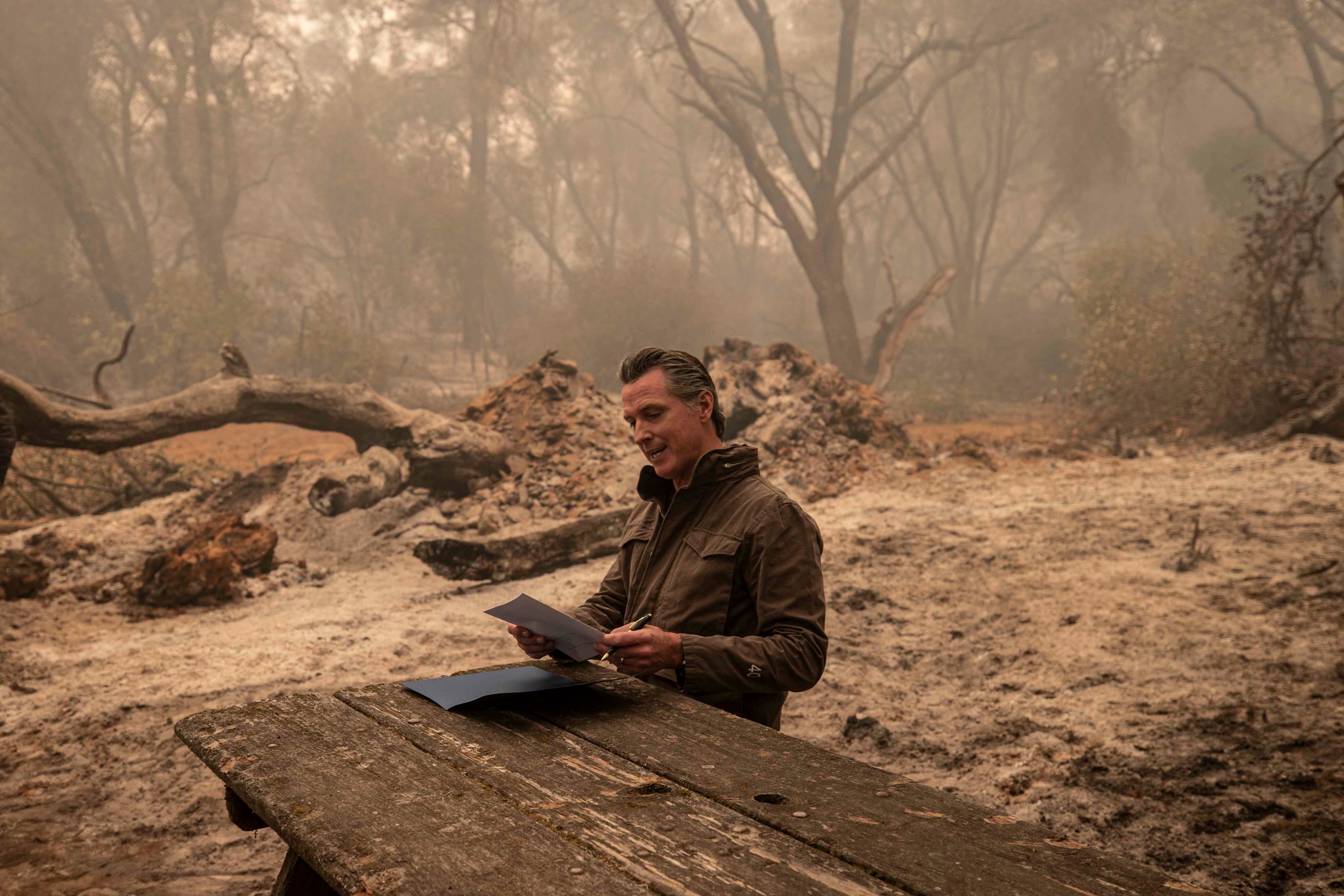
The fire brought both policy and controversy. On September 11, Governor Gavin Newsom visited the burn zone to discuss climate change and sign AB2147 into law, legislation that allows former inmate firefighters to pursue professional firefighting careers. Republican legislators from the region pushed back, arguing that forest management failures, not climate, bore responsibility for the devastation. Representative Doug LaMalfa criticized what he called the governor's audacity in using the disaster to advance a climate agenda. State Senator Jim Nielsen and Assemblyman James Gallagher pointed to fuels buildup in the forests as the fundamental cause. The debate continues, but for the residents of Berry Creek, Feather Falls, and the scattered communities throughout the Middle Fork canyon, the North Complex Fire left questions that policy arguments cannot answer. The mountainsides above the Feather River still bear the scars, stands of blackened timber visible from the air, a reminder of those 21 lightning strikes on an August morning and the inferno they unleashed.
From the Air
Located at 39.85N, 120.96W in the Plumas National Forest, Northern California. The burn scar is visible from cruising altitude, appearing as a large dark patch against the green Sierra Nevada foothills. Best viewed from 10,000-15,000 feet for full extent. Nearby airports include Quincy-Gansner Field (O05) and Oroville Municipal Airport (OVE). The terrain is mountainous with deep canyons along the Feather River system.