North Sea Flood of 1953
Twenty-year-old Jos de Boet went to bed on Saturday 31 January 1953 in the village of Oude-Tonge with forty-two living relatives. By Monday morning he had none. The water came at his village in the dark, after a high spring tide collided with a hurricane-force northwest gale and the dykes failed in sixty-seven places across the province of Zeeland. Most local radio stations had signed off for the night with the Wilhelmus, as was the custom. The warnings the meteorologists had broadcast went out into rooms where no one was listening. Three hundred and five people drowned in Oude-Tonge alone. That number is one village. There were many villages.
A Saturday Night, a Spring Tide
The pressure had been dropping over Iceland for days. By the afternoon of 31 January, a windstorm was driving water out of the northern North Sea, funnelling it south between Norway and Scotland into a basin that narrows like a wedge toward Belgium and the Netherlands. On any ordinary night the basin would have absorbed the surge. This was not an ordinary night. A spring tide — the higher kind that comes near a new or full moon — was running, and the surge piled on top of it. At 10:30 p.m., when the tide should have been falling, the water on the Dutch coast simply refused to drop. The hurricane had broken the rhythm of the sea. The water that should have ebbed reached for the top of the dykes, and at low spots and weak places it found its way over and through.
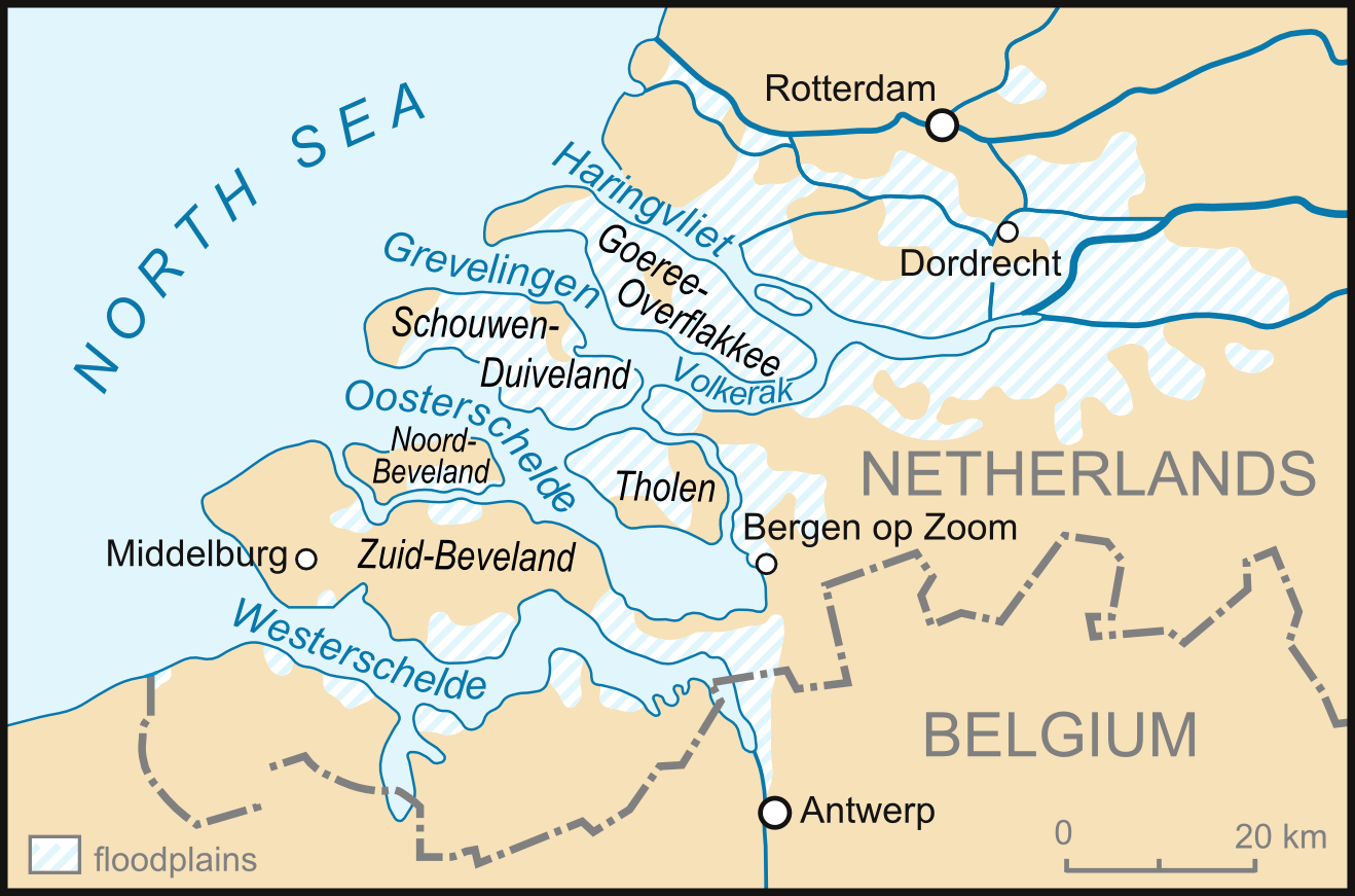
What 1,836 Means
By Sunday afternoon, when the second high tide came in even higher than the first, the islands of Schouwen-Duiveland, Goeree-Overflakkee, and Tholen lay almost entirely under water. People who had climbed onto their roofs to escape the first surge died when their houses collapsed beneath them in the second. The Dutch government did not yet know how bad it was. Telephones were down. The Netherlands at the time had exactly one helicopter, and no large-scale rescue was even attempted until Monday, when fishermen began sailing into the flooded country to pull survivors from chimneys and attic windows. The final Dutch death toll was 1,836, with around 70,000 more evacuated, 47,300 buildings damaged, 30,000 farm animals drowned, and the worst losses concentrated on Schouwen-Duiveland and Goeree-Overflakkee. In a country whose southwestern half lay at or below sea level, the sea had taken back what humans had borrowed.
The Two Brothers
Three million people lived behind the Schielands Hoge Zeedijk, the dyke that protected the deep polders of North and South Holland from the river Hollandse IJssel. A weak section called the Groenendijk began to collapse around 5:30 a.m. on 1 February. Sea water poured into a polder that lay metres below the level of the flood. In desperation, the mayor of Nieuwerkerk aan den IJssel commandeered a river ship called De Twee Gebroeders — The Two Brothers — and ordered its captain, Arie Evegroen, to plug the hole in the dyke by ramming the ship into it. Evegroen, fearing the ship might be sucked into the polder, took a row boat along for escape. The plan worked. The vessel lodged in the breach and held. Three million people did not drown that morning because of one improvised plug and the nerve of one mayor and one captain.
England, Belgium, and the Sea
The surge raced down the British east coast, where the shallow southern North Sea amplified it further. Three hundred and seven people drowned in England — fifty-eight on Canvey Island in Essex, forty-one in prefabricated homes at Felixstowe, thirty-seven in the seafront village of Jaywick. Police officers Charles Lewis and Leonard Deptford and American airmen Reis Leming and Freeman Kilpatrick earned George Medals for hauling neighbours and strangers from waist-high water. Nineteen people died in eastern Scotland; twenty-eight in West Flanders, Belgium. At sea, more than two hundred and thirty more died as ships foundered: the car ferry MV Princess Victoria with 133 souls in the North Channel, the Swedish steamer Aspo with twenty-two, the Dutch trawler Catharina Duyvis with sixteen, the British trawler Sheldon with fourteen, and others, each name a crew and each crew a family.
Never Again
The Dutch response was the Delta Works — a system of dams and storm-surge barriers that took most of the rest of the twentieth century to complete, with the Maeslantkering in the Nieuwe Waterweg finishing the system in 1998. The British response was the Thames Barrier, opened in 1984. The flood is remembered every February in services from Chelmsford Cathedral to small churches in Zeeland. The Watersnoodmuseum opened at Ouwerkerk in 2001, housed inside the very caissons that finally closed the last dyke breach eleven months after the flood. The promise the Dutch made themselves was simple and absolute: never again. The Delta Works are an attempt to keep it.
From the Air
The flood's epicentre in the Netherlands centred on the islands of Zeeland and South Holland at around 51.57°N, 3.75°E. From cruise, the Rhine–Meuse–Scheldt delta is unmistakable: a green-and-blue tessellation of polders, channels, and Delta Works dams. Useful viewing altitudes 5,000–10,000 ft. Nearest major airports: Rotterdam The Hague (EHRD) ~40 nm north and Antwerp (EBAW) ~50 nm east-southeast; Midden-Zeeland (EHMZ) sits within the affected region. The same southwesterly North Sea storm track that drove the 1953 surge is still active in winter; expect strong winds and gusty crosswinds on coastal approaches November through February.