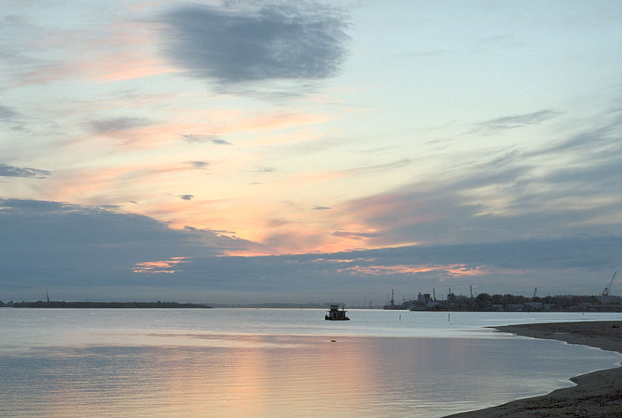
Northern Dvina
In the Komi language, they call it Vynva -- the powerful river. The Northern Dvina earns the name. Rising at the confluence of the Sukhona and Yug rivers near the ancient merchant town of Veliky Ustyug, it flows 744 kilometers northwest through Vologda and Arkhangelsk Oblasts before spreading into a 900-square-kilometer delta and emptying into the Dvina Bay of the White Sea. Together with the Sukhona, the system stretches 1,302 kilometers -- roughly the length of the Rhine. Its basin drains 357,000 square kilometers of northern Russia, and for centuries before roads or railways existed, the Northern Dvina was the highway that connected Russia's interior to the Arctic and, through the port of Arkhangelsk, to the wider world.
The Shape of Water
The Northern Dvina basin is roughly T-shaped. The Sukhona flows eastward for 558 kilometers, meeting the northward-flowing Yug at Veliky Ustyug. Their combined stream takes the name Northern Dvina and flows north about 60 kilometers to Kotlas, where it absorbs the 1,130-kilometer Vychegda arriving from the east, fed by snowmelt from the northern Ural Mountains. From Kotlas the river turns northwest, collecting the Vaga from the south, the Pinega from the east, and dozens of smaller tributaries before splitting into its vast delta near Arkhangelsk. The river is navigable for its entire summer length and was historically used for timber rafting on an enormous scale. A series of canals -- the Northern Dvina Canal linking it to the Volga-Baltic Waterway, the abandoned Northern Ekaterininsky Canal connecting it to the Kama basin, and the neglected Kuloy-Pinega Canal of the 1920s -- testify to repeated attempts to integrate the river into Russia's broader transportation network.
Merchants on the Portage
Long before Arkhangelsk existed, the Northern Dvina was a trade artery. Finnic peoples populated the basin first, followed by colonists from the Novgorod Republic who reached the White Sea by the 13th century, drawn by the fur trade. Their route was laborious: up the Volga to the Sheksna, along the Slavyanka into Lake Nikolskoye, overland to Lake Blagoveshchenskoye, down the Porozovitsa to Lake Kubenskoye, and finally onto the Sukhona and the Northern Dvina. From the Dvina, merchants could branch into the Mezen, Pechora, and even the Ob basins through a network of river-and-portage routes that crisscrossed the north. Veliky Ustyug, first mentioned in 1207, became a nexus of this network. Kholmogory served as the chief harbor from the 14th century until Arkhangelsk supplanted it in the 17th century, growing into Russia's primary seaport for European trade.
Peter's Pivot
The Northern Dvina's decline as Russia's premier trade route can be dated with unusual precision. In 1703, Peter the Great founded Saint Petersburg, redirecting Russia's commercial ambitions toward the Baltic Sea. Arkhangelsk, which until then had been the country's window to western Europe, found its monopoly broken. Peter even built a highway from Saint Petersburg to Arkhangelsk via Kargopol, further reducing the river's commercial importance. The final blow came between 1894 and 1897, when a railway between Vologda and Arkhangelsk offered a faster, year-round alternative to a waterway that froze solid each winter. Heavy commercial passenger navigation has since largely disappeared -- the Kotlas-to-Arkhangelsk passenger line ceased operation in 2005. Yet the river still carries timber, and every town along its banks exists because the Dvina once made it a place worth settling.
A River of Battles
The Northern Dvina's strategic importance did not end with the decline of trade. During the Russian Civil War following the 1917 revolution, the river became a theater of combat. British, American, and French forces of the Allied interventionist Entente penetrated deep into northern Russia as part of the North Russia Campaign, fighting Bolshevik forces along the Dvina's banks. A dedicated Northern Dvina Flotilla operated during the conflict, turning the river into a corridor of gunboats and contested bridges. The cities along the river -- Arkhangelsk at the delta, Kotlas at the Vychegda confluence, Veliky Ustyug at the headwaters -- each bore the marks of this conflict. Today the battles are forgotten by most, but the river that shaped them still flows through the same towns, past the same forests, carrying snowmelt from the Urals to the White Sea as it has for millennia.
From the Air
The Northern Dvina's course is visible as a major river corridor from 60.73°N, 46.33°E (near the confluence at Veliky Ustyug) northwest to the delta at Arkhangelsk (64.55°N, 40.53°E). The river is unmistakable from cruising altitude as one of the widest waterways in northern Russia. Key landmarks: the T-shaped confluence at Veliky Ustyug/Kotlas, the 900 km² delta near Arkhangelsk. Nearest airports: Arkhangelsk (Talagi), ICAO: ULAA; Kotlas (Pinega), ICAO: ULKK. The river meanders through flat taiga terrain with numerous oxbow lakes. In winter the frozen river appears as a white ribbon; in summer, timber rafts may be visible.