Northern Territory
The population density of the Northern Territory is 0.18 people per square kilometre. For comparison, the Sahara Desert averages about 1. That number — almost nothing, distributed across an area the size of Mongolia — begins to explain what the Northern Territory actually is: not empty, but spacious in a way that changes how the world feels. The red desert of the Centre, the monsoon-lashed tropics of the Top End, the gorges, the ancient rock art, the cattle stations bigger than European countries. This is where Australia keeps its extremes.
Two Territories in One
The NT divides itself neatly into two distinct worlds. The Top End, centred on Darwin, is tropical — a place of monsoon rains, floodplains, saltwater crocodiles, and the vast World Heritage wetlands of Kakadu National Park. The seasons here are two: the Wet and the Dry. The Wet (November through April) brings torrential rain, lightning storms, and roads that close as rivers overflow. The Dry brings relief — clear skies, warm days, and the tourist season that sustains much of the economy. The Centre, anchored by Alice Springs, is something else entirely: semi-arid, ancient, the red earth of the MacDonnell Ranges stretching east and west, and at the heart of it all, Uluru. Two landscapes, two climates, one territory.
The People
Approximately 30 percent of the Northern Territory's 246,000 people are Aboriginal Australians — the highest proportion of any state or territory in the country. Darwin alone is home to people from more than 60 nationalities and 70 ethnic backgrounds, making it one of Australia's most multicultural cities despite its modest size. The connections between different Aboriginal communities stretch across the territory in networks of kinship, ceremony, and shared country. Many communities are remote, accessible by dirt track, with their own distinct languages, governance structures, and cultural lives. Yuendumu, Nhulunbuy, Maningrida, Yirrkala — each is a world unto itself, while also being part of a larger fabric.
Getting There, Getting Around
The NT's small population means limited transport options and higher prices. Darwin receives direct international flights from Singapore, Bali, and Dili; Alice Springs connects to major Australian capitals. The Ghan, Australia's legendary passenger train, runs between Adelaide and Darwin via Alice Springs twice weekly during the dry season — a 54-hour journey covering 2,979 kilometres of outback. For those who want to drive, several themed routes have been mapped: the Red Centre Way loops through Uluru, Kings Canyon, and the West MacDonnell Ranges. The Explorer's Way follows the route of John McDouall Stuart along the length of the territory. The Nature's Way meanders through Kakadu, Litchfield, and Nitmiluk. For the most adventurous, the Binns Track runs 2,191 kilometres from the South Australian border to near Kununurra.
Icons and Edges
Kakadu National Park, in the Top End, protects one of the world's most significant collections of Aboriginal rock art — paintings and engravings that span tens of thousands of years of continuous cultural practice. Nitmiluk (Katherine Gorge) cuts through sandstone country in thirteen chasms, navigable by canoe in the dry season. In the Centre, the Devils Marbles — known to the Warumungu people as Karlu Karlu — are clusters of granite boulders balanced against each other in the desert near Tennant Creek, a place of ceremony and of geological wonder in equal measure. And then there is Uluru, which requires no superlatives: the great sandstone monolith that has become, for many people both within Australia and beyond, something close to a symbol of the continent itself.
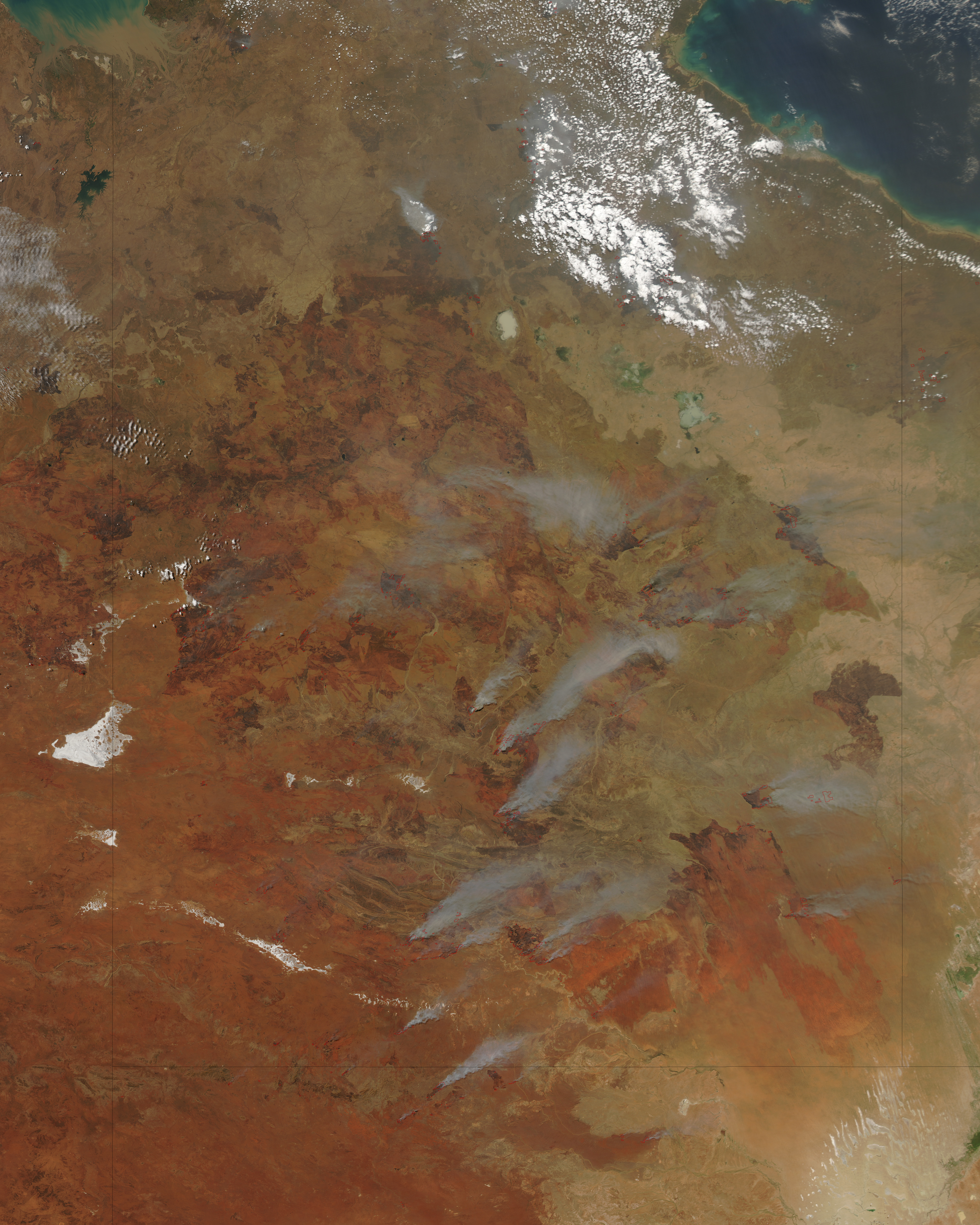
From the Air
The Northern Territory occupies the north-central portion of Australia, centred approximately at 20°S, 133°E. Darwin (YPDN) in the north and Alice Springs (YBAS) in the south are the major airports. Flying the length of the territory covers roughly 1,500 km. From cruising altitude, the landscape transitions visibly from the red desert of the Centre to the greener, more dissected terrain of the Top End. Kakadu's floodplains are visible from altitude during the wet season as a vast inland sea. The MacDonnell Ranges cut east-west across the Centre as a distinct ridge visible for hundreds of kilometres.