Nosy Boraha
In 2015, divers pulled a 55-kilogram ingot from the seafloor off Nosy Boraha and announced they had found part of Captain Kidd's legendary treasure. UNESCO tested the metal. It was 95 percent lead -- a broken piece of the old Sainte-Marie port construction. The episode captures something essential about this 60-kilometer sliver of island off Madagascar's northeast coast: the line between pirate legend and historical reality has always been blurred here, and the treasure people find is rarely what they expected.
The Pirate Shore
Between 1691 and 1719, Nosy Boraha -- known to Europeans as Ile Sainte-Marie, or St. Mary's Island -- served as one of the most active pirate bases in the Indian Ocean. The location was ideal. Ships returning from the East Indies, their holds heavy with silk, spices, and precious metals, passed through these waters on their way to Europe. The island offered sheltered bays, fresh fruit, and quiet anchorages far from any navy patrol. Adam Baldridge established the first pirate trading post in 1691, and within a decade the island had attracted some of the era's most infamous names: William Kidd, Robert Culliford, Henry Every, Thomas Tew, and Olivier Levasseur -- the last known as La Buse, who reportedly left behind an unsolved cryptogram said to reveal the location of hidden plunder. Many of these pirates lived on the tiny Ile aux Forbans, an islet in the bay of the main town, Ambodifotatra. A cemetery on Nosy Boraha still draws visitors who come to see headstones marked with skull-and-crossbone carvings, though no remains have been positively identified.
Kingdom and Colony
The Betsimisaraka people, the island's largest ethnic group, have inhabited Nosy Boraha for centuries, and their history with European arrivals was anything but passive. In 1750, the ruler of the Betsimisaraka kingdom, Queen Bety, ceded the island to France by treaty. Two years later, the local population rebelled and massacred the French colonists. France abandoned the settlement for half a century before returning in 1818, this time converting the island into a penal colony. The colonial legacy deepened in 1857 when the French built what became the first Catholic church in Madagascar -- a structure that remains in use today. Centuries of contact, including intermarriage with the pirates of the 17th century, produced a population with a complex and layered cultural identity. French rule ended in 1960 when the island's residents voted in a referendum to join the Malagasy Republic.
Giants in the Channel
Each year between July and September, substantial pods of humpback whales migrate from Antarctic feeding grounds to the warm, sheltered waters of the Baie de Tintingue, the channel separating Nosy Boraha from the Madagascar mainland. The conditions here -- calm seas, shallow sandbars, and protection from open-ocean swells -- make it one of the best breeding and calving grounds in the western Indian Ocean. Mothers nurse newborn calves in the shallows while males compete with acrobatic breaching displays visible from shore. Southern right whales, once hunted to near-extinction in these waters, have begun reappearing along the coast in small numbers as part of a slow recolonization of their former range. The whale-watching season has become the island's primary draw for international visitors.
An Island Ecology Under Pressure
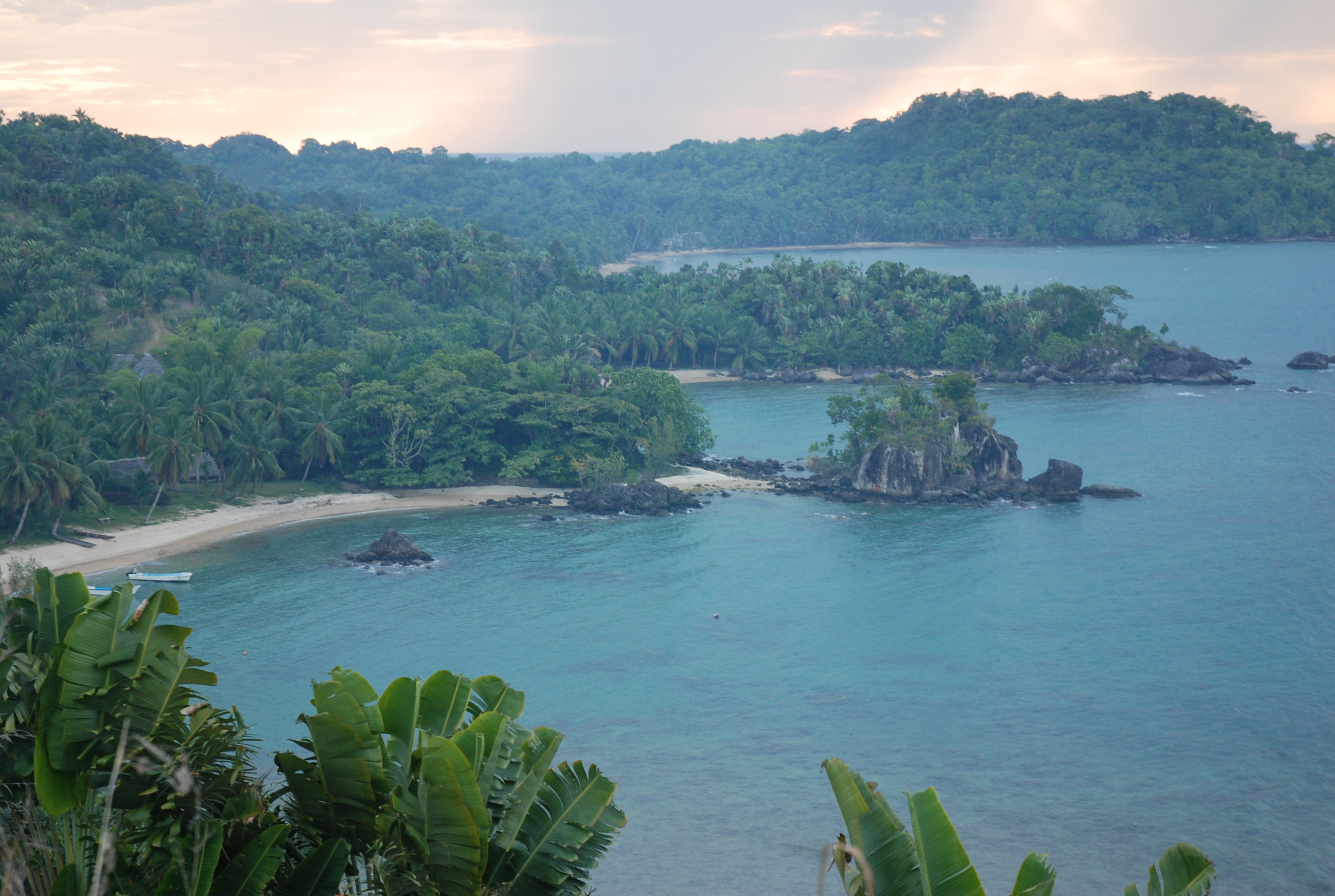
Nosy Boraha's isolation and coral-rich soil have fostered distinctive plant and animal life. Several species of lemur inhabit the island's remaining forests, and among its orchids grows Eulophiella roempleriana, known locally as the Queen of Madagascar. But the island also carries a quieter distinction: it was the only known home of Delalande's coua, a species of cuckoo that disappeared in the 19th century, driven to extinction by deforestation, overhunting, and the rats that European ships introduced. The lagoon surrounding the island, largely free of sharks, supports significant coral formations and has become a popular diving site. Underwater, the fauna is conserved as natural heritage -- a recognition that the reef's health underpins both the island's ecology and its economy.
Reaching Sainte-Marie
Nosy Boraha covers 222 square kilometers and is home to roughly 30,000 people spread across 17 villages and the main town of Ambodifotatra. An international airport inaugurated in 2015 sits at the island's southern end, and ferries connect to the mainland from Soanierana Ivongo and Mahambo, with additional boat service from Toamasina. A single paved road runs along the west coast. At the island's southern tip, dugout canoes ferry passengers to Ile aux Nattes, a smaller island with no cars and no electricity grid. The contrast is striking -- from pirate legends and colonial cathedrals to a place where the only sound is the lap of the Indian Ocean against a wooden hull.
From the Air
Nosy Boraha lies at approximately 16.90S, 49.90E, a narrow island running roughly north-south off Madagascar's northeast coast. From 3,000-5,000 feet AGL, the island's elongated shape, surrounding coral reef, and the channel separating it from the mainland are clearly visible. Sainte Marie Airport (FMMS) is at the southern end. The tiny Ile aux Nattes is visible just off the southern tip. During July-September, humpback whale activity may be visible in the channel waters. The Madagascar mainland coast and its lush tropical vegetation provide a dramatic backdrop to the east.