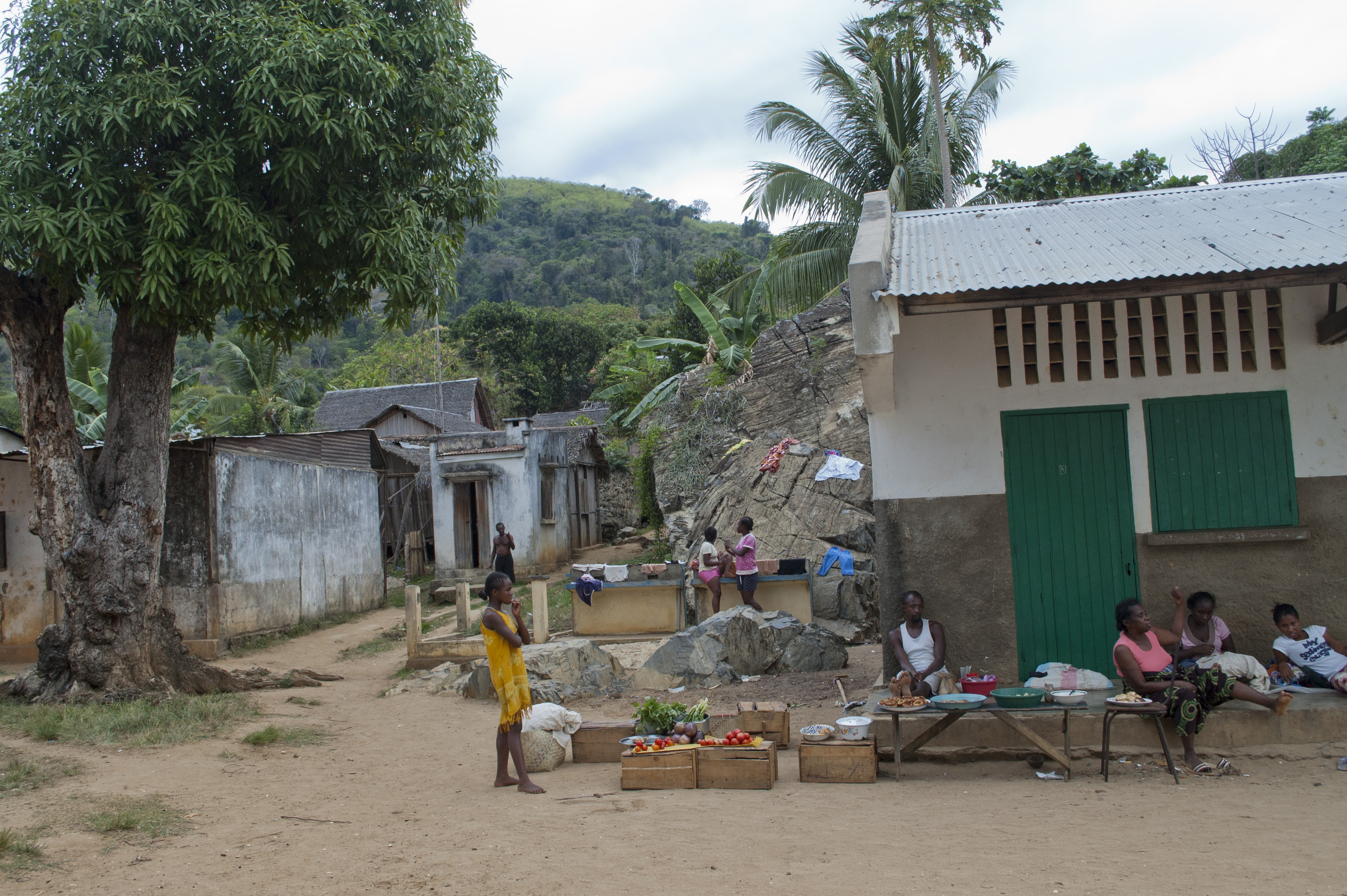
Nosy Komba
In 1837, Queen Tsiomeko of the Boina Kingdom fled to this island. Merina forces pursued her, attempted to seize the place, and were thrown back. Within three years, France had claimed it. Within a decade, a hangar housing over 800 indentured laborers had been built on its slopes, screening workers shipped from Mozambique -- many of whom died shortly after arrival. Today, tourists arrive by pirogue from Nosy Be, three kilometers to the north, to feed bananas to black lemurs in the coastal forest. Nosy Komba's layers of history are that abrupt, that unsettling, and that close together.
A Mountain Rising from the Channel
Nosy Komba is a near-perfect circle of volcanic rock, 27.9 square kilometers in area, rising sharply from the Mozambique Channel to the summit of Antaninaomby at 622 meters. The island formed during or shortly after the end of the Cretaceous period, roughly 66 million years ago, as Madagascar separated from Africa. Its core is an igneous intrusion of gabbro and nepheline surrounded by schist, with the surface rock estimated at around 10 million years old. During the Last Glacial Period, lower sea levels connected Nosy Komba to Nosy Be and the Madagascan mainland. Around 8,000 years ago, rising waters severed those land bridges. The mean annual temperature hovers around 26 degrees Celsius, with heavy rain most of the year except during the dry season from June to September. Five villages cluster on the northern half of the island, with Ampangorina as the administrative center. The 2018 census counted 5,834 residents, all classified as rural.
The Colony's Staging Ground
France gained control of Nosy Komba in July 1840, folding it into the colonial administration of Nosy-Be et Dependances, governed from Reunion. What followed was a grim chapter. The islands became labor hubs, processing engages -- nominally indentured servants, in practice often enslaved people whose freedom had been purchased by Europeans only to bind them to fourteen-year contracts. When slavery was abolished in the French colonies, the emancipation decree did not extend to nearby Madagascar, so settlers continued to rent enslaved workers from Malagasy elites and ship them onward to Mayotte and Reunion. A large hangar on Nosy Komba processed laborers recruited from Mozambique; conditions were dire enough that many died soon after reaching the island. Simultaneously, disease ravaged the colonial enterprise. Malaria, cholera, and smallpox hammered Nosy Be so persistently that in 1841, the French built a highland convalescent retreat on Nosy Komba. By 1895, it had been upgraded to a full sanatorium handling 1,883 patients in a single year, with a mortality rate of 5.3 percent. The resident physician, Jean Darricarrere, called it a sanatorium in name only.
Black Lemurs and Vanishing Forests
Nosy Komba draws its modern fame from the black lemurs that live in its coastal forests. Residents protect them, though unlike in some other parts of Madagascar, the animals are not considered sacred -- the protection is practical, tied to the ecotourism that now anchors the island's economy. The lemurs' genetic diversity is lower than on neighboring Nosy Be, suggesting the population descended from a small founding group that crossed from the Ambato peninsula. More troubling is what has disappeared. The gray-backed sportive lemur, a nocturnal species, once inhabited the island. No confirmed sightings have been made since the late 1990s. Villagers near the summit report a small colony may persist, attributing the decline to wildfires, deforestation, and the locally taboo practice of hunting for bushmeat. The island hosts 41 species of reptiles -- six chameleons, sixteen geckos, eleven snakes -- and eleven frog species, diverse for its size but significantly less than neighboring Nosy Be, where Lokobe National Park preserved habitat that Nosy Komba lost to two centuries of deforestation.
Coffee Plantations as Accidental Refuges
Heavy deforestation during the 19th and 20th centuries stripped Nosy Komba of most of its original forest cover. Only about 45 hectares of old-growth indigenous forest survive in a traditionally protected area, plus a 60-hectare colonial-era arboretum that nominally falls under the Ministry of the Environment but has essentially no enforcement. Illegal logging continues. Yet the island's ecology has found unexpected allies. The patchwork of shade-grown coffee plantations, interspersed with secondary forest, has functioned as a refuge for many reptile species. The chameleon Calumma boettgeri has actually thrived in this degraded landscape, its population growing thanks to a lack of predators and its adaptability to disturbed habitats. The island sits within the Sambirano rainforest region and hosts the flowering plant Takhtajania perrieri, the only species of the Winteraceae family found in Africa. In 1998, researchers discovered a liverwort endemic to the summit, Cololejeunea nosykombae -- a species found nowhere else on Earth. Conservation here is not a success story, but it is not a simple tragedy either. It is an ongoing negotiation between human need and biological resilience.
From the Air
Located at 13.47S, 48.35E between Nosy Be and the Madagascan mainland. From altitude, Nosy Komba appears as an almost perfectly circular island with a prominent central peak (Antaninaomby, 622 m). The island is 3 km south of Nosy Be and 4 km north of Ankify on the mainland. Nosy Be's Fascene Airport (FMNN) is the nearest commercial airport. Villages are clustered on the northern coast, visible as small clearings in the forest. The adjacent tiny island of Nosy Tanikely lies to the southwest.