Novaya Zemlya
On October 30, 1961, a Soviet bomber released a device over Novaya Zemlya that produced the largest man-made explosion in human history. The Tsar Bomba detonated at altitude, generating a fireball visible from 1,000 kilometers away and a shockwave that circled the Earth three times. The island barely registered the change. Novaya Zemlya had endured worse — centuries of Arctic cold, eight-month winters, and the kind of isolation that makes most of the inhabited world feel like a rumor.
Two Islands, One Name
Novaya Zemlya — New Land in Russian — is an archipelago of two main islands separated by the narrow Matochkin Strait. Together, Severny (Northern) and Yuzhny (Southern) cover roughly 83,000 square kilometers, sitting in the Arctic Ocean at the far northeastern edge of Europe. The Barents Sea lies to the west; the Kara Sea to the east. Geologically, the islands are a northward extension of the Ural Mountains, mountainous in their interior with a coastline so deeply indented by fjords that Novaya Zemlya holds the largest number of fjords in the entire Russian Federation. The highest peak on Severny Island reaches 1,547 meters. Most of the year, both islands are locked in ice and weather that discourages all but the most determined visitors — and the polar bears, who need no encouragement at all.
A History of Distant Visitors
Russian hunters from Novgorod knew of Novaya Zemlya from at least the eleventh century. Western Europeans arrived later, searching for the Northeast Passage — a sea route around Asia's northern coast. The Dutch navigator Willem Barentsz reached the island in the sixteenth century and spent a brutal winter trapped in the ice there; he died on the return voyage and may have been buried on Severny Island. His gravesite, if it exists, has never been confirmed. During expeditions in 1821 to 1824, Fyodor Litke mapped the western coast; systematic surveys of the islands followed in the early 1830s under Pyotr Pakhtusov and Avgust Tsivolko. The first permanent settlement, Malye Karmakuly, was established in 1870. By then, small populations of Nenets people had been resettled onto the islands by the Russian Empire as part of its colonization of the territory.
The Nuclear Chapter
In 1954, the Soviet government designated Novaya Zemlya as its primary nuclear weapons testing site. Over the following decades, hundreds of devices were detonated here — in the air, on the surface, and underground. The Tsar Bomba test of October 1961 was the apex: a 50-megaton hydrogen bomb so powerful that its designers fitted it with a parachute to give the delivery aircraft time to escape the blast radius. The fireball was roughly eight kilometers in diameter. A 1973 underground test series — four devices totaling 4.2 megatons — created a seismic event measuring 6.97 on the Richter scale, triggering an 80-million-ton avalanche that blocked two glacial streams and created a new lake two kilometers long. The last confirmed nuclear test on the island occurred in 1990. Since 1998, Russia has conducted subcritical experiments there each autumn. In 2023, satellite imagery suggested new construction activity at the test sites.
Living at the Edge
Today, roughly 2,400 people live on Novaya Zemlya — nearly all of them in two settlements, Belushya Guba and Rogachevo, connected by a five-mile road. The population consists mainly of military personnel and construction workers. Severny Island is virtually uninhabited. Access requires special permission from the Russian government; two weekly flights connect Belushya Guba to Arkhangelsk. The archipelago is remote not just geographically but administratively: it exists in a zone of restricted access that has changed little since the Cold War. Polar bears wander through the settlements with increasing frequency as Arctic sea ice retreats, forcing them inland in search of food. In February 2019, Arkhangelsk regional authorities declared a state of emergency after dozens of bears entered homes and public buildings in the northeastern part of the island. Novaya Zemlya remains, as it has always been, a place where the terms of ordinary life do not quite apply.
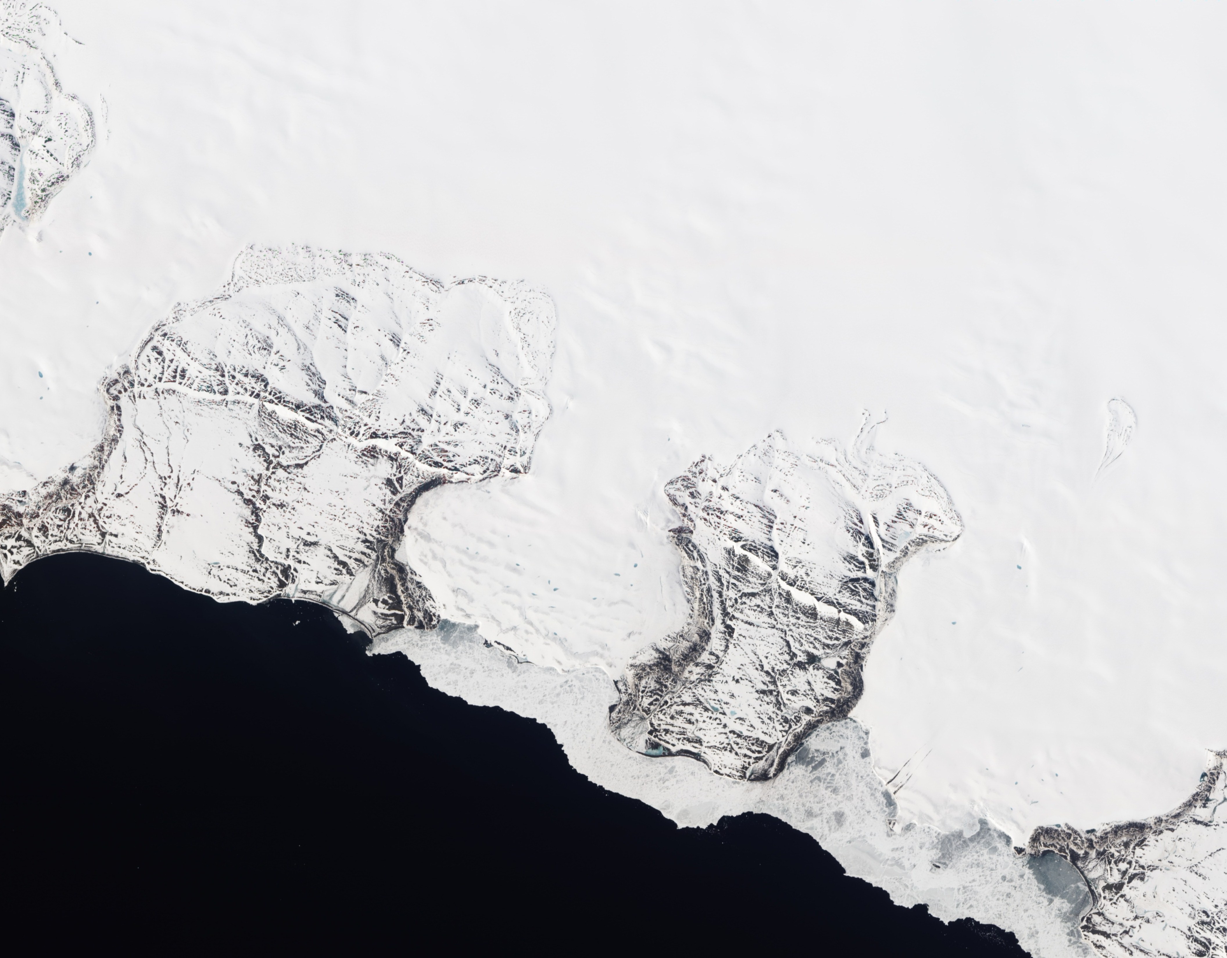
From the Air
Novaya Zemlya is located at approximately 73.95°N, 56.35°E in the Arctic Ocean, roughly 800 km northeast of the city of Arkhangelsk. The archipelago is clearly visible from altitude as a large elongated landmass separating the Barents and Kara Seas. The nearest airport with scheduled service is Rogachevo military airport (ULNN) on Yuzhny Island. The terrain is mountainous on Severny Island, with extensive glaciation; Yuzhny Island is lower and more rolling. Sea ice surrounds the islands for much of the year. The Matochkin Strait, separating the two main islands, is visible as a narrow channel cutting across the archipelago's midsection.