Nubra Valley
Sand dunes should not exist here. At 34 degrees north latitude, above 3,000 meters, in a valley carved by glacial rivers between the Karakoram and Ladakh Ranges, the golden dunes near Hunder village look like a geographical error. Bactrian camels -- the two-humped kind, descendants of animals that once carried Silk Road cargo -- wander across them as if auditioning for a documentary set in the wrong continent. This is Nubra Valley, a vast region in the Indian territory of Ladakh where the improbable is ordinary. Temperatures swing from pleasant summer warmth to minus 40 degrees Celsius in winter. Two rivers, the Shyok and the Nubra, converge near a hamlet called Khalsar, and the Nubra's headwaters begin at the Siachen Glacier, one of the most militarized landscapes on earth.
The Old Silk Road, Still Legible
Nubra Valley lies along the ancient trade corridor that connected South Asia to Central Asia. Caravans loaded with silk, tea, and salt once traversed this route between Ladakh, Kashmir, and distant markets in Yarkand and Baltistan. The evidence is everywhere: in the 350-year-old monastery at Diskit, the de facto main town; in the stone carvings that can still be found near the mosque in Turtuk; in the very layout of the villages, which cluster along the rivers the way caravanserais once clustered along trade roads. The route is no longer commercial. It is military. Nubra Valley is bordered by Pakistan and China, and India maintains a heavy presence. The road to Panamik leads toward the Siachen base camp, though tourists cannot proceed past the town. Permits are required for all non-Ladakhi visitors, a bureaucratic echo of the strategic sensitivity that has defined this valley since the partition of the subcontinent.
Villages at the Edge
Turtuk is the settlement that draws the most fascination. Until 1971, it belonged to Baltistan -- to Pakistan, not India -- and its residents still speak Balti, still share cultural ties with Tibet, and still observe Ramadan in a region otherwise dominated by Tibetan Buddhism. It is the penultimate village open to foreign tourists before the Line of Control. Beyond Turtuk lies Tyakshi, the last village non-Indians can reach, with a single guesthouse and little else. At the other end of the valley, Panamik draws visitors to its hot springs, and Hunder trades on those improbable sand dunes. Diskit, with its hilltop monastery and apricot orchards, functions as the valley's hub. Each village operates at its own pace, connected by a road that forks at a junction the locals call T-mord -- literally, 'T junction' in Hindi.
Over the Passes
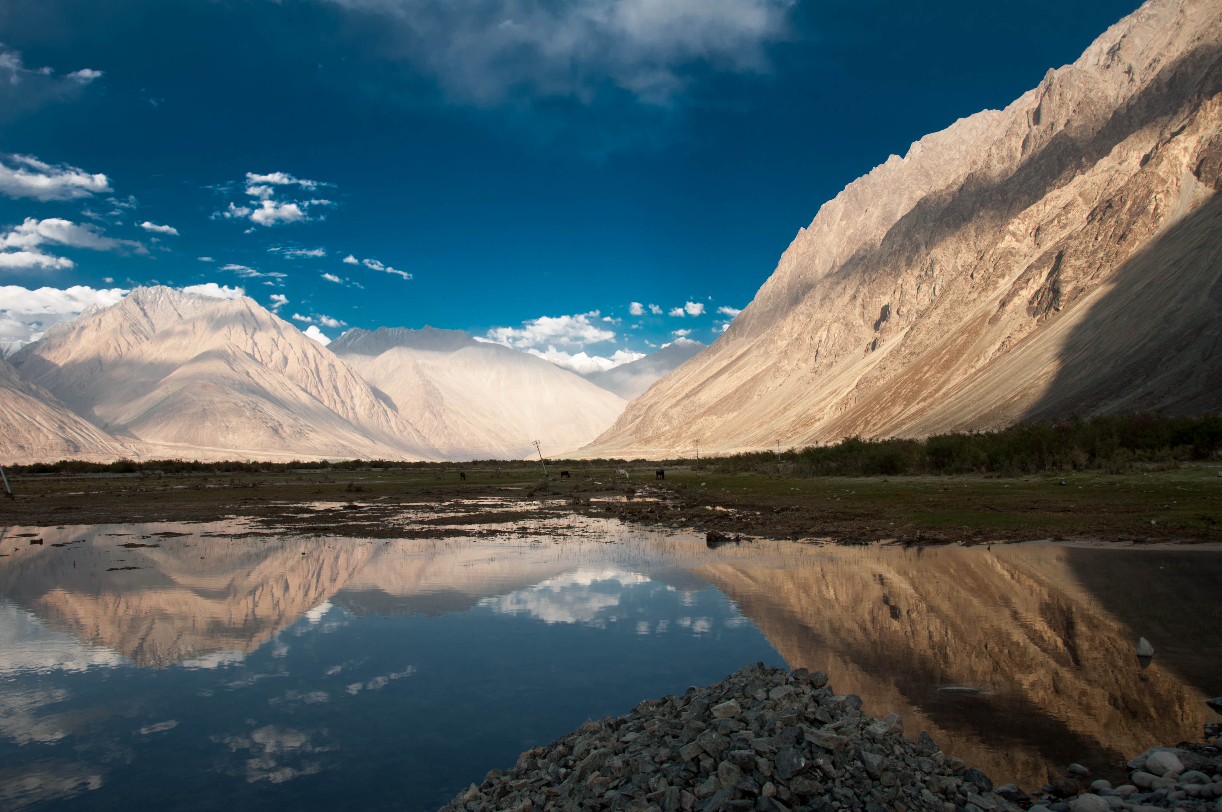
Getting to Nubra requires crossing a mountain pass. The most popular route from Leh goes over Khardung La, frequently but incorrectly claimed to be the highest motorable pass in the world. The road is paved almost everywhere except at the pass itself, and the seven-hour bus journey costs between 250 and 320 rupees. Alternative routes come through Wari La or from Pangong Lake via Tangtse, though these see far less traffic. For those willing to walk, a 64-kilometer hiking trail from Phyang to Hunder crosses Lasimiru La at 5,466 meters. The approach from any direction is a lesson in altitude and patience. The thin air thins further. The views grow more expansive with every switchback until the valley opens below -- a patchwork of sand, green fields, and braided river channels that seems impossibly wide after hours of mountain constriction.
Living in Nubra
People here speak Ladakhi or Balti and their dialects, along with serviceable Hindi and fragments of English picked up from decades of tourism. The local brew, chang -- a kind of barley beer -- and salt butter tea are offered at nearly every homestay. Apricots are the valley's signature crop, harvested in September, and guesthouses surrounded by apricot trees offer both shade and dessert. Accommodation is basic and cheap. Hunder has at least two hostels charging 400 to 500 rupees per night. In Turtuk, homestays start at 400 rupees without meals and rise to 1,000 with dinner and breakfast included. Camping near the river at Sumur is possible for the adventurous. The economy runs on agriculture, the Indian military presence, and a growing but still modest tourism trade. Many visitors arrive on motorbike tours from Leh, spend two or three days circulating through the valley, and then continue east toward Pangong Lake along the busy gravel road through Shyok Valley.
From the Air
Located at 34.60°N, 77.70°E in the Ladakh region of India, between the Karakoram and Ladakh Ranges. The valley floor sits above 3,000 m, with surrounding passes exceeding 5,000 m. The Shyok and Nubra Rivers are visible as braided channels through the valley, and the sand dunes near Hunder village are a distinctive visual feature. The nearest major airport is Kushok Bakula Rimpochee Airport in Leh (VILH), approximately 120 km south over Khardung La. The Siachen Glacier lies to the north, and the Line of Control with Pakistan runs along the western edge. This is a sensitive military zone; low-altitude overflights should be avoided. Best visibility in summer months.