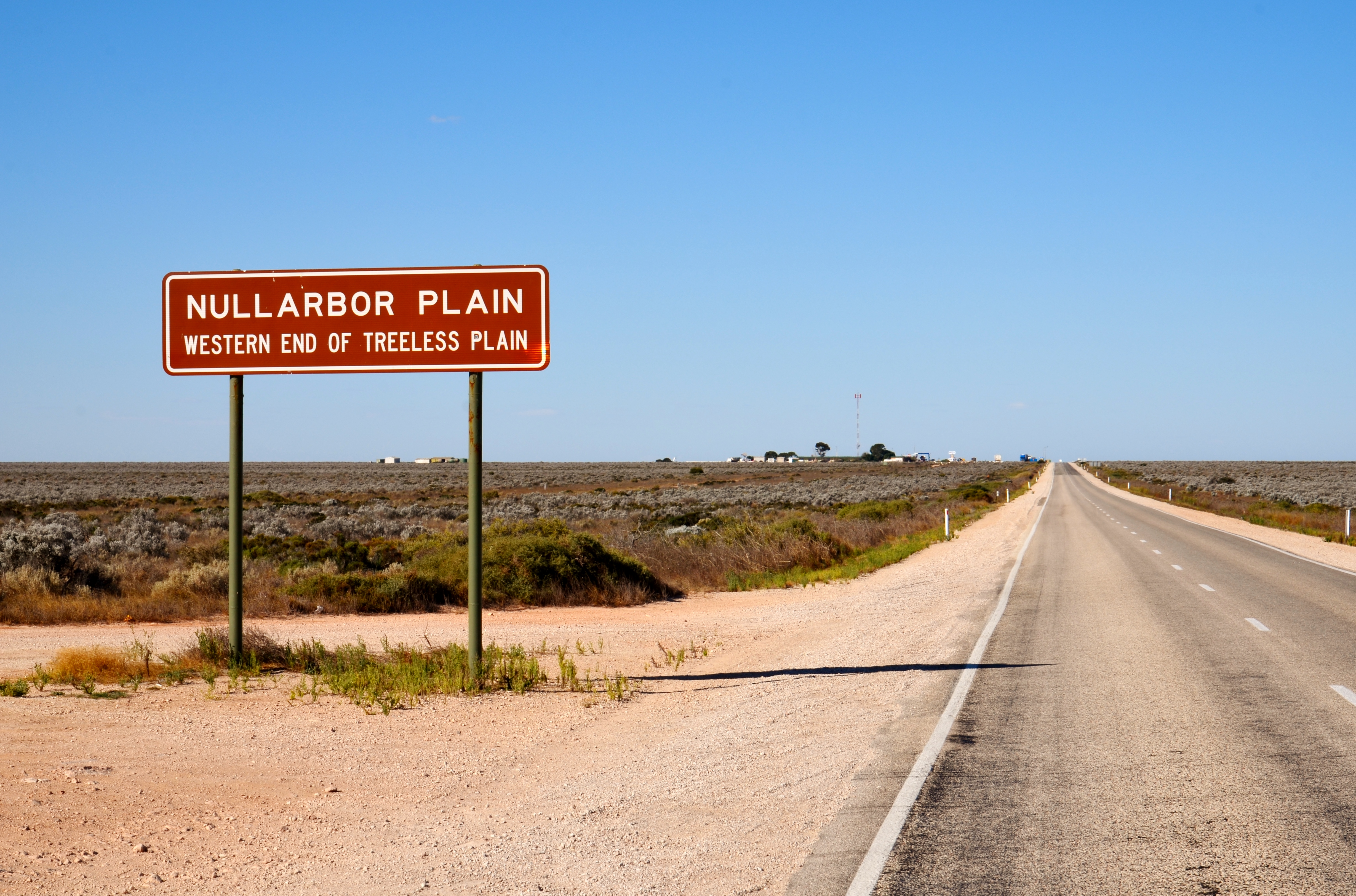
Nullarbor Plain
The name says it plainly: nulla arbor, no tree. For 1,100 kilometers between South Australia and Western Australia, the Nullarbor Plain stretches flat and almost featureless beneath a sky so wide it bends at the edges. This is the world's largest single exposure of limestone bedrock, roughly 200,000 square kilometers of ancient seabed lifted into the sunlight during the Miocene, somewhere between 15 and 5 million years ago. The Mirning clans and Yinyila people knew this country long before Latin provided its name. They called it Oondiri -- the waterless -- and their seasonal occupation of its vast reaches speaks to an intimate knowledge of a landscape that Europeans would spend decades trying merely to cross.
An Ocean's Memory
Everything about the Nullarbor begins with water, or rather its absence. The limestone underfoot was once the floor of a shallow sea, and the rock remembers. Beneath the surface, more than 250 known caves riddle the plain, some plunging into flooded passages that rank among the world's longest underwater caves. The Cocklebiddy Cave system alone extends more than 6 kilometers through submerged tunnels. There is no surface drainage anywhere on the plain. Rain, when it falls, vanishes into the karst, filtering through fissures and sinkholes into aquifer systems hidden below. North of the Nullarbor lies the Great Victoria Desert, whose internal drainage terminates in scattered salt lakes. The flatness is extraordinary -- the Trans-Australian Railway runs 478 kilometers without a single curve, the longest straight stretch of railway on Earth.
Those Who Dared to Cross
Edward John Eyre made the first European crossing in 1841, a grueling five-month ordeal through summer heat that nearly killed him. His companion John Baxter was murdered during the journey, and Eyre survived only with the help of an Aboriginal companion named Wylie and the chance arrival of a French whaling ship at Rossiter Bay. It took another half-century before anyone attempted a bicycle crossing. On Christmas Day 1896, Arthur Charles Jeston Richardson pedaled out of Coolgardie with a small kit and a waterbag, following the telegraph line that had been strung across the plain since 1877. Thirty-one days later he reached Adelaide, describing the heat as "1,000 degrees in the shade." In 1985, six young members of the Jesus Christians walked 1,600 kilometers from Port Augusta to Norseman carrying no food, water, or supplies, surviving entirely on what passing motorists offered through car windows.
Steel and Asphalt Across the Void
The telegraph line came first, completed in 1877 after two years of labor, its eight repeater stations the only human outposts across hundreds of kilometers of scrub. The Trans-Australian Railway followed in 1917, connecting Kalgoorlie to Port Augusta and finally stitching the eastern and western halves of the continent together. The Eyre Highway was carved across the plain in 1941 as a wartime necessity, though it remained a rough track for decades. The last unsealed section was not paved until 1976. Today the highway hugs the southern edge of the plain, where it meets the Great Australian Bight in 70-meter-high cliffs that drop straight into churning ocean. Between the Caiguna and Balladonia roadhouses, the road runs 146.6 kilometers without a single curve -- the longest straight stretch of road in Australia.
Life at the Edge of Nothing
The plain is not quite as lifeless as its Latin name suggests. Bluebush and saltbush carpet much of the surface, and southern hairy-nosed wombats burrow into the limestone. Wedge-tailed eagles ride the thermals above. But the real surprise lies along the coast, where the flat land ends abruptly in the Bunda Cliffs and the Southern Ocean begins. Southern right whales migrate here each winter to calve in the sheltered waters of the Head of the Bight, their numbers slowly recovering after nineteenth-century whaling drove them toward extinction. The Eyre Bird Observatory, housed in a restored telegraph station south of Cocklebiddy, documents the surprising avian diversity that the scrubland sustains. Summer temperatures can reach 50 degrees Celsius. Winter nights plunge below freezing. The mean annual rainfall at Cook, the railway settlement at the plain's heart, is just 184 millimeters.
The Quintessential Crossing
For Australians, "crossing the Nullarbor" carries the weight of a national rite of passage. Roadhouse stickers declaring "I have crossed the Nullarbor" appear on vehicles of every description. The towns along the way -- if they can be called towns -- exist primarily to service travelers. Cook, population roughly four, survives only because of the railway. A sign at its station reads: "If you're crook, come to Cook." Another, more bluntly: "Our hospital needs your help. Get sick!" The isolation is the point. To stand midway across the Nullarbor, climb atop a vehicle, and look in every direction is to see a landscape that consists, as one traveler wrote, of only two dimensions. The sky presses down. The land stretches out. Between them, nothing but the slow patience of limestone waiting to become ocean floor again.
From the Air
Centered at approximately 30.77S, 128.97E. From cruising altitude, the Nullarbor appears as an immense flat expanse of tan and pale green stretching between the Great Australian Bight coastline to the south and the Great Victoria Desert to the north. The Bunda Cliffs along the southern edge are visible as a sharp white line where land meets ocean. The Trans-Australian Railway and Eyre Highway are visible as thin threads crossing the plain. Nearest airports: Ceduna (YCDU), Forrest (YFRT), Kalgoorlie-Boulder (YPKG). Conditions are typically clear with excellent visibility, though summer heat haze can obscure ground detail.