The Fire That Had a Name Before It Had a Suspect
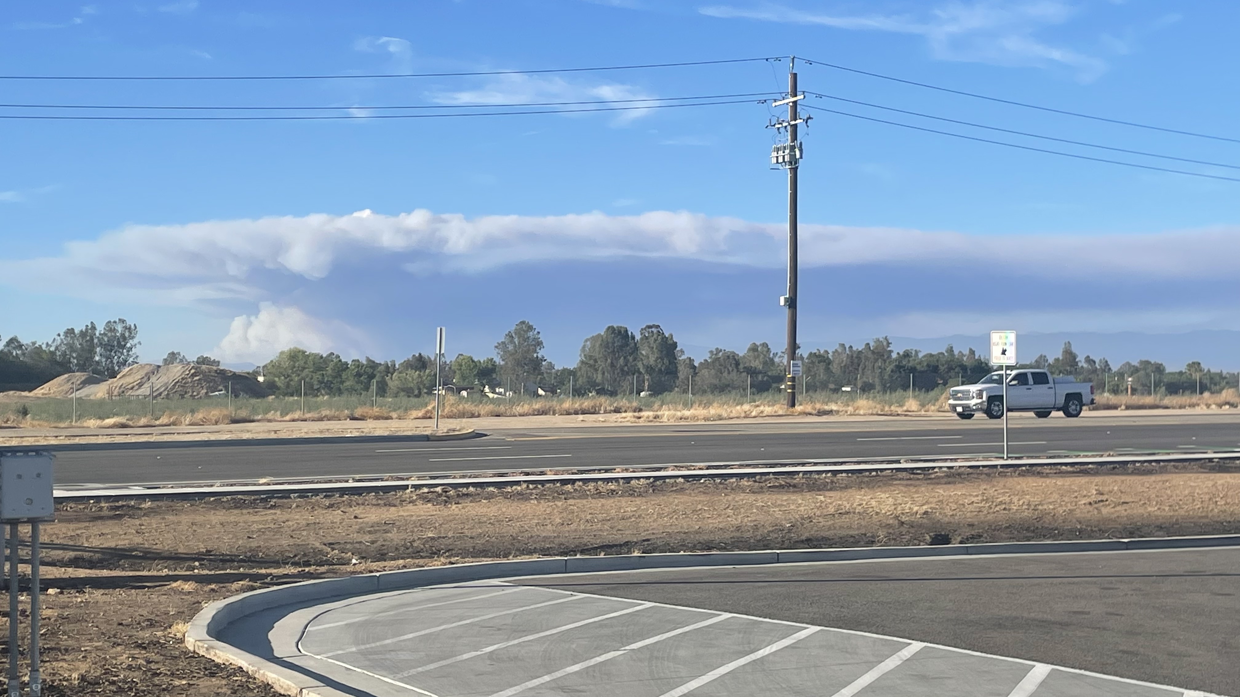
The pyrocumulus cloud rose to 20,000 feet, a tower of smoke and superheated air visible from Reno, 150 miles to the northeast. It was 2:10 in the afternoon on Friday, July 22, 2022, and a fire had just ignited in Midpines, a small community in the Sierra Nevada foothills of Mariposa County. Nine hours later, 4,350 acres had burned. The next morning, Governor Gavin Newsom declared a state of emergency. Within days, more than 6,000 people had evacuated their homes as the Oak Fire tore through drought-starved forest and oak woodland at the doorstep of Yosemite National Park. What no one knew yet -- what would take eleven months and the combined efforts of the FBI, the National Park Service, and Cal Fire to establish -- was that someone had started it on purpose.
Tinder Waiting for a Match
The Oak Fire did not ignite in a vacuum. Sixty percent of California was classified under extreme drought in the summer of 2022, and the Sierra Nevada foothills near Mariposa were among the driest terrain in the state. A meteorologist with the National Weather Service office in Hanford noted that the area's drought indices were the worst in the entire range. Years of accumulated drought had killed trees by the thousands and dried the underbrush into what officials described as a tremendous fuel load. On the day the fire started, temperatures sat in the low to mid-90s and relative humidity hovered around eight or nine percent -- conditions in which a spark of any kind could become catastrophic within minutes. The landscape was primed, and the result was a fire that defied containment from its first hour, throwing embers up to two miles ahead of the main fire front.
Six Thousand Front Doors
The Oak Fire threatened communities that most Californians had never heard of: Lushmeadows, Midpines, Jerseydale, Bootjack -- small clusters of homes in the forest where people lived for the quiet and the proximity to Yosemite. By the day after ignition, more than 6,000 residents were under evacuation orders. Local hotels filled with displaced families even as the weekend's normal surge of Yosemite tourists canceled their reservations. By the third day, 2,093 firefighters were on the lines, supported by 17 helicopters, 225 fire engines, and 58 bulldozers cutting firebreaks through the forest. The U.S. Forest Service closed portions of the Sierra National Forest to the public. Yosemite itself was largely spared, but the smoke drifted far beyond the mountains -- air quality advisories reached as far as Barstow and the Victor Valley, more than 200 miles to the south. When the fire was finally declared fully contained on September 2, it had consumed 19,244 acres, destroyed 193 structures including 127 homes, and cost more than $100 million to fight.
The Arrest
For eleven months, the cause of the Oak Fire remained officially undetermined. Then, on June 16, 2023, investigators arrested Edward Frederick Wackerman, a 71-year-old Mariposa County resident, on suspicion of arson. The investigation had involved the FBI, the National Park Service's law enforcement division, and Cal Fire's arson investigators -- a coalition of agencies that reflected the fire's severity and the complexity of proving intent in a burned landscape. Wackerman was charged with multiple felonies, including aggravated arson and arson causing great bodily injury. Mariposa County Sheriff Jeremy Briese disclosed that Wackerman was believed to have previously worked as a firefighter, though authorities did not describe a specific method or motive. Investigators also believed Wackerman had set three other fires in July 2022 before igniting the Oak Fire. The news transformed the disaster's narrative: what had seemed like another chapter in California's annual wildfire tragedy was, in fact, a crime.
Scars on the Foothills
Drive through the Midpines area today and the Oak Fire's legacy is written in the landscape. Blackened tree trunks stand in rows like charred columns. Cleared lots mark where homes once stood. The regrowth is visible too -- new grass, sprouting manzanita, the slow green reassertion of life -- but fire scars in the Sierra foothills take decades to fully heal, and the drought conditions that fueled the Oak Fire have not permanently retreated. For the 127 families who lost their homes, the fire's aftermath was measured in insurance claims, temporary housing, and the grinding effort of rebuilding in a place where wildfire risk is not a hypothetical but a fact of geography. The Oak Fire caused no fatalities, a statistic that fire officials attributed to rapid evacuations and the community's familiarity with wildfire protocols. But three firefighters were injured, and the psychological toll on a rural county of fewer than 18,000 residents extended well beyond the burn perimeter.
From the Air
The Oak Fire burn area is located at approximately 37.55N, 119.92W in the Sierra Nevada foothills of Mariposa County, California. From altitude, the burn scar is still visible as a lighter patch of dead timber and regrowth amid the surrounding mixed conifer and oak forest. The fire burned between the community of Midpines and the Sierra National Forest boundary, roughly 15 nm west of Yosemite Valley. Mariposa-Yosemite Airport (MPI) lies approximately 8 nm to the south. Highway 140, a primary Yosemite access route, passes through the burn area. The terrain is steep and rugged, with elevations ranging from 1,500 to 4,500 feet. The Merced River canyon runs to the north, and the Central Valley is visible to the west on clear days.