Oakland Long Wharf
On the morning of November 8, 1869, a train left Oakland heading east. That evening, the inaugural westbound transcontinental train arrived at the same pier, completing a circuit that had taken the nation decades and billions of dollars to build. The place where America's coasts finally met by rail was not a grand terminus in San Francisco -- it was a wooden wharf on the mudflats of the East Bay, stretching two miles into the shallow waters of San Francisco Bay to reach water deep enough for ferries. The Oakland Long Wharf was an improbable endpoint for an epic undertaking: a pier so long that passengers arriving from New York still had a ferry ride ahead of them before reaching the city on the other side of the bay. Yet for nearly a century, this slender finger of timber, rock, and fill was the hinge point where overland travel met ocean passage, where the railroad age handed off to the ferry age, and where the East Bay staked its claim as the real gateway to the Pacific.
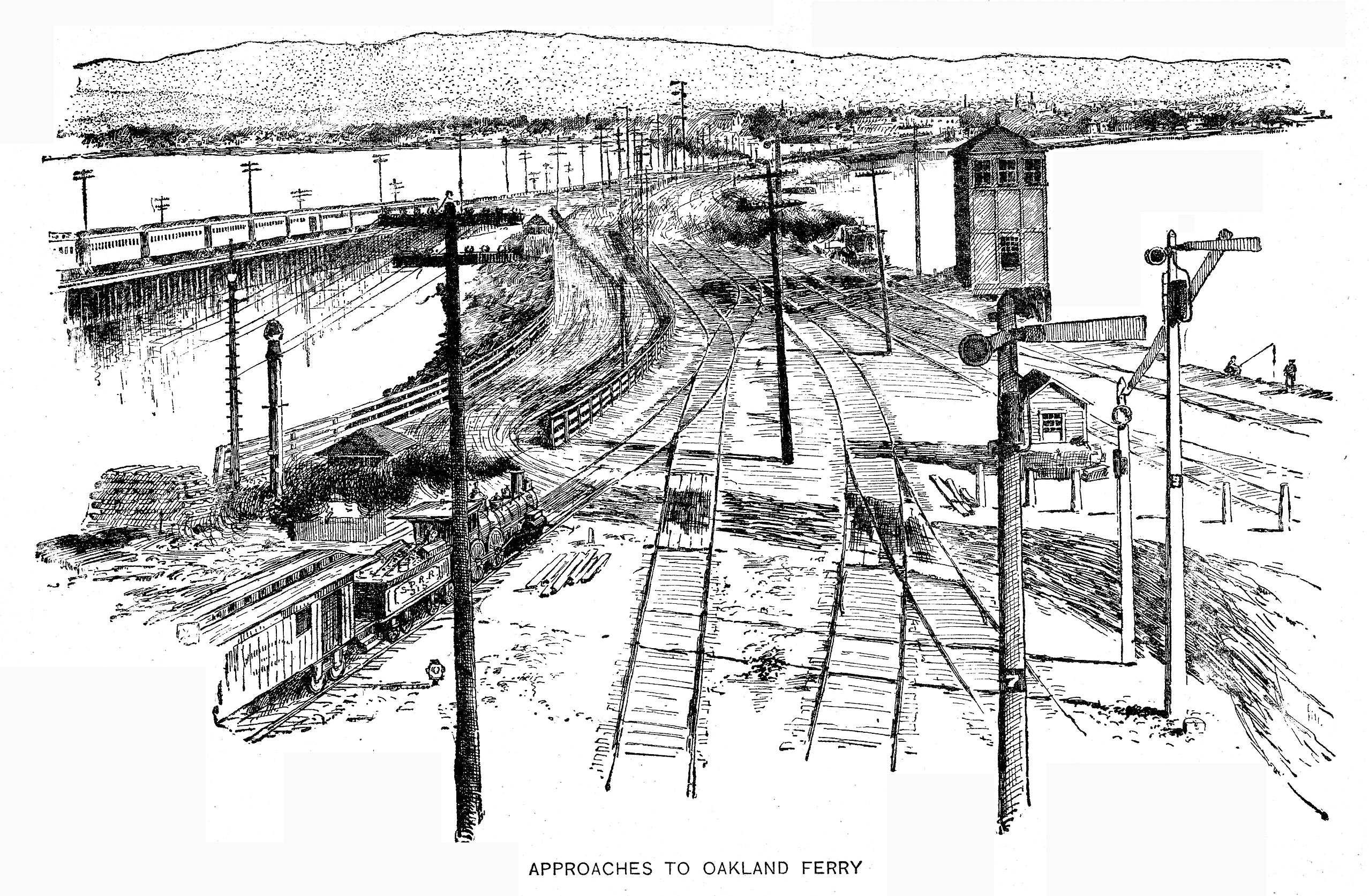
Two Miles into the Mud
The site's maritime history predates the railroad by nearly two decades. In 1852, a man named Gibbons built a small wharf at what was then called Gibbons' Point, pushing west into the bay. By 1862, the point had been renamed Oakland Point, and the San Francisco and Oakland Railroad was using the wharf as a ferry landing. But the Central Pacific Railroad had grander ambitions. After acquiring the pier in 1868, the railroad began extending it relentlessly into the bay -- 11,000 feet from shore to deep water, a distance that required roughly a million cubic yards of rock and fill to stabilize. The Long Wharf opened fully for business on January 16, 1871, and from its far end, ferries carried passengers and freight across the bay to San Francisco. It was an engineering solution born of geography: Oakland's shallow shoreline meant that oceangoing vessels could not dock close to land, so the railroad simply built the land out to meet them.
The Mole and Its Machines
In 1881, the Southern Pacific Railroad -- which had absorbed the Central Pacific -- constructed a large depot on the solid fill at the wharf's end, a building clad in corrugated iron and glass and lit by electric lighting. This structure became the Oakland Pier, or more commonly, the Oakland Mole, named for the architectural term describing a massive pier built as a breakwater. The Mole opened for traffic on January 22, 1882, and for the next seven decades it served as one of the busiest transit points on the Pacific coast. Commuter trains from the East Bay delivered office workers to the ferry terminal each morning; long-distance passengers transferred between rail and water on journeys spanning the continent. Between 1949 and 1958, the Western Pacific Railroad's California Zephyr -- one of the most celebrated passenger trains in American history -- used the Mole as its western terminus, bringing travelers from Chicago to the edge of the bay.
Bridges, Buses, and the End of the Ferry
The Oakland-San Francisco Bay Bridge, completed in 1936, began the Long Wharf's slow obsolescence. By January 1939, the East Bay Electric Lines had shifted their commuter trains from the Mole to tracks on the bridge's lower deck, running directly to San Francisco's Transbay Terminal. Southern Pacific discontinued the interurban electric trains entirely by July 1941. Ferries held on longer, but on July 29, 1958, the last Southern Pacific ferry crossed the bay from Oakland, ending a service that had run continuously since the 1860s. Buses over the Bay Bridge replaced the boats, and the great Mole fell quiet. The transition felt inevitable in hindsight -- bridges are faster than ferries -- but it erased an entire way of moving through the landscape, a rhythm of train and boat and water that had defined Bay Area commuting for generations.
Buried Under Progress
Throughout its existence, the bayshore around the Long Wharf was being filled in, the tidelands converted to solid ground. In the 1960s, the wharf was demolished to make room for the Port of Oakland's expanding container ship facilities -- the same port that would become one of the busiest on the West Coast. Almost nothing survived. The sole remnant is the Southern Pacific Mole's switchman's tower, which was restored and relocated to Middle Harbor Shoreline Park. In the early 1970s, BART's Transbay Tube was built near the old wharf's alignment, carrying commuters under the bay on the same route the ferries had once sailed above it. The Long Wharf also left a trace in popular culture: Frank Sinatra's character arrives by train at the Mole in the 1957 film Pal Joey, and Joan Crawford's Sudden Fear used the pier as a location in 1952. These celluloid glimpses are among the few visual records of a structure that once stretched two miles into the bay and connected a continent to its coast.
From the Air
Located at 37.810N, 122.326W along the Oakland waterfront at the foot of Seventh Street in West Oakland. The Long Wharf itself no longer exists -- its site is now occupied by Port of Oakland container terminals and the eastern portal of the BART Transbay Tube. Middle Harbor Shoreline Park, which contains the only surviving structure (the switchman's tower), lies just to the northwest. Best viewed below 2,500 feet AGL, where the port's container cranes and the Bay Bridge's eastern span provide visual reference. Nearest airports: Oakland International (KOAK, 7 nm south), San Francisco International (KSFO, 12 nm southwest).