Ocean Shores, Washington
Pat Boone moved here. That detail, more than any planning document or engineering report, captures the ambition of Ocean Shores in the 1960s: a resort city conjured from empty sand dunes on Washington's Pacific coast, promoted through celebrity golf tournaments, and declared the "richest little city" per capita in the country by 1969 -- with an assessed valuation of $35 million and just 900 permanent residents. The city that Boone helped sell into existence has grown considerably since, reaching a population of 6,715 by the 2020 census. But it remains a place defined by the tension between grand aspiration and the raw, indifferent power of the ocean it was named for.
Built on Sand, Literally
By December 1960, developers had drawn plans for 25 miles of canals, opened a six-hole golf course, and prepared a mall shopping area for the Ocean Shores Estates construction boom. The following year, 100 motel units, three restaurants, and an airstrip rose from the dunes. A marina followed in 1963. The developers even brought the SS Catala, a retired steamship, up from California to serve as a floating hotel -- a "boatel" -- and charter fleet office. Two years later, a southwest winter storm drove the Catala into the sand, and for decades she remained the most famous shipwreck on the Washington coast, a monument to the gap between what developers imagined and what the Pacific had in mind. The city was formally incorporated in 1970. Its first school opened in 1971, and only then did road paving begin in earnest -- infrastructure catching up to ambition, as it always does in Ocean Shores.
Boom, Bust, and the Long Rebound
The 1970s hit hard. Washington's economic recession stalled construction and drained the resort town's momentum. Homes sat half-finished. Investment dried up. For a city built on optimism, the downturn was existential. But the 1980s brought recovery, and construction of homes and businesses accelerated again. The population nearly doubled between the 2000 and 2020 censuses, from 3,836 to 6,715 residents. Today, 41 percent of Ocean Shores residents are 65 or older, giving the city the character of a retirement community layered on top of a beach resort -- quieter than its founders intended, perhaps, but enduring. The canals that developers carved into the peninsula still lace through residential neighborhoods, connecting backyards to the bay and giving the city a Venice-on-the-dunes quality that looks striking from the air.
Living at Sea Level
Ocean Shores sits on a flat peninsula at essentially zero elevation. The city's municipal airport perches at just 13 feet above sea level. This geography makes the community acutely vulnerable to the tsunamis that would follow a Cascadia Subduction Zone earthquake -- the massive tectonic rupture that seismologists consider not a question of if, but when. In 2022, voters rejected a bond measure that would have funded a tsunami evacuation shelter and relocated a school to higher ground. The state government and FEMA later allocated $5 million toward a vertical evacuation shelter designed to hold 800 people, though rising costs have forced design revisions. Across the harbor mouth, the neighboring community of Westport has moved faster on tsunami preparedness, building North America's first publicly funded vertical shelter. Ocean Shores watches, debates, and weighs its options on a timeline dictated by geology.
A City Between Tides
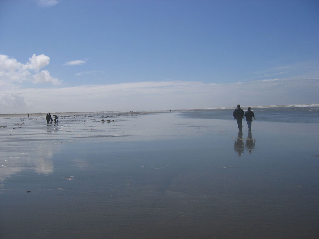
The climate here is oceanic, mild and relentlessly wet, with temperatures moderated by the Pacific to a narrower range than inland Aberdeen experiences just a few miles east. Summer brings the tourists, the clam diggers, the families building bonfires on six miles of publicly accessible beach. Winter brings storms that rearrange the shoreline and remind everyone that the dunes are temporary structures. Ocean Shores covers nearly 14 square miles, but more than five of those are water -- the canals, the estuary edges, the tidal flats that blur the boundary between city and sea. From the air, the Point Brown peninsula looks like a hand reaching into the Pacific, fingers spread wide, holding on. Whether the city's founders understood the precariousness of what they were building is unclear. What is clear is that the people who live here now understand it completely, and have chosen to stay anyway.
From the Air
Ocean Shores sits at 46.97°N, 124.16°W on the Point Brown peninsula at the north side of the Grays Harbor entrance. The city's canal system is visible from altitude as a grid of waterways threading through residential blocks. The long, flat beach on the western shore and the Ocean Shores Municipal Airport (W04) at 13 feet elevation are easy landmarks. Across the harbor mouth to the south lies Westport. Bowerman Airport (KHQM) in Hoquiam is approximately 15 nm to the northeast. The city is extremely flat -- approach from the west for dramatic views of the peninsula against Grays Harbor. Recommended viewing altitude 2,000-4,000 feet AGL.