
Okefenokee Swamp
Step onto the peat mat and the ground moves beneath you. The whole surface of the Okefenokee ripples outward like a waterbed, trees swaying gently with each footfall. The Hitchiti-speaking people who named this place called it something close to 'bubbling water,' though generations of English speakers preferred the more dramatic translation: 'land of trembling earth.' Both descriptions are accurate. The Okefenokee Swamp covers 438,000 acres straddling the Georgia-Florida line, making it the largest blackwater swamp in North America. It is one of the Seven Natural Wonders of Georgia, a National Natural Landmark since 1974, and a place that has stubbornly resisted every scheme to drain, log, mine, or otherwise civilize it.
Born from an Ancient Sea
The Okefenokee owes its existence to a coastline that no longer exists. Around 6,500 years ago, peat began accumulating in a shallow basin perched on the edge of an ancient Atlantic coastal terrace, the geological remnant of a Pleistocene estuary. Trail Ridge, a strip of elevated land that probably formed as coastal dunes or an offshore barrier island, hems in the swamp's eastern edge. Two rivers drain the basin in opposite directions: the Suwannee River carries ninety percent of the watershed southwest toward the Gulf of Mexico, while the St. Marys River drains the southeastern corner on a meandering path that flows south, then north, then east to the Atlantic. The swamp's tea-dark water gets its color from tannins leached out of decaying vegetation, a hallmark of blackwater systems where nutrients are locked in the peat rather than dissolved in the water column.
Swampers and Elizabethan English
The earliest known inhabitants were the Timucua-speaking Oconi, who navigated the swamp's hazardous waterways with such skill that the Spanish later employed them as ferrymen on the St. Johns River. After European colonization, settlers of overwhelmingly English ancestry moved into the Okefenokee's margins and became known as 'Swampers.' Their relative isolation preserved something remarkable: well into the 20th century, Okefenokee residents spoke with Elizabethan phrases and syntax carried over from the early colonial period. The 19th century brought the Suwannee Canal Company, which attempted to drain the entire swamp and went bankrupt. The Hebard family of Philadelphia then purchased most of the land and ran extensive cypress logging operations from 1909 to 1927. Railroad lines pushed into the swamp until 1942, and on Billy's Island, the ruins of a 1920s logging town that once housed 600 people still stand among the cypress knees.
Carnivorous Plants and 80-Year-Old Alligators
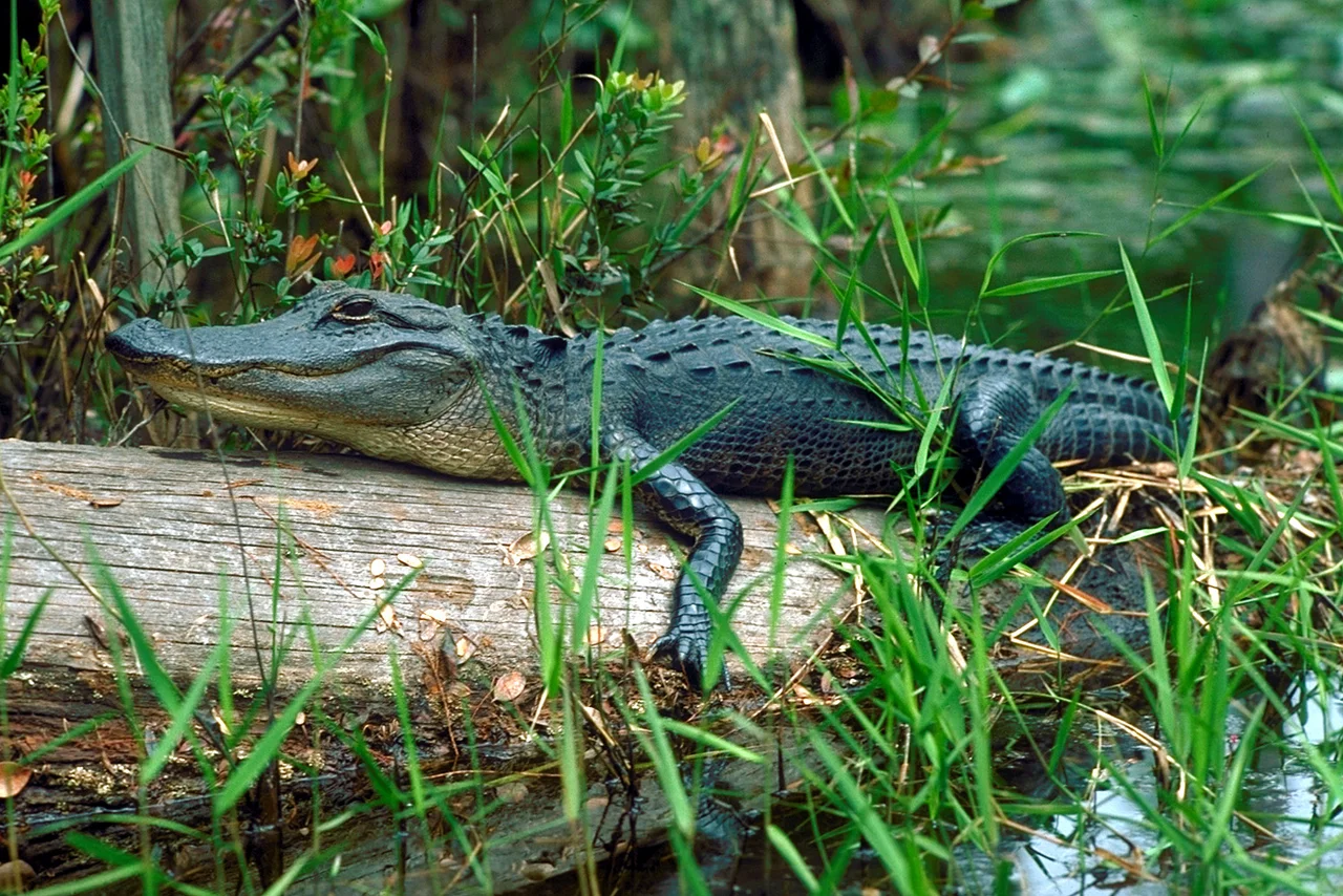
The Okefenokee is a biological inventory that defies its harsh chemistry. Bald cypress and swamp tupelo dominate the flooded forests, while drier uplands support longleaf pine woodlands and thick stands of evergreen oaks. The swamp harbors an unusually rich collection of carnivorous plants, including multiple species of bladderwort, the parrot pitcher plant, and the giant hooded pitcher plant found nowhere else. Wading birds fill the canopy: herons, egrets, ibises, cranes, and bitterns rotate through with the seasons. The swamp is famous for its American alligators, and one individual in particular made headlines. Named Okefenokee Joe after a local environmentalist, this alligator died in September 2021 at nearly 80 years of age, believed to be the oldest known alligator on record. The Okefenokee also provides critical habitat for the Florida black bear.
Fire and Defiance
The Okefenokee burns. It has always burned. But the fires of 2007 were something else entirely. On May 5, lightning struck near the center of the refuge, igniting what became the Bugaboo Scrub Fire. It merged with a second wildfire that had started when a tree fell on a power line near Waycross, and by the end of May the combined blaze had consumed more than 935 square miles, making it the largest wildfire in both Georgia and Florida history. Smoke drifted as far as Atlanta and Orlando. Four years later, the Honey Prairie Fire burned through the drought-parched swamp for a full year, finally declared out on April 17, 2012, after deploying 202 engines, 112 dozers, 12 helicopters, and 1,458 personnel at peak response. Yet the Okefenokee recovers. Fire is part of its ecology, clearing deadwood and recycling nutrients through the peat.
Sixty Million Dollars to Leave It Alone
Twice, mining companies have tried to extract titanium from the swamp's perimeter. DuPont proposed a 50-year operation in the 1990s but abandoned the project in 2000 after sustained public opposition, eventually donating the land to the Okefenokee National Wildlife Refuge. In 2018, Twin Pines Minerals proposed a second attempt, drawing over 60,000 public comments in opposition. After years of legal and regulatory battles, the Conservation Fund purchased all of Twin Pines' land near the Okefenokee on June 20, 2025, for a reported $60 million, permanently ending the mining threat. Today more than 600,000 visitors from as many as 46 countries travel to the refuge each year, supporting over 750 local jobs and contributing $64 million to the regional economy. The swamp that resisted draining, logging, and mining has become more valuable standing than anything buried beneath it.
From the Air
The Okefenokee Swamp is centered at approximately 30.617N, 82.317W, straddling the Georgia-Florida border. At 438,000 acres, it is unmistakable from altitude as an enormous dark expanse of wetland bordered by Trail Ridge on the east. The Suwannee River drains southwest from the swamp toward the Gulf of Mexico. Public entrances are at Folkston, GA (east), Fargo, GA (west), and Waycross, GA (north). Nearest airports include Waycross-Ware County Airport (KAYS) approximately 10 nm north and Valdosta Regional Airport (KVLD) about 40 nm to the northwest. Best viewed at 5,000-10,000 ft AGL to take in the full scale of the blackwater expanse. Look for the canal cuts and prairie openings within the swamp canopy.
Nearby Stories
- Okefenokee Swamp Park 21 km away
- Olustee Battlefield Historic State Park 23 km away
- Great Fire of 1901 25 km away
- Murder of Ahmaud Arbery 40 km away
- Fort Clinch 44 km away
- Georgia Museum of Agriculture & Historic Village 80 km away
- Letchworth-Love Mounds Archaeological State Park 99 km away
- Manatee Springs State Park 102 km away