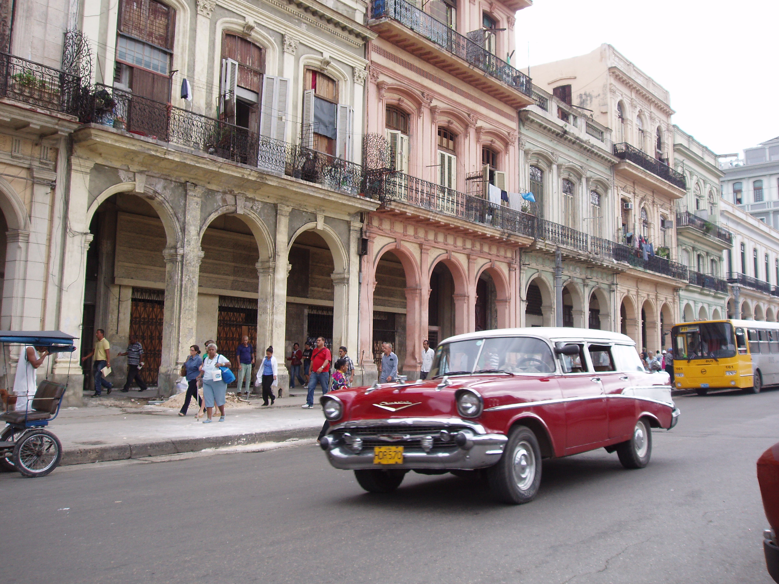
Old Havana
Every night at nine o'clock, soldiers in period uniforms fire a cannon from the ramparts of La Cabana fortress. The boom rolls across Havana Harbor and echoes off the crumbling baroque facades of the old city. For centuries, this shot signaled the closing of the massive gates in the walls that encircled Havana -- walls that have long since vanished, though their ghost footprint still defines the boundaries of Old Havana. Within those invisible borders lies one of the most complete collections of colonial architecture in the Americas: a dense, intoxicating maze of plazas, fortresses, cathedrals, and palaces that earned UNESCO World Heritage status in 1982.
Born from the Bay
Havana owes its existence to geography. Founded by the Spanish on November 16, 1519, the city grew up around one of the finest natural harbors in the Caribbean -- a deep, sheltered bay accessed through a narrow channel that made it both a perfect anchorage and an easy place to defend. Spanish galleons laden with gold and silver from Mexico and South America gathered here before making the dangerous Atlantic crossing back to Spain, and Havana became the most important waypoint on the route to the New World. That wealth attracted pirates. When Sir Francis Drake appeared off the coast in the 1580s, the Spanish Crown responded with a fortress-building campaign that transformed Havana into one of the most heavily fortified cities in the Americas. The Castillo de la Real Fuerza, begun in 1558 on the ruins of an earlier fort destroyed by the French corsair Jacques de Sores, anchors the Plaza de Armas. Across the harbor entrance, Castillo del Morro -- designed by the Italian military engineer Battista Antonelli, who arrived in 1587 -- guards the bay from its rocky promontory.
Stone, Iron, and Chain
Old Havana's defenses were layered and ingenious. The harbor mouth was protected not just by Morro Castle on its northern headland and San Salvador de la Punta on the southern shore, but by a massive iron chain stretched between the two fortresses each night to prevent enemy ships from slipping in under cover of darkness. This system was established in 1629. La Cabana, the enormous 18th-century fortress on the eastern heights above the bay, completed the defensive ring. Together, these fortifications made Havana one of the hardest targets in the colonial world. The city itself was ringed by walls that enclosed a tight grid of streets and plazas. Inside, the architecture tells the story of Spanish colonial ambition: the Catedral de San Cristobal, raised after 1748, stands as one of the finest examples of American baroque. The National Capitol, modeled after the Pantheon in Paris, dominates the skyline. The Galician Center, a neobaroque social club built between 1907 and 1914 atop the old Teatro Tacon, speaks to the waves of Spanish immigrants who continued arriving centuries after the conquest.
Plazas and Promenades
Old Havana organizes itself around its plazas, each with a distinct character. The Plaza de Armas, the oldest, has hosted military ceremonies since the late 16th century. The Plaza de la Catedral, anchored by the asymmetrical twin towers of San Cristobal, is the district's architectural showpiece. Between these formal squares, the Paseo del Prado marks the western boundary of Old Havana, a tree-lined promenade separating the old city from Centro Habana. To the north, the Malecon -- Havana's iconic seawall boulevard -- curves along the shore from the old district all the way to the Almendares River, serving as the city's living room where residents gather at sunset. The Gran Teatro de la Havana, home to the National Ballet of Cuba founded by the legendary Alicia Alonso, stands near Central Park. The Museum of the Revolution occupies the former Presidential Palace, with the yacht Granma -- the vessel that carried Fidel Castro and his revolutionaries from Mexico to Cuba in 1956 -- displayed in a glass case out front. The Basilica of San Francisco de Asis, built in 1608 and reconstructed in 1737, anchors the old commercial waterfront.
Decay and Defiance
Old Havana's beauty has always been shadowed by fragility. The district has the second-highest population density in the city, and many of its historic buildings have suffered decades of neglect. Salt air corrodes iron balconies. Tropical humidity seeps into limestone walls. In 2008, Hurricane Ike struck with devastating force, destroying structures and overturning years of painstaking conservation work. Residents fled as water surged through narrow streets and into ground-floor apartments. The threats compound: age, decay, and the relentless Caribbean climate work together against preservation efforts launched after the UNESCO designation in 1982. A safeguarding campaign begun in 1983 aimed to restore the authentic character of buildings throughout the district, and the work of city historian Eusebio Leal became legendary for its ambition and scope. Yet for every restored facade, another building sags under the weight of time. Old Havana endures as a place where the past is not preserved under glass but lived in daily -- where families hang laundry from baroque balconies and children play in plazas that once hosted colonial military parades.
The View from Above
From the air, Old Havana reveals its logic. The narrow harbor entrance is immediately apparent -- that tight channel between Morro Castle and La Punta that determined the city's fate for centuries. The grid of the old city presses against the waterfront, its density contrasting sharply with the broader boulevards of modern Havana beyond. The dome of the Capitol building catches the light. The Malecon traces its long curve along the coast. On the eastern shore of the bay, La Cabana fortress sprawls along the heights, its star-shaped walls still intact. The whole defensive system becomes legible from altitude in a way it never can from street level -- the fortresses, the channel, the bay, the old city crouching behind its vanished walls, all part of a single strategic vision that made Havana the key to the New World.
From the Air
Old Havana sits at 23.14N, 82.36W on the western shore of Havana Bay. The narrow harbor entrance between Morro Castle and La Punta fortress is a prominent visual landmark. Best viewed from 2,000-4,000 feet AGL approaching from the north or northeast. The Capitol dome and Malecon seawall are visible landmarks. Nearest airport is Jose Marti International (MUHA), approximately 10 nm southwest. The contrast between the dense colonial grid and modern Havana is striking from altitude.