Oldwick Historic District
There is no traffic light in Oldwick. No chain restaurant, no strip mall, no neon. What there is, lining Main Street and the handful of lanes that branch off it, is one of the most intact collections of 18th- and 19th-century architecture in central New Jersey -- 127 contributing buildings that earned this quiet corner of Tewksbury Township a place on the National Register of Historic Places in 1988. The village feels less like a preserved district and more like a place that simply never saw a reason to change.
Settled in Stone and Timber
The story begins in the 1740s, when Ralph Smith bought land in the northern part of what would become Oldwick. German and Dutch settlers followed, drawn by the fertile valley between the Hunterdon hills. By 1749, they had raised the Zion Lutheran Church, a stone building that still stands after nearly three centuries -- remodeled in 1831 with a blend of vernacular Gothic and Greek Revival details that reflects the congregation's evolving taste without abandoning its roots. The church anchors the district's northern end, its graveyard a catalog of the families who built this place. Walk south along Main Street and the timeline advances: the Tewksbury Inn appeared in 1800, its Colonial Revival embellishments added later, and the Oldwick Methodist Church rose in 1865 in the fashionable Romanesque Revival style. Each generation left its mark, but none erased what came before.
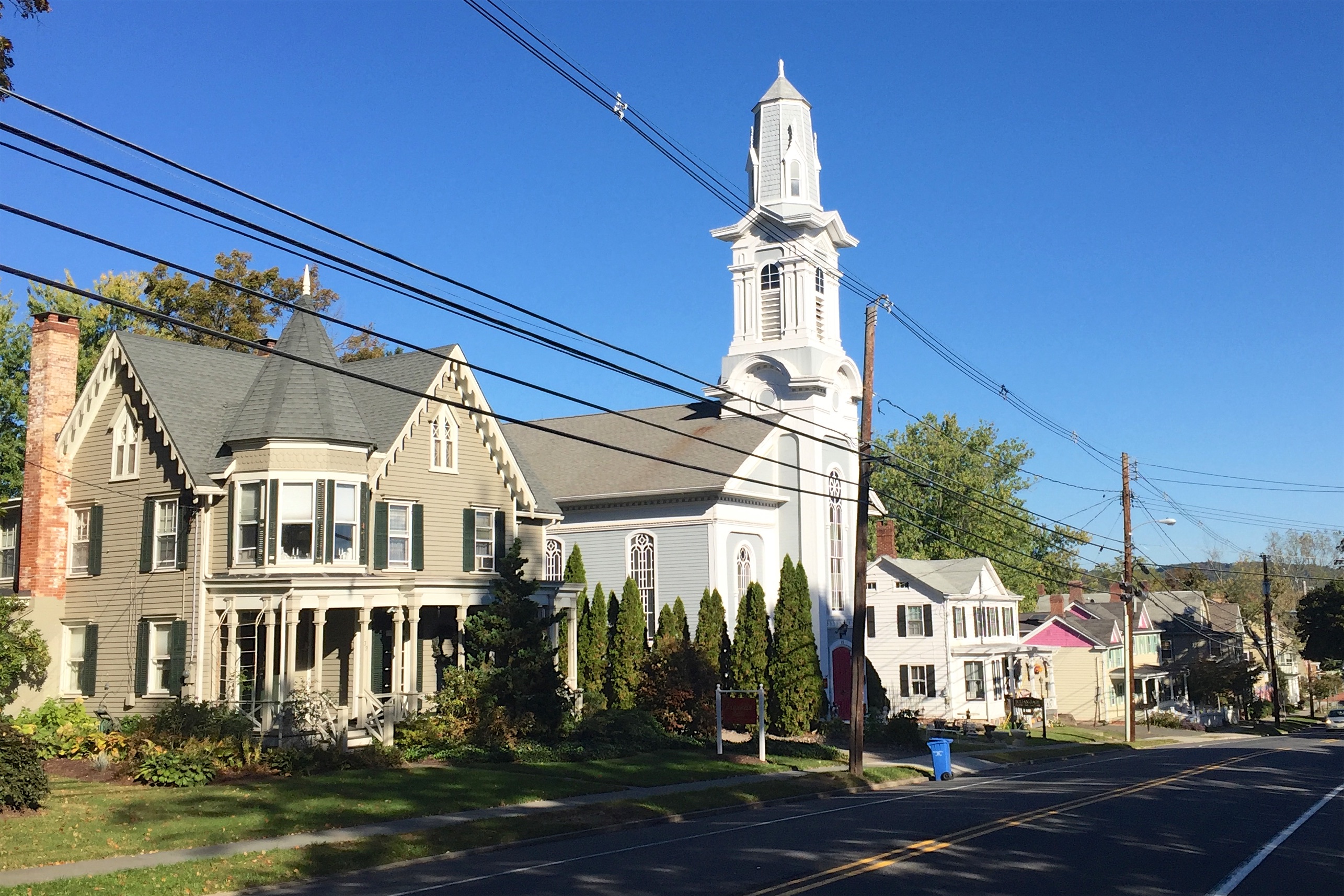
A Village of Architectural Layers
What makes Oldwick unusual is not any single landmark but the density of the ensemble. The district spans 170 acres and includes 12 contributing structures and one contributing site beyond its 127 buildings. Georgian farmhouses sit near Queen Anne cottages. Victorian gingerbread trims a porch just down the road from a plain stone dwelling that predates the Revolution. The Kline Farmhouse, significant enough to earn its own individual listing on the National Register in 1984, contributes to the broader district as well. Many of these buildings were documented by the Historic American Buildings Survey, the federal program that has cataloged the nation's architectural heritage since the 1930s. The result is a streetscape that reads like a textbook of American vernacular architecture -- except it is not a museum. People live here, shop at the general store, and drink at the inn.
Commerce on a Human Scale
The National Register citation recognizes Oldwick for significance in three categories: architecture, commerce, and industry. That third category might surprise anyone who walks the village today, where the loudest sound is often birdsong. But for more than a century, Oldwick was a working crossroads. The general store at 57 Main Street served farmers from the surrounding hills. The Tewksbury Inn at number 55 provided lodging for travelers along what is now County Route 517. Small workshops and tradesmen's homes filled the side streets -- Church, King, James, Joliet, and William. The commerce was local, the industry modest, and the scale intimate. When the automobile age arrived, Oldwick was far enough off the main highways to avoid the demolition that leveled similar villages across New Jersey.
Preserved by Geography
Oldwick's survival owes as much to topography as to any preservation effort. Tewksbury Township sits in the western reaches of Hunterdon County, where the Highlands meet the rolling farmland of the Raritan Valley. Interstate 78 passes to the south, and Route 22 to the north, but neither cuts through the village itself. This geographic buffer kept developers at bay during the postwar suburbanization that transformed much of central New Jersey. Today, the district's quiet streets attract visitors who come for the antique shops and the restaurant scene that has grown up around the old village core, but the bones of the place remain 18th and 19th century. Standing at the intersection of Main and Church streets on a winter morning, with woodsmoke rising from a farmhouse chimney and the stone walls of Zion Lutheran catching the low sun, the 21st century feels like a rumor.
From the Air
Located at 40.67°N, 74.75°W in the Hunterdon County hills of western New Jersey. Best viewed from 2,000-3,000 feet AGL, where the compact village grid is visible against surrounding farmland. Nearest airports: Solberg-Hunterdon (N51) approximately 6 nm east, Somerset Airport (SMQ) approximately 8 nm southeast. The village sits along County Route 517 in a valley framed by low ridgelines.