Omkareshwar Temple
Seen from above, the island of Mandhata in the Narmada River looks like the Devanagari character for Om -- the syllable that Hindus consider the sound of creation itself. It is a coincidence of geography so striking that it has drawn pilgrims for over a thousand years. On this island, roughly four kilometers long and 2.6 square kilometers in area, stands Omkareshwar Temple, one of only twelve Jyotirlinga shrines in all of India -- places where Shiva is believed to have manifested as a fiery column of light piercing the three worlds.
The Pillar of Light
Hindu scripture tells the story this way: Brahma and Vishnu once argued over who was supreme. To settle the matter, Shiva pierced the universe as an endless column of radiance. Vishnu dove downward to find its base; Brahma flew upward to find its crown. Neither succeeded. Vishnu admitted defeat. Brahma lied, claiming he had reached the top. For that lie, Shiva cursed Brahma to be denied worship in ceremonies -- a curse that, according to tradition, explains why so few temples in India are dedicated to Brahma compared to the thousands honoring Vishnu and Shiva. The twelve Jyotirlinga shrines mark the places where that pillar of light touched the earth. Inside Omkareshwar Temple, the jyotirlinga takes the form of a roundish black stone, with a white stone beside it representing Parvati, Shiva's consort.
Two Temples, One River
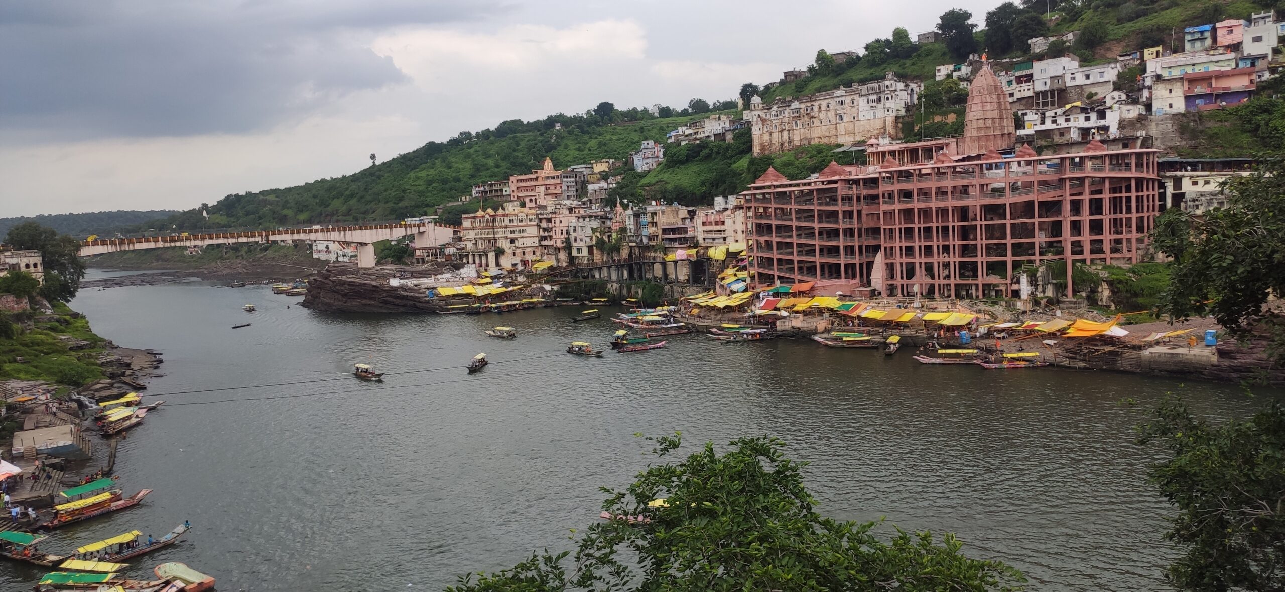
Omkareshwar is unusual even among Jyotirlinga sites because it contains two major Shiva temples facing each other across the Narmada. On the island sits Omkareshwar itself -- the Lord of Omkara, the Lord of the Om sound. On the southern bank of the river stands Mamleshwar, also called Amaleshwar, whose name means the Immortal Lord. Pilgrims cross between the two by bridge and by boat, making a circuit that connects the sacred island to the mainland. The Narmada, one of India's holiest rivers, flows around and between these shrines. According to a second legend, King Mandhata of the Ikshvaku clan -- an ancestor of Lord Rama -- performed such intense devotion at this site that Shiva appeared as a Jyotirlinga. The island and the nearby town still bear the king's name.
Builders and Rebuilders
The temple's architecture reflects centuries of destruction and restoration. The Paramara kings of Malwa built the original structure in the 11th century CE. The Chauhan rulers administered it after them. Beginning in the 13th century, Muslim invaders attacked and looted the site, though the temple survived without total destruction. It stood largely unrepaired through the entire Mughal period, the Chauhan kings maintaining it as best they could without major renovation. Then, in the 18th century, the Holkar dynasty transformed it. Queen Gautama Bai Holkar began the reconstruction, and her daughter-in-law, the legendary administrator Devi Ahilyabai Holkar, completed it. Ahilyabai was famous across central India for rebuilding Hindu temples that had been damaged over the centuries, and Omkareshwar was among her most important projects.
Where the Narmada Bends
The temple sits about 16 kilometers from Barwaha in Khandwa district, with Madhya Pradesh's second Jyotirlinga -- Mahakaleshwar at Ujjain -- roughly 140 kilometers to the north. The nearest major airport is at Indore. Pilgrims arrive by train to Khandwa Junction, by bus from cities across Madhya Pradesh, and increasingly by private car along improving highways. The island can be reached by a pedestrian bridge or by the flat-bottomed boats that ferry devotees across the Narmada. For those approaching from the air, the river itself is the landmark -- a broad, winding ribbon of water cutting through the dry deciduous landscape of central India, with the temple complex and its cluster of ghats visible on the island where the Narmada bends around the shape of Om.
From the Air
Located at 22.25°N, 76.15°E on Mandhata Island in the Narmada River, Khandwa district, Madhya Pradesh. The Om-shaped island is approximately 4 km long and visible from altitude where the Narmada bends. Nearest airport is Devi Ahilya Bai Holkar Airport, Indore (VAID, approximately 100 km northwest). Khandwa Junction railway station is the nearest railhead. Look for the river island with temple structures and ghats along the banks. Best viewed at 3,000-5,000 feet AGL to appreciate the island's distinctive shape.