
Oodnadatta
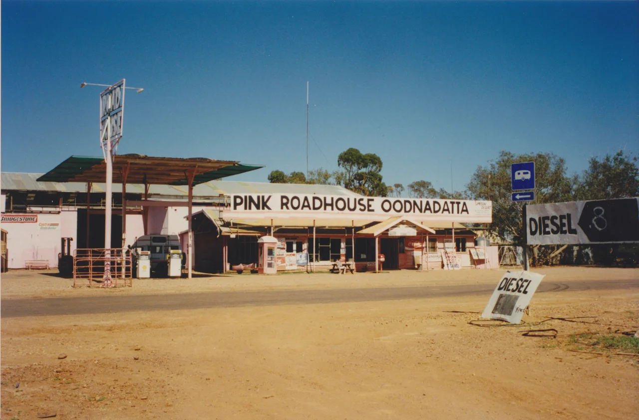
You smell the heat before you see the town, and then you see the pink. Out here, on the long unsealed run between Marree and Marla, where the desert flattens into red gibber and shimmering saltpan and the horizon seems to retreat as you drive, the last thing you expect is a building painted candy pink. But there it is - the Pink Roadhouse, an electric splash of colour against a landscape of rust and bone. This is Oodnadatta, one of the hottest and driest inhabited places in Australia, a town of around eighty people clinging to the line of the old Ghan railway in the deep north of South Australia. People do not stumble onto Oodnadatta. You come here on purpose, along the legendary track that bears its name, and the pink roadhouse is your reward for the dust.
The Pink Roadhouse
The roadhouse is the beating heart of the town and the unofficial capital of the whole Oodnadatta Track. Its story begins in 1975, when Adam and Lynnie Plate - self-described hippies trekking the old Ghan route with camels, donkeys and horses - rolled into the small Aboriginal community and decided to stay. Lynnie started selling cups of tea because travellers couldn't get one anywhere else. By 1983 the enterprise had a shopfront on the main street, and when Lynnie's father gave her an old Dodge, Adam had it sprayed bright pink and parked it out front. They painted the whole store to match, called it the Pink Roadhouse, and an icon was born. Today it dispenses fuel, supplies, advice, hand-drawn maps of the back roads, and the famous Oodnaburger to dusty, grateful travellers. Adam died in a rally accident in 2012, but the pink endures - a beacon visible long before the rest of the town.
An Ancient Road
Long before any roadhouse, this was a place of water, and in this country water is everything. For tens of thousands of years Aboriginal people travelled through here along trade routes that linked reliable soaks and springs across the desert. The land belongs to the Arabana people, whose country covers much of the western side of Kati Thanda-Lake Eyre, with the Lower Southern Arrernte to the north - peoples who read this seemingly empty landscape as a map of water, food and law written across the saltbush. The very name Oodnadatta is thought to come from an Arrernte word, utnadata, meaning the blossom of the mulga. When Europeans pushed north, they followed the same logic of water the first peoples always had, threading the Overland Telegraph Line - completed in 1872 - through the chain of mound springs that rise along the western edge of the Great Artesian Basin.
The Town the Train Built and Left
Oodnadatta exists because the railway stopped here. Proclaimed a township in 1890, it became the northern railhead of the Great Northern Railway - the line that would grow into the Ghan - and for nearly four decades it was the end of the line, a roaring frontier depot where goods and passengers transferred to camel trains for the long haul to Alice Springs. That ended in 1929 when the rails finally reached Alice. The harder blow came in 1980, when the Ghan was rerouted onto a new western alignment and the old tracks through Oodnadatta were closed. Many assumed the town would simply die. It didn't. The old stone railway station still stands, and the abandoned line became the spine of the Oodnadatta Track, reborn the same year as one of Australia's great outback drives - the railway's loss becoming the traveller's gain.
Heat, Dust and the Track Ahead
Make no mistake about the climate. Oodnadatta holds a fearsome reputation as one of the hottest, driest towns in the country - the place where, on 2 January 1960, the thermometer reached 50.7 degrees Celsius, long cited as the highest reliably recorded temperature in Australia. Summer here is not a season so much as a siege. The town is small enough to walk in minutes, and parking, as the locals dryly note, is never a problem. You can get a meal of pub or roadhouse food, a cold beer, a patch of ground to camp on or a basic motel room. The nightlife will not keep you dancing, but that is not why you came. From here the track runs on - south past the dry southern lakes toward William Creek and Kati Thanda-Lake Eyre, or north to the Stuart Highway at Marla and on to Alice Springs. Fill the tank, fill the water cans, check with the roadhouse on conditions, and go. Out here the desert sets the terms, and the pink dot on the horizon is the last sure thing for a long, long way.
From the Air
Oodnadatta sits at roughly 27.53 degrees south, 135.43 degrees east, in the far north of South Australia, about 1,000 kilometres north-north-west of Adelaide. From the air the town is a small grid of streets in an immense red-and-ochre plain, and the surest visual cue is the dead-straight line of the old Ghan railway grade and the parallel Oodnadatta Track slicing across the landscape. To the south-east, the vast white shimmer of Kati Thanda-Lake Eyre's salt pans can dominate the horizon when dry. Oodnadatta Airport (YOOD) is at the town; William Creek lies to the south and Coober Pedy and Marla to the west. There are no other settlements for great distances - navigate by the railway line, the track, and the river channels. Visibility is routinely exceptional, often well beyond 50 kilometres, though summer heat haze and occasional dust can soften the view; cool early-morning light gives the cleanest air and the richest red in the gibber plains below.
Nearby Stories
- Alberga River 16 km away
- Indigenous Australian Culture 27 km away
- William Creek 86 km away
- Mount Willoughby Indigenous Protected Area 113 km away
- Oodnadatta Track 139 km away
- Munga-Thirri–Simpson Desert Regional Reserve 143 km away
- Australian Overland Telegraph Line 147 km away
- Serbian Orthodox Church, Coober Pedy 156 km away