Oosterdok
By the late 1700s, Amsterdam was a great port that ships could barely reach. The IJ before the city had become a mud bank a metre deep, and during certain neap tides with the wrong wind it would go dry entirely. Vessels anchored far out, transloading cargo onto small boats that ferried it into the canals. The Dutch tried dredging. Dredging failed. So in 1805 they did something more characteristic: they offered a gold medal for the best scientific solution to the silt. The man who won, an engineer named Jan Blanken, proposed an idea that sounded simple and was anything but. If you cannot bring the deep water to the city, build the city out into the deep water.
A Wet Dock Cut from the IJ
Construction of the Oosterdok began in May 1828, led by C.W.M. Klijn of the city's maritime works. The plan was a 4,194-metre dyke driven through the IJ, from Kraansluis in the west to the Diemerdijk near Zeeburg in the east, enclosing two great basins: the Oosterdok itself and, to its east, the Stads Rietlanden. The dyke swallowed up older mooring posts that had stood in open water - Admiraliteits Boom, Keerweeers Boom, O.I. Compagnie Boom - and absorbed the three industrial islands of Kattenburgh, Wittenburgh, and Oostenburgh into the new dock. On 11 June 1830, Prince Willem, the future King William III, laid the first stone of the Oosterdoksluis, a double lock that would let ocean-going ships in and out. The big lock opened with festivities in 1832. After centuries of fighting the mud, Amsterdam finally had a deep harbour again.
The Islands Inside the Dock
Each enclosed island told its own story. Kattenburgh held the Marine Etablissement and 's Lands Zeemagazijn, the massive seventeenth-century arsenal that still stands today. It is, technically, still a Dutch navy base, though the navy has largely moved on. Oostenburgh had been the operational heart of the Amsterdam division of the Dutch East India Company until 1822, when its enormous warehouse, the Oost-Indisch Zeemagazijn, collapsed. The site passed to Van Vlissingen en Dudok van Heel, who built it into the largest private enterprise in Amsterdam - a machine works that eventually became the industrial giant Werkspoor. At the dock's southern edge, the Rapenburg Lock gave access to the Entrepotdok, a vast row of warehouses where ships could land cargo without paying import duties unless the goods eventually entered the Dutch market. Around the dyke's north-eastern bend, at Dijksgracht, Amsterdam's first wooden dry dock opened in 1842 to service modern copper-sheathed hulls.
When the Trains Arrived
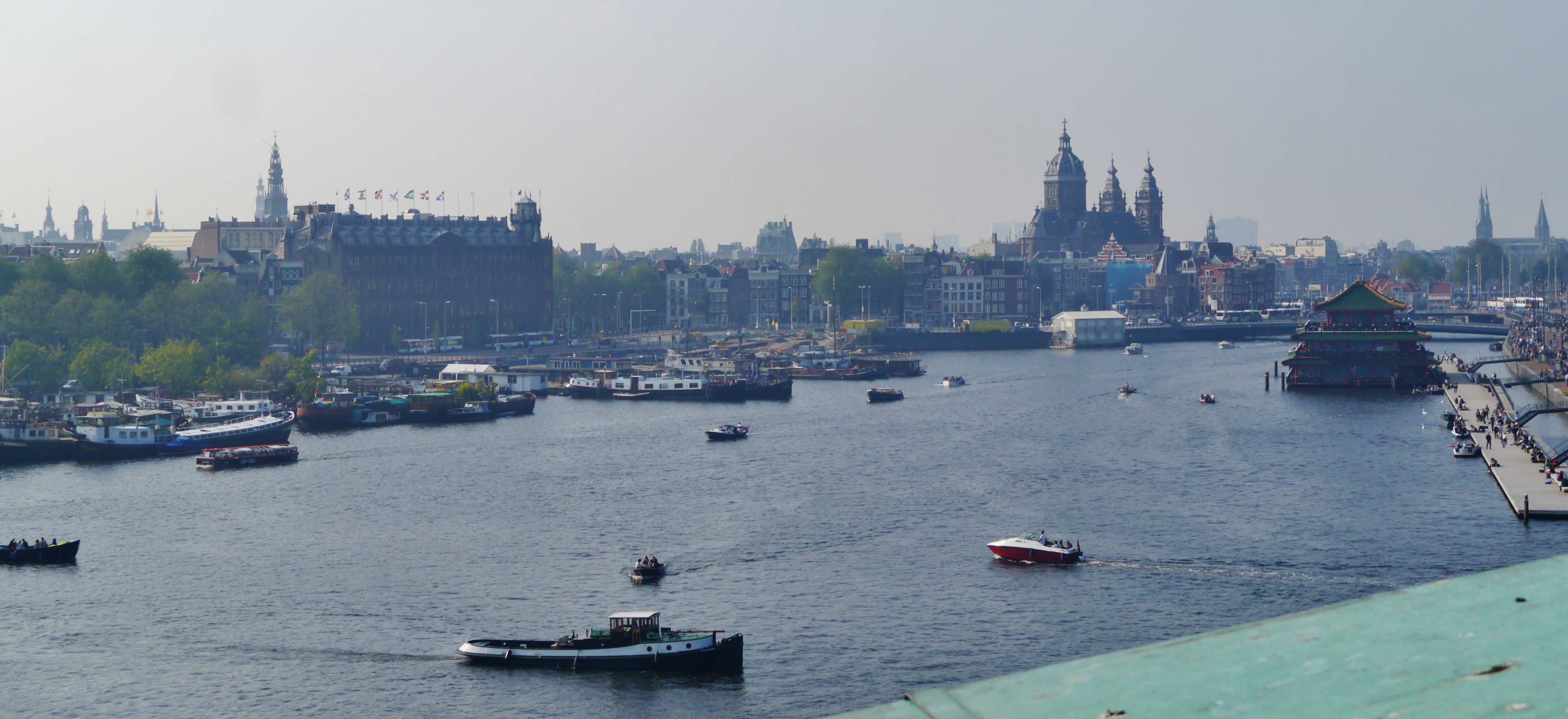
Then in 1869 the municipal council made a decision that reshaped the dock again: Amsterdam's new central station would be built on an artificial island in the IJ, between Westerdok and Oosterdok. Oosterdokseiland was raised partly outside the dyke and partly inside, biting into the basin itself. The first trains ran from a temporary station here in 1874. New ocean liners like the Netherland Line's SS Willem III, drawing 6.7 metres, never used the Oosterdok at all - too shallow for their hulls. Their cargo went to the new Oostelijke Handelskade north of the dyke, where steam cranes could unload directly to warehouses. The Oosterdok began its long second life as something other than a working port. The blow came in the 1960s, when the IJtunnel was driven through two-thirds of the dock's width, severing it visually and physically. Most of the Marine Etablissement's officer's residence, Het Paleis, was demolished. At the time, almost no one objected.
Libraries, Ships, and a Copper Hull
What stands now is a different kind of harbour. In 1997, Renzo Piano's NEMO Science Museum opened on top of the IJtunnel's foundations, its green copper hull rising from the water like the prow of a ship. In 2007 the Openbare Bibliotheek Amsterdam - the city's main public library - opened on Oosterdokseiland, joined the next year by the Conservatorium van Amsterdam. Across the basin, in the long brick warehouse of 's Lands Zeemagazijn, Het Scheepvaartmuseum has been telling Dutch maritime history since 1973, with a full-size replica of the East Indiaman Amsterdam tied up alongside. On Oostenburg, the former ropeworks of the East India Company and the Admiralty still stand. The Oosterdam at the western end - the small dam that closed the basin off from the IJ - was removed in the late 2010s to open up the view. The Oosterdok, built to bring deep water back to Amsterdam, now holds a different kind of cargo: a library, a science museum, a music school, a replica ship, and a few centuries of memory.
From the Air
Oosterdok, central Amsterdam (52.374 N, 4.910 E). Lies immediately east of Amsterdam Centraal station. The green copper roof of NEMO is one of the most recognisable shapes from the air on the eastern edge of the canal belt. Schiphol (EHAM) is 14 km southwest. Best viewed at 1,500-3,000 ft, with Centraal Station and the IJ tunnel approach forming clear landmarks.