Oregon Caves National Monument and Preserve
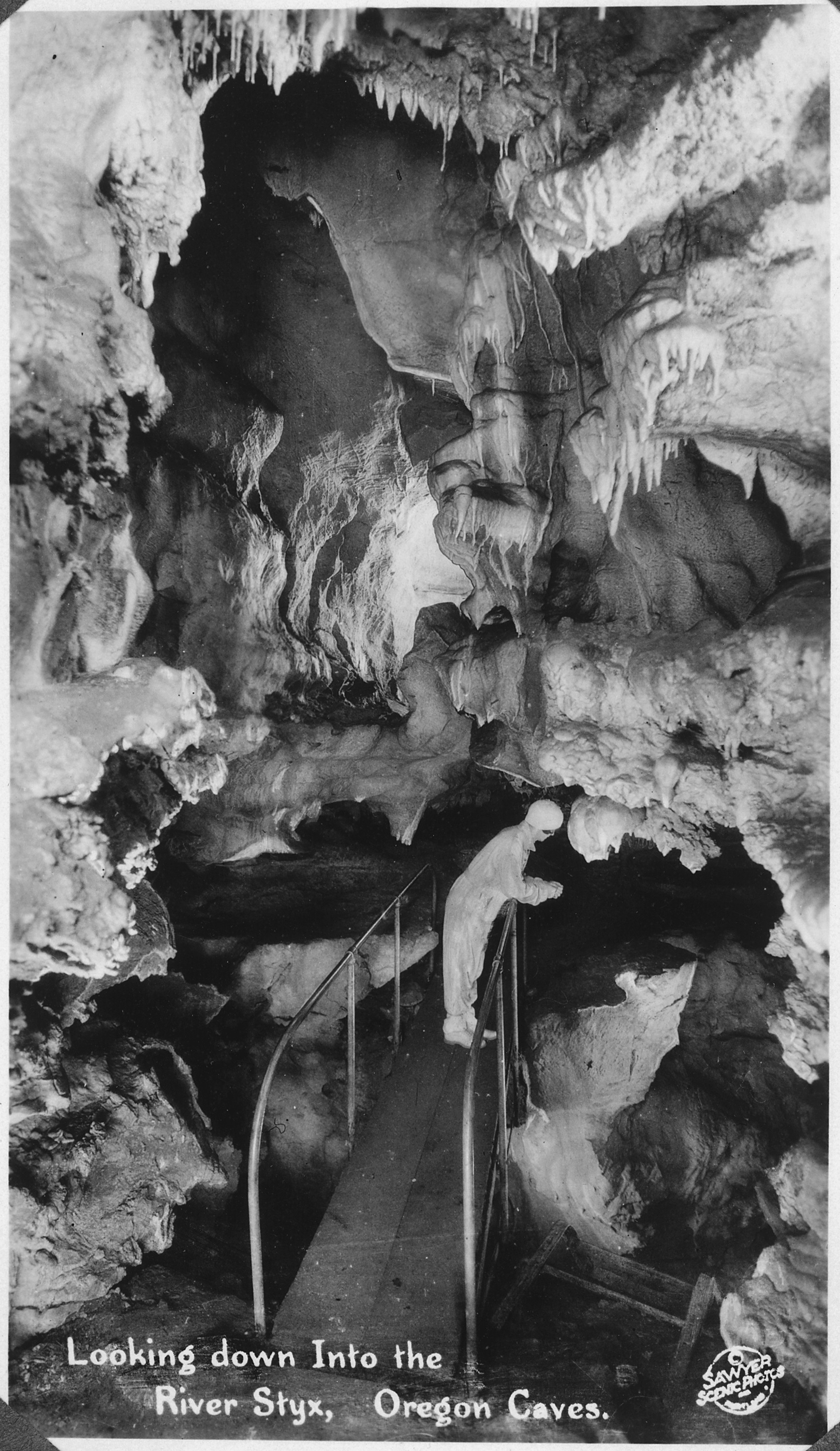
A river runs through darkness here, beneath 4,554 acres of mountain forest. In 2014, the National Park Service renamed this subterranean stream for the mythological Styx, making it the only underground river in America's Wild and Scenic Rivers System. Above ground, gold rush prospectors and native peoples alike passed through these mountains for millennia without ever discovering the marble passages below. It took a hunter's dog, chasing a bear into a hillside opening in 1874, to reveal what the Siskiyou Mountains had been hiding.
Discovery in Pursuit
Elijah Jones Davidson had emigrated from Illinois to Oregon with his parents, eventually settling along Williams Creek in Josephine County. On that day in 1874, his dog Bruno disappeared into a dark opening in the mountainside, chasing a bear into the unknown. Davidson followed with a handful of matches, becoming the first recorded person to enter the marble passages that would bear Oregon's name. For the next two decades, private investors tried and failed to establish successful tourist ventures at the publicly owned site. The caves remained a local curiosity until 1909, when President William Howard Taft invoked the Antiquities Act to establish Oregon Caves National Monument.
Stone Transformed
The caves formed in marble, but the story begins with limestone laid down about 190 million years ago when this region lay beneath ancient seas. As the Klamath Mountains rose, immense pressure and heat metamorphosed that limestone into the white and gray marble visible throughout the cavern today. Water did the rest, dissolving passages through the stone over millions of years. Though the parent rock is ancient, the cave itself is only a few million years old, a relative newcomer carved by acidic groundwater percolating through fractures. Scientists value sections of the cave that tourists never see, where fossils of national importance remain undisturbed in the perpetual darkness.
The Chateau on the Mountain
The Oregon Caves Chateau rises six stories against the forested mountainside, a rustic lodge completed in 1934 when the Civilian Conservation Corps was transforming remote corners of America. Mason Manufacturing of Los Angeles crafted the hotel's furniture in a style called Monterey, pieces now valued at up to $5,000 for a single chair. The CCC also installed water and telephone lines, improved trails, and landscaped the grounds throughout the 1930s and early 1940s. Today the Chateau stands as a National Historic Landmark within the Oregon Caves Historic District, offering lodging mere steps from the cave entrance. Food and additional accommodations are available in Cave Junction, 20 miles west via Oregon Route 46.
From Gold Dust to Tourists
This region remained largely bypassed by early explorers and fur traders due to its remote location. That changed in 1851 when prospectors discovered gold near Jacksonville in the Rogue River valley, triggering the creation of Jackson County in 1852. More gold near Waldo brought enough miners to justify carving out Josephine County, named for the daughter of a gold miner. Even so, the 1870 census counted only 1,204 residents in all of Josephine County. The automobile and paved highways changed everything. Boosters from Grants Pass promoted tourism aggressively, and by the late 1920s cave visitation had soared. The National Park Service assumed control in 1933 and continues to offer tours from mid-April through early November.
Giants Above and Below
A trail through the monument leads to Big Tree, the widest Douglas fir known in Oregon. Above ground, the 4,554-acre preserve encompasses subalpine meadows, old-growth forest, and mountain creeks, all managed to protect the watershed feeding the River Styx below. Hunting is permitted in the preserve but not the monument, and recent management changes aim to end cattle grazing in the Cave Creek watershed. Radiocarbon dating suggests humans arrived in southwestern Oregon at least 8,500 years ago, establishing permanent villages along streams at least 1,500 years before European contact. Yet no evidence suggests any native peoples, including the Takelma who lived along the Rogue and Applegate rivers, ever used the cave. It waited for a dog named Bruno.
From the Air
Oregon Caves National Monument sits at 42.10N, 123.41W in the Siskiyou Mountains of southwestern Oregon, approximately 20nm east of Cave Junction and 25nm southwest of Grants Pass. The heavily forested terrain makes the monument difficult to spot from altitude, but the area lies within the Rogue River-Siskiyou National Forest with distinctive mountain ridgelines. Nearest airports include Illinois Valley (3S4) approximately 15nm west and Grants Pass (3S8) about 25nm northeast. Terrain rises to over 4,000 feet in the monument; maintain adequate altitude in this mountainous region.