Oregon Trail
You have died of dysentery. For millions of American schoolchildren, that sentence is more familiar than any textbook account of westward migration. The Oregon Trail computer game, created in 1971 by a student teacher named Don Rawitsch for his eighth-grade history class, turned a 2,200-mile overland route into the most influential educational game ever made. But the real Oregon Trail needed no embellishment. Between the early 1830s and the completion of the Transcontinental Railroad in 1869, an estimated 400,000 settlers used the trail or its branches to cross the continent, departing from Independence, Missouri, and arriving -- if they survived -- near the Pacific coast in Oregon City, Oregon. The journey took about six months by ox-drawn wagon. Many did not survive.
The Great Migration Begins
The Louisiana Purchase and the Lewis and Clark Expedition cracked open the Northwest for white settlement. Mountain men and fur traders blazed the earliest paths, finding passes barely adequate for a horse and rider. Better routes emerged gradually, and by 1843, the infrastructure had improved enough for nearly a thousand settlers to cross the Rocky Mountains in a single year -- the event known as the Great Migration. The Organic Act of the Oregon Territory granted 640 acres of free homestead land per couple in a territory covering modern Washington, Oregon, Idaho, and parts of Wyoming and Montana. The flood became a torrent: Oregon-bound homesteaders from 1843 to 1854, Mormon pioneers heading to Utah in 1846 and 1847, and California gold rush prospectors in 1849. Weather dictated everything. Mountain passes became impassable in winter, so expeditions departed in early spring. Hundreds of settlers traveled together in wagon trains, trading with each other when supplies ran low and abandoning possessions when wagons grew too heavy for animals to pull.
Two Miles an Hour for a Hundred Days
An ox-drawn cart traveling at two miles per hour needed ten hours a day for more than a hundred days to cover the trail -- and obstacles routinely extended that time. Horses were faster but expensive and needed to be fed, while an ox could graze along the way. Mules brought their own stubborn complications. At night, groups circled wagons with livestock in the middle to prevent animals from being stolen or wandering. Dried, salted, and tinned foods were chosen for their durability. Firearms allowed hunting to stretch limited supplies. Skills in wagon repair and basic medicine were essential, because opportunities to acquire help grew scarcer and more expensive the further west one traveled. On arrival, a successful party could claim contiguous 320-acre parcels for each adult in an extended family. Arriving early meant better chances at prime locations controlling river valleys with water for irrigation. The stakes could not have been higher.
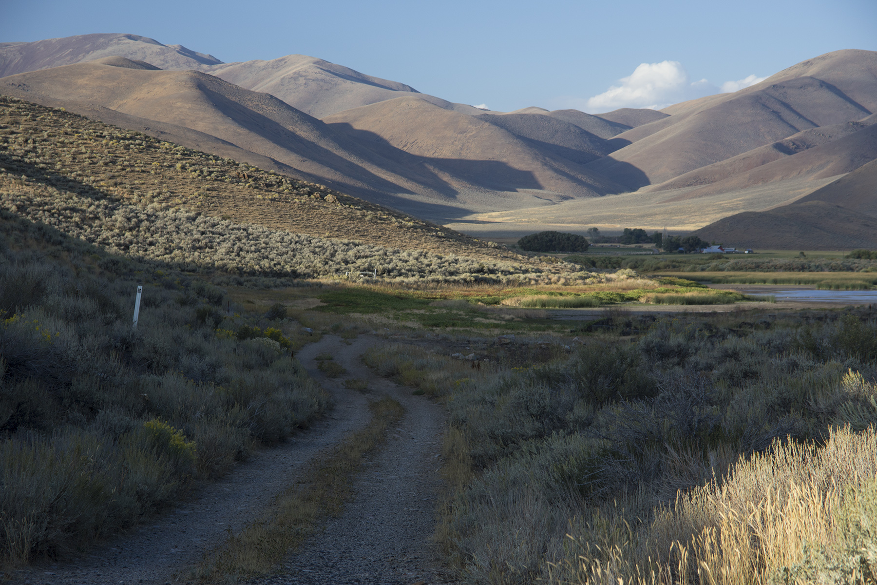
Chimney Rock and Independence Rock
The trail's landmarks became famous even before the age of photography. Chimney Rock in western Nebraska, a slender spire of clay and sandstone rising above the Platte River valley, served as a beacon visible for miles -- a sign that the Great Plains were giving way to the Rockies. Travelers noted it obsessively in their journals. Further west in Wyoming, Independence Rock -- a massive granite dome along the Sweetwater River -- became the trail's visitor register. Emigrants carved their names into the stone, aiming to reach it by the Fourth of July to stay on schedule for safe passage through the mountains before winter. The trail followed the Platte River across Nebraska, crossed South Pass in Wyoming's Wind River Range at 7,550 feet, descended along the Snake River through Idaho, and climbed the Blue Mountains into Oregon. Each stretch brought different hazards: river crossings that could capsize wagons, mountain passes that broke axles, and vast stretches of sagebrush desert where water was scarce.
The Last Spike Ends an Era
On May 10, 1869, the Last Spike was driven at Promontory Summit in Utah, joining the Union and Central Pacific Railroads. A journey that had taken half a year was suddenly reduced to one week. Where travel by wagon had cost around $200 per person, a train ticket ran about $60 -- with a roof overhead. The Oregon Trail became a relic almost overnight. Before long, it existed mainly in movie serials and dime novels as a setting for danger and frontier drama. But the trail's physical traces endured: wagon ruts worn into stone by countless wheels are still visible at several sites in Wyoming, including the Oregon Trail Ruts near Guernsey. The ruts are open to visitors year-round and remain among the most evocative physical reminders of the westward migration.
You Have Died of Dysentery
In 1971, Don Rawitsch built a text-based game on a mainframe terminal for his Minnesota classroom. Players named their characters, chose supplies, and then subjected their creations to the perils of the trail: starvation, disease, river crossings, and injuries of every kind. Unlike any other educational game, characters could die. Players erected gravestones -- usually with profane epitaphs -- for subsequent players to discover. Teachers found themselves mediating arguments over whether capsizing a wagon in the Snake River was deliberate sabotage. Ported to the Apple II in 1979, the Macintosh and IBM PC in 1990, and to smartphones in 2011, The Oregon Trail taught more Americans about westward migration than any textbook. The game's environmentalist message -- hunt too aggressively and the game punished you -- was nearly drowned out by the howls of bloodthirsty students shooting virtual bison. But beneath the fun was real history, well taught. The Oregon National Historic Trail, maintained by the National Park Service, preserves the route today and can be followed by car in about a week -- a journey that once took half a year and cost many settlers everything they had.
From the Air
The Oregon Trail traditionally began in Independence, Missouri (39.09°N, 94.42°W) and ended near Oregon City, Oregon (45.36°N, 122.61°W), covering approximately 2,200 miles across Nebraska, Wyoming, Idaho, and Oregon. The Independence origin point is in the Kansas City metropolitan area. Kansas City International (KMCI) serves the eastern terminus. Key trail landmarks visible from the air include Chimney Rock in western Nebraska (near KIBM Kimball), Independence Rock in central Wyoming (near KRIW Riverton), and South Pass in the Wind River Range. The trail corridor roughly parallels modern Interstate 80 across Nebraska and Interstate 84 through Idaho and Oregon. From altitude, the Platte River valley that guided settlers across Nebraska remains one of the most distinctive visual features of the central United States.